-
-
Add to cart
![[South Africa] Photograph panorama of Cape Town, c. 1870](https://neatlinemaps.com/wp-content/uploads/2022/09/Screen-Shot-2022-12-18-at-11.22.15-AM-300x300.png) Quick View
Quick View - Africa
[South Africa] Photograph panorama of Cape Town, c. 1870
- $1,600
- Panoramic photograph showing Cape Town and the Cape Colony during the heyday of British colonial rule.
-
-
-
-
Add to cart
 Quick View
 - Africa
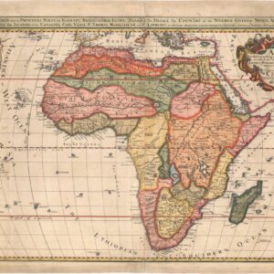
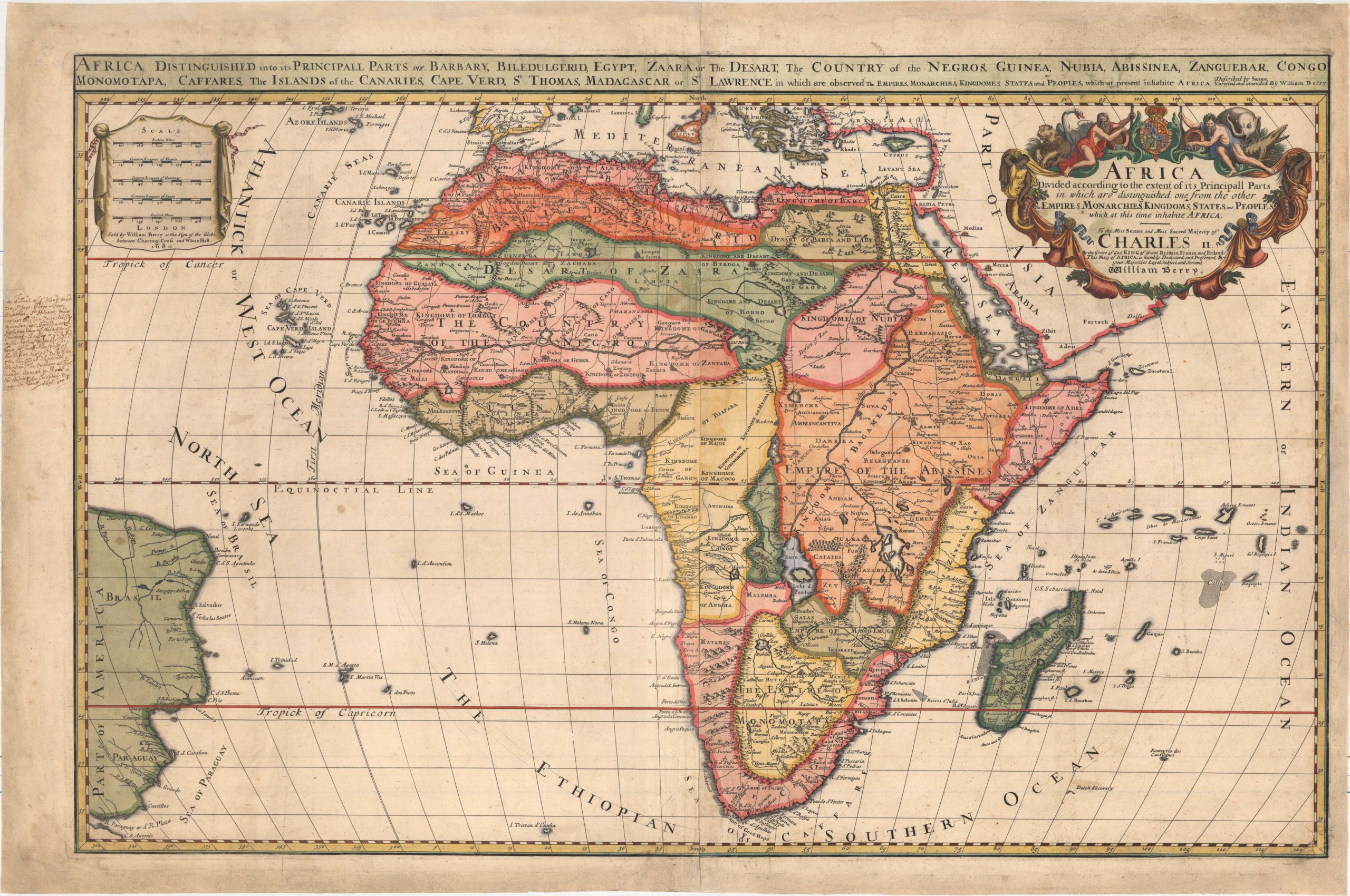
Africa Divided According to the Extent of Its Principall Parts in Which Are Distinguished One from the Other the Empires, Monarchies, Kingdoms, States, and Peoples…
- $1,400
- William Berry’s rare and gorgeous map of the African continent with original 17th-century hand-written annotations in the margin.
-
-
-
-
-
Add to cart
 Quick View
 - Africa, Curiosities - Miscellanea
Passage System of the Great Pyramid of Giza in the Land of Egypt June – July 1909.
- $2,500
- Uncovering the secrets of the Great Pyramid.
-
-
-
-
Add to cart
 Quick View
 - Africa
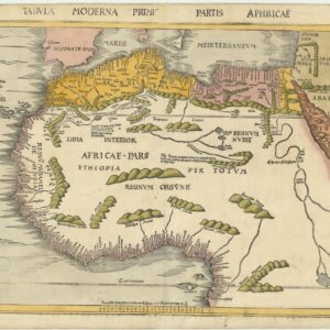
Tabula Moderna Prime Partis Aphricae
- $8,000
- Gorgeous example of famed cartographer Martin Waldessemüller’s double-page woodcut map of North and West Africa.
-
-
-
-
Add to cart

 Quick View
 - Africa, Arabia and the Red Sea
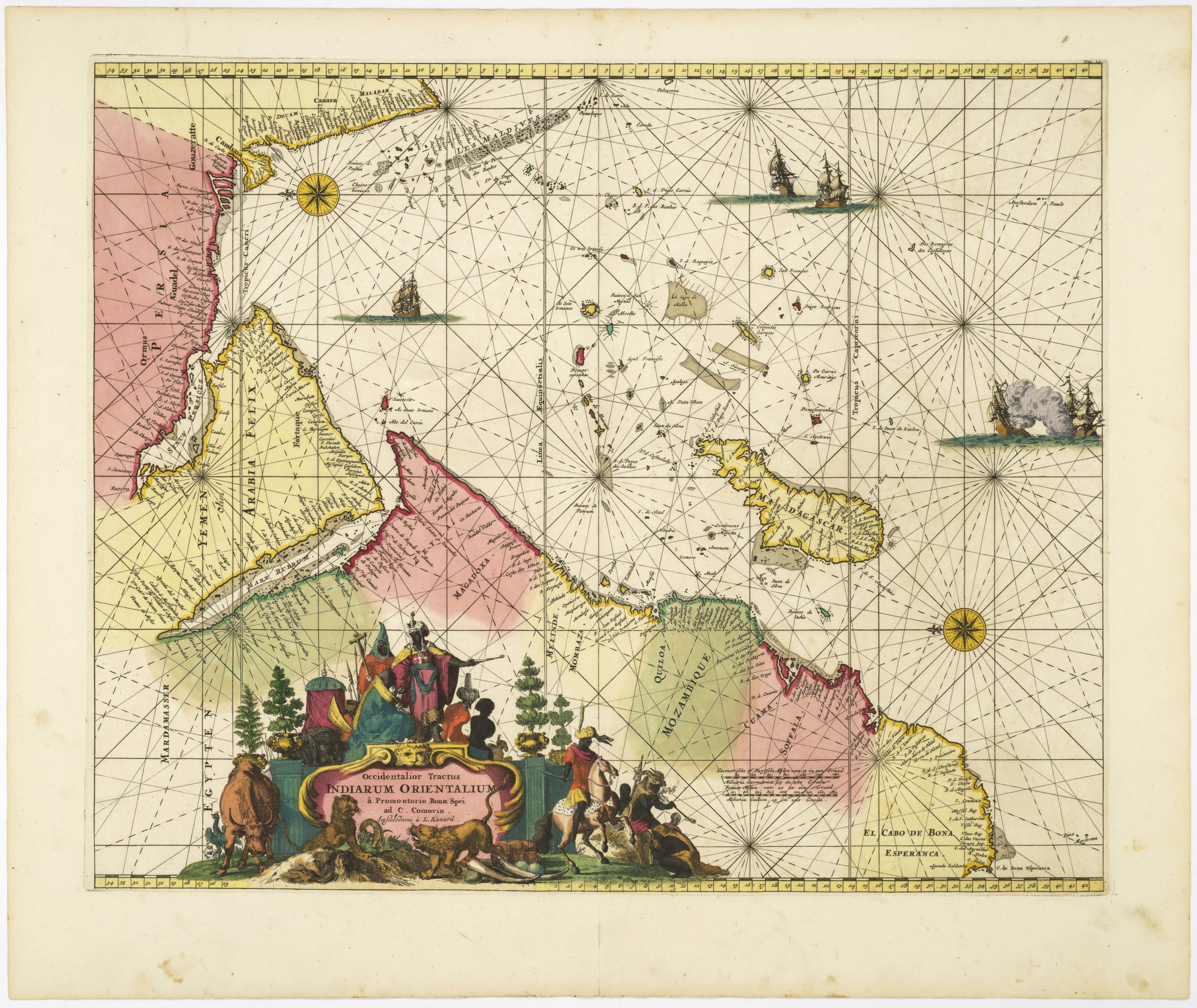
Occidentalior Tractus Indiarum Orientalium à Promontorio Bonae Spei ad C. Comorin
- $1,400
- Stunning Renard sea chart of the Indian Ocean, with East Africa, Arabia, and southern India, from the Atlas de la Navigation.
-
-
-
-
-
Add to cart
 Quick View
 - Africa
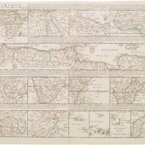
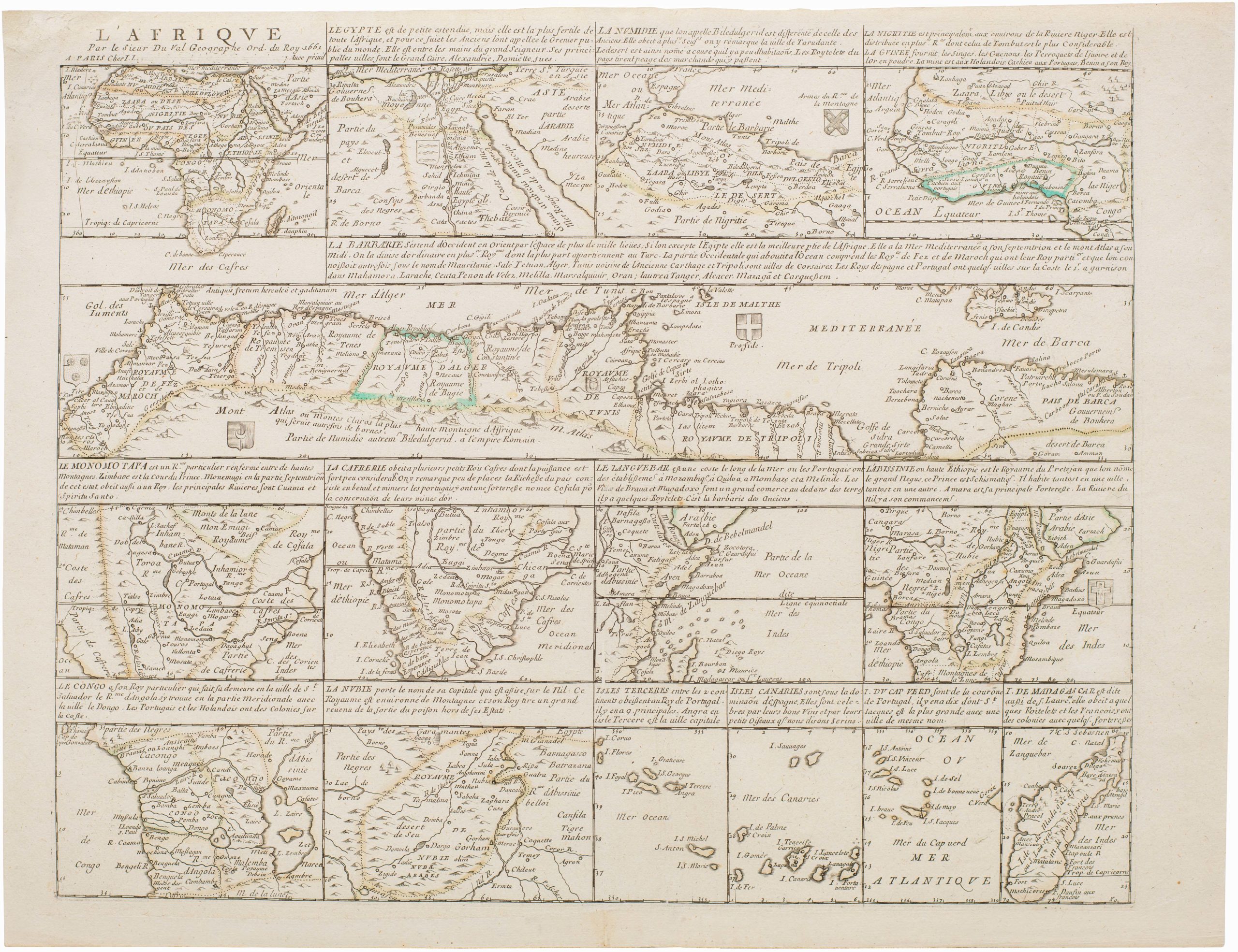
L’Afrique Par le Sieur Du Val, Geographe Ord. du Roy
- $2,000
- A separately-issued rarity of Africa by Pierre Duval.
-
-
-
-
-
Add to cart
 Quick View
 - Africa
Fessae, et Marocchi Regna Africae Celeberr.
- $450
- Ortelius’s fine map of Morocco, with an inset of Pigaffetta’s Kingdom of Congo.
-
-
-
-
Add to cart
 Quick View
 - Africa, Pictorial maps
Maroc. Région Nord
- $375
- Vivid 1943 pictorial map of Morocco.
-
-
-
-
Add to cart
![[Title on Verso] Tabula Prima Aphricae Continent Mauritania Tingitanam, & Mauritaniam Caesariensem](https://neatlinemaps.com/wp-content/uploads/2019/09/NL-00293_Thumbnail-300x300.jpg)
![[Title on Verso] Tabula Prima Aphricae Continent Mauritania Tingitanam, & Mauritaniam Caesariensem](https://neatlinemaps.com/wp-content/uploads/2019/09/NL-00293_r-scaled.jpg) Quick View
Quick View - Africa
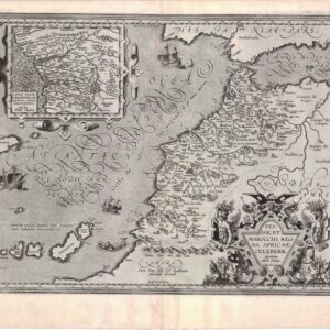
[Title on Verso] Tabula Prima Aphricae Continent Mauritania Tingitanam, & Mauritaniam Caesariensem
- $775
- Colorful 1541 woodcut map of Morocco with old manuscript notations.
-
-
![[Title on Verso] Tabula Prima Aphricae Continent Mauritania Tingitanam, & Mauritaniam Caesariensem](https://neatlinemaps.com/wp-content/uploads/2019/09/NL-00293_r-scaled-300x300.jpg)
-