-
-
Add to cart
 Quick View
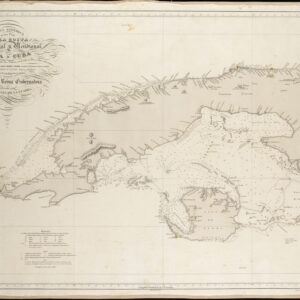
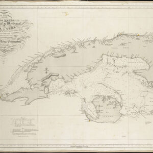
 - Americas, Cuba, West Indies, Caribbean
Carta Esferica De Una Parte de la Costa Setentrional y Meridional de la Isla de Cuba…
- $450
- Excellent Spanish sea chart of Western Cuba.
-
-
-
-
-
Add to cart
 Quick View
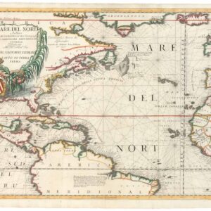
 - Americas, Cuba, West Indies, Caribbean, East & Midwest United States, North America
Mare del Nord.
- $2,200
- A gorgeous full-color example of Coronelli's chart of the Eastern Seaboard and North Atlantic.
-
-
-
-
Add to cart
 Quick View
 - Americas, Cuba, West Indies, Caribbean
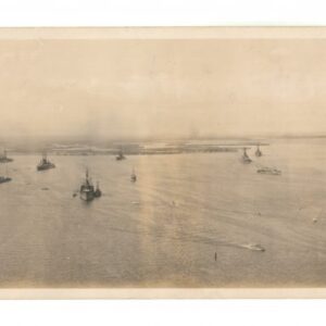
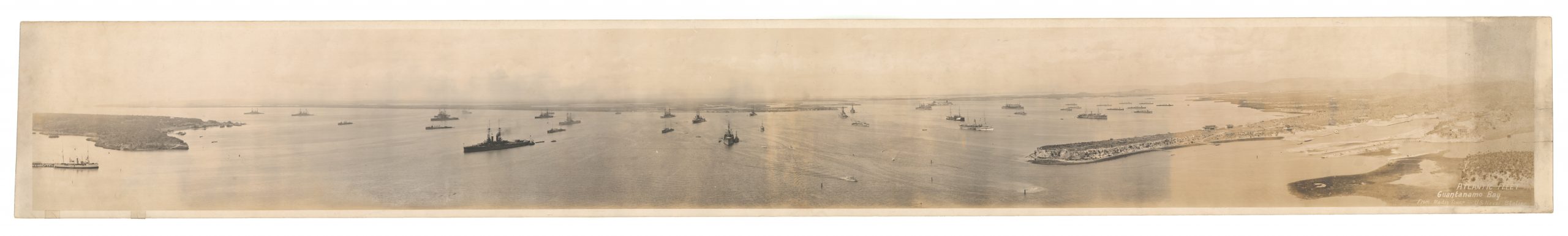
Atlantic Fleet. Guantanamo Bay from Radio Tower – U.S. Naval Station
- $450
- An evocative WW1 panoramic photograph of the U.S. Navy’s Atlantic Fleet stationed at their new base in Guantanamo Bay, Cuba.
-
-
-
-
-
Add to cart
 Quick View
 - Americas, Cuba, West Indies, Caribbean, East & Midwest United States
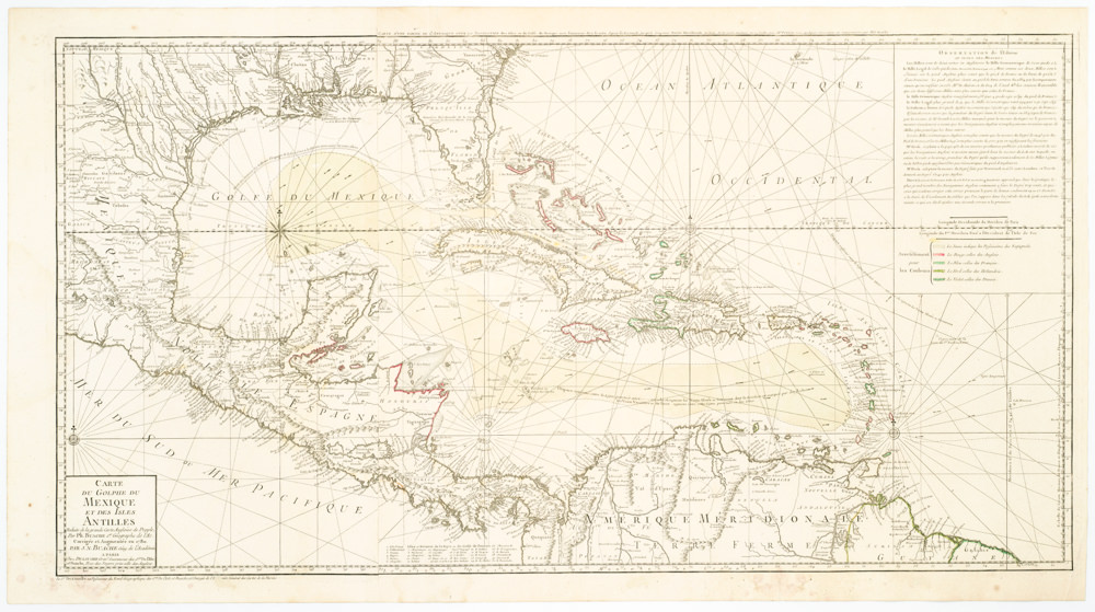
Carte Du Golphe Du Mexique Et Des Isles Antilles Reduite de la grande carte Angloise de Popple, Par PH. Buache…1780.
- $900
- Dezauche's exquisite chart of the Gulf Coast, Florida, and Caribbean Archipelago depicts a French Colonial Empire that is slowly falling apart.
-
-
-
-
-
Add to cart
 Quick View
 - Americas, Cuba, West Indies, Caribbean
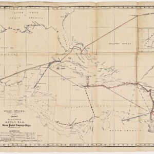
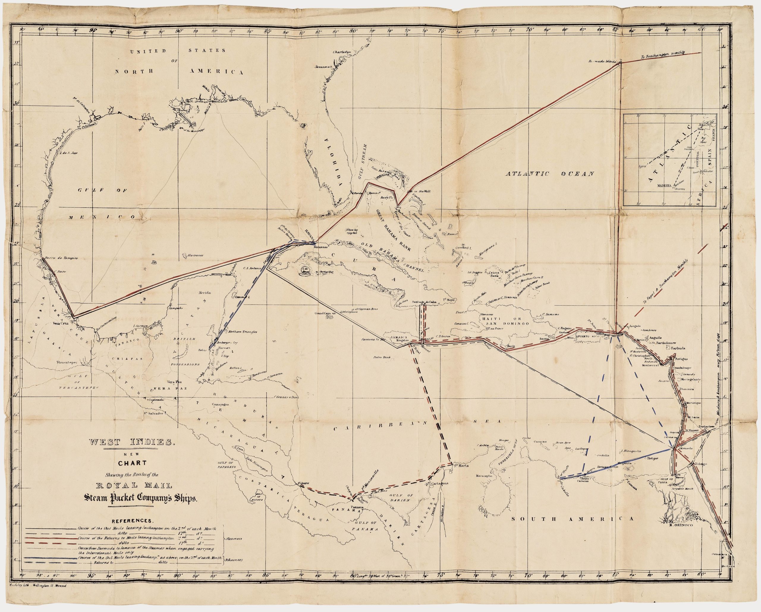
West Indies. New Chart shewing the Routes of the Royal Mail Steam Packet Company’s Ships.
- $1,800
- The communications lifeline of the British Caribbean: an unrecorded map of the Royal Mail Steam Packet Company’s Ships to the West Indies.
-
-
-
-
-
Add to cart
 Quick View
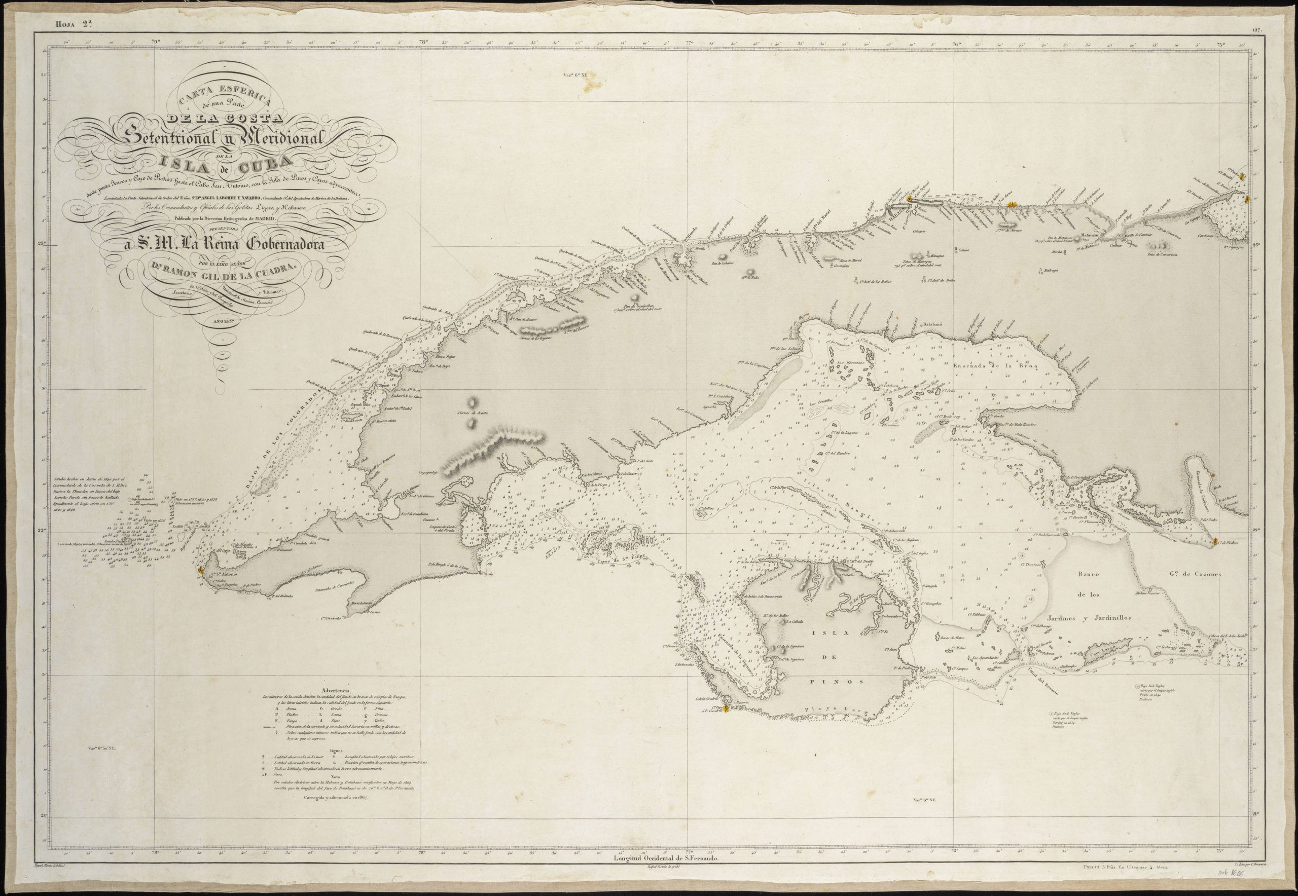
 - Americas, Cuba, West Indies, Caribbean
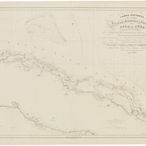
Carta Esferica de una Parte de la Costa Setentrional y Meridional de la Isla de Cuba con el canal viejo de Bahamas y el de Santarén. Por el comandante General y oficiales….
- $400
- Rare 1836 Spanish sea chart around central Cuba with manuscript lighthouse notations.
-
-