-
-
Add to cart
 Quick View
 - California, Curiosities - Miscellanea
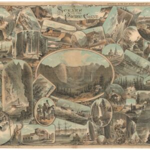
Scenes on the Pacific Coast.
- $2,800
- Pacific Panorama: Keller's Visual Tapestry of the West Coast.
-
-
-
-
Add to cart
 Quick View
 - California, Southern California
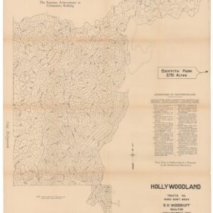
Hollywoodland, Tracts No. 6450 9367 9594.
- $1,800
- The birth of one of L.A.'s most iconic neighborhoods.
-
-
-
-
Add to cart
![[Oil Painting of Lake Merritt, Oakland]](https://neatlinemaps.com/wp-content/uploads/2024/05/NL-01966_thumbnail-300x300.jpg) Quick View
Quick View - Bay Area & Silicon Valley, California
[Oil Painting of Lake Merritt, Oakland]
- $14,500
- The earliest known view of Oakland’s Lake Merritt.
-
-
-
-
Add to cart
 Quick View
 - California, San Francisco
Map of the City & County of San Francisco, from the Latest Certified Data.
- $575
- Settling the Southern Part of San Francisco.
-
-
-
-
Add to cart
 Quick View
 - Atlases & Books, San Francisco
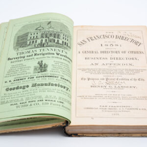
San Francisco Directory Year and Business Guide for 1858: Henry G. Langley Compiler.
- $2,400
- The first Langley San Francisco city directory!
-
-
-
-
Add to cart
 Quick View
 - California, Pictorial maps
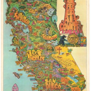
Home Federal Country. Eureka! The Golden State. California.
- $525
- Probably the best pictorial map of California from the early 1970s.
-
-
-
-
Add to cart
 Quick View
 - Bird's-eye-views, Pictorial maps, San Francisco
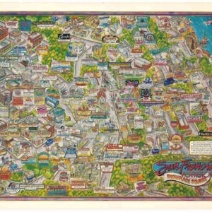
San Francisco Potrero Hill Showplace Square.
- $900
- Images of a different era: an exciting, block-by-block glimpse of late 1980s Potrero Hill, San Francisco.
-
-
-
-
Add to cart
 Quick View
 - Bay Area & Silicon Valley, California
Album of photographs of commercial and residential properties in Berkeley, California.
- $1,250
- A fascinating documentation of Berkeley in the 1930s.
-
-
-
-
Add to cart
 Quick View
 - California, Southern California
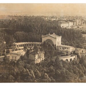
Balboa Park San Diego. Open Air Pipe Organ, Balboa Park.
- $1,400
- Large-format photograph of the Open Air Pipe Organ built in Balboa Park, San Diego, for the 1915 Panama-California Exhibition.
-
-
-
-
Add to cart
 Quick View
 - California
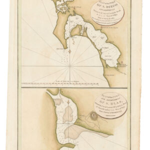
Plan of the Port of S. Diego in California. / Plan of the Port and Deparetement of S. Blas.
- $500
- The earliest acquirable map of the bay of San Diego.
-
-
-
-
Add to cart
 Quick View
 - San Francisco
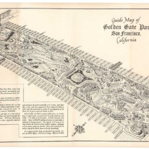
Guide Map of Golden Gate Park San Francisco, California.
- $650
- 1956 Ted Hubbard map of Golden Gate Park.
-
-
-
-
Add to cart
 Quick View
 - San Francisco
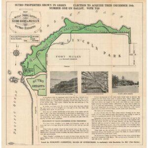
Map of the Ocean Shore Lands. Sutro Baths & Museum Sutro Heights.
- $875
- A large Britton & Rey cartographic advertisement for Sutro’s shore-lands.
-
-