-
-
Add to cart
![[Pictorial Map of West Sussex, England].](https://neatlinemaps.com/wp-content/uploads/2025/06/NL-02402_thumbnail-300x300.jpg) Quick View
Quick View - British Isles, Featured Maps & Views, Michael's Collection, Pictorial maps
[Pictorial Map of West Sussex, England].
- $45,000
- A rediscovered painting by MacDonald Gill, one of the foremost artists of pictorial cartography.
-
-
-
-
Add to cart
 Quick View
 - British Isles, Europe
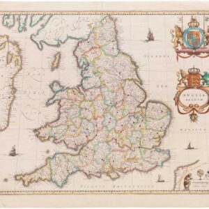
Anglia Regnum.
- $550
- Willem Blaeu's elegant mid-17th-century map of England and Wales.
-
-
-
-
Add to cart
 Quick View
 - Bird's-eye-views, British Isles, Europe
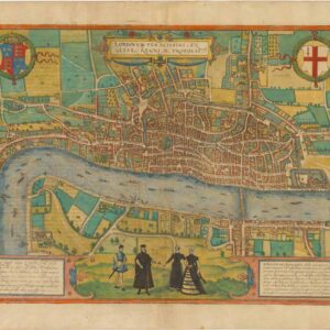
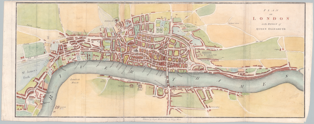
Londinum Feracissimi Angliae Regni Metropolis.
- $8,500
- Braun & Hogenberg’s extraordinary rendition of Elizabethan London as Shakespeare knew it.
-
-
-
-
Add to cart
 Quick View
 - British Isles
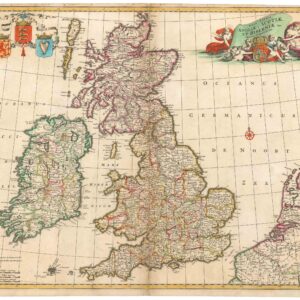
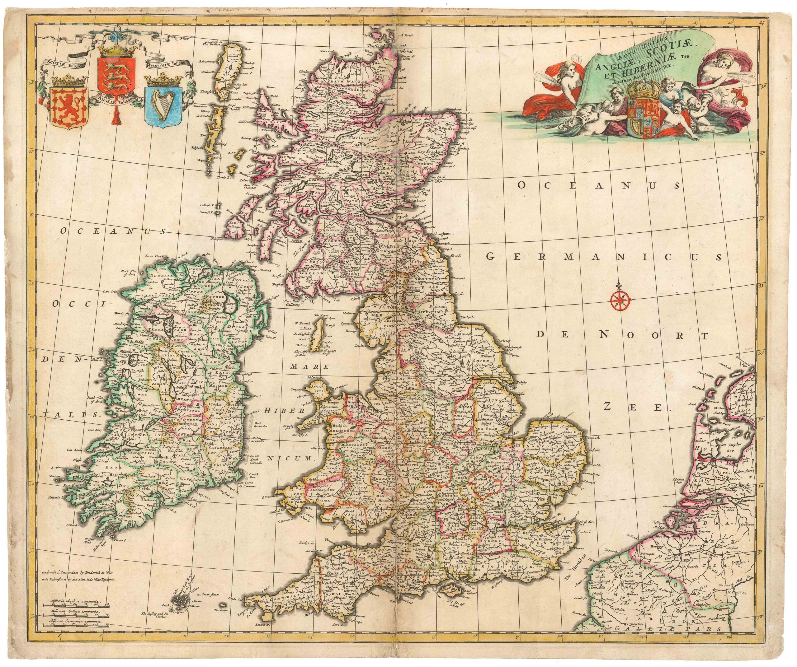
Nova totius Angliae, Scotiae et Hiberniae
- $450
- Frederick de Wit’s large folio of the British Isles in old color.
-
-
-
-
-
Add to cart

 Quick View
 - Europe, British Isles, Pictorial maps
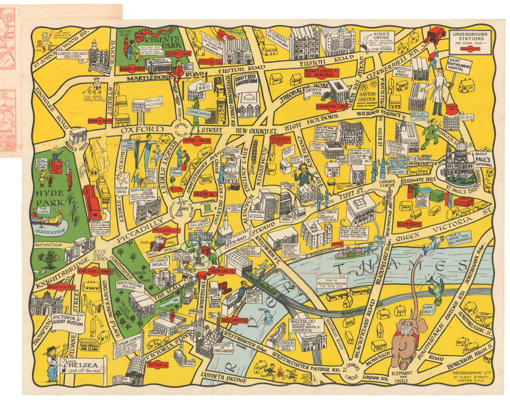
The New Pictorial Map of London.
- $650
- A rare Interwar period pictorial city map of London.
-
-
-
-
-
Add to cart
 Quick View
 - British Isles, Europe
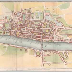
Plan of London in the reign of Queen Elisabeth.
- $725
- Attractive 1835 city plan of Elizabethan London.
-
-
-
-
-
Add to cart
 Quick View
 - British Isles, Europe
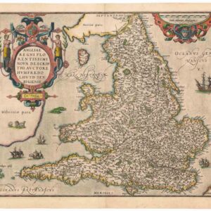
Angliae Regni Florentissimi Nova Descriptio, Auctore Humfredo Lhuyd Denbygiense
- $975
- Lovely 1574 Ortelius map of England and Wales with elaborate cartouche.
-
-