-
-
Add to cart
 Quick View
 - British Isles, Europe
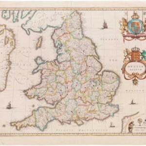
Anglia Regnum.
- $550
- Willem Blaeu's elegant mid-17th-century map of England and Wales.
-
-
-
-
Add to cart
 Quick View
 - Europe, Iceland & Scandinavia
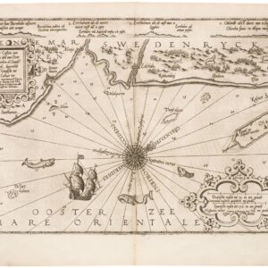
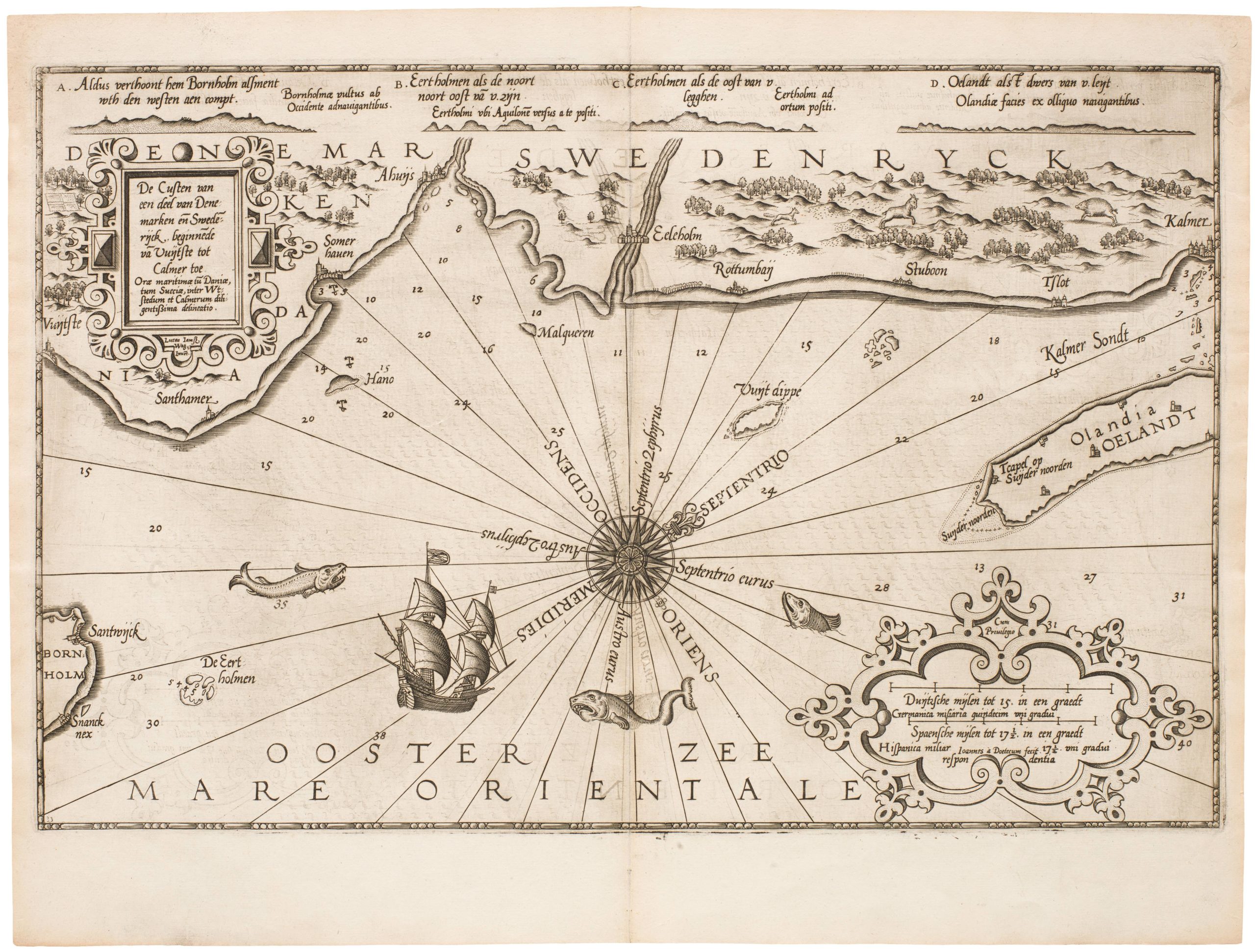
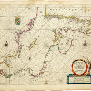
De Custen van een deel van Denemarken en Swederijck, beginnede va Vuijtste to Calmer Toe…
- $900
- Waghenear’s gorgeous 16th-century sea chart of Sweden’s Baltic coastline.
-
-
-
-
-
Add to cart
 Quick View
 - Europe, Iceland & Scandinavia
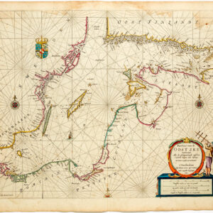
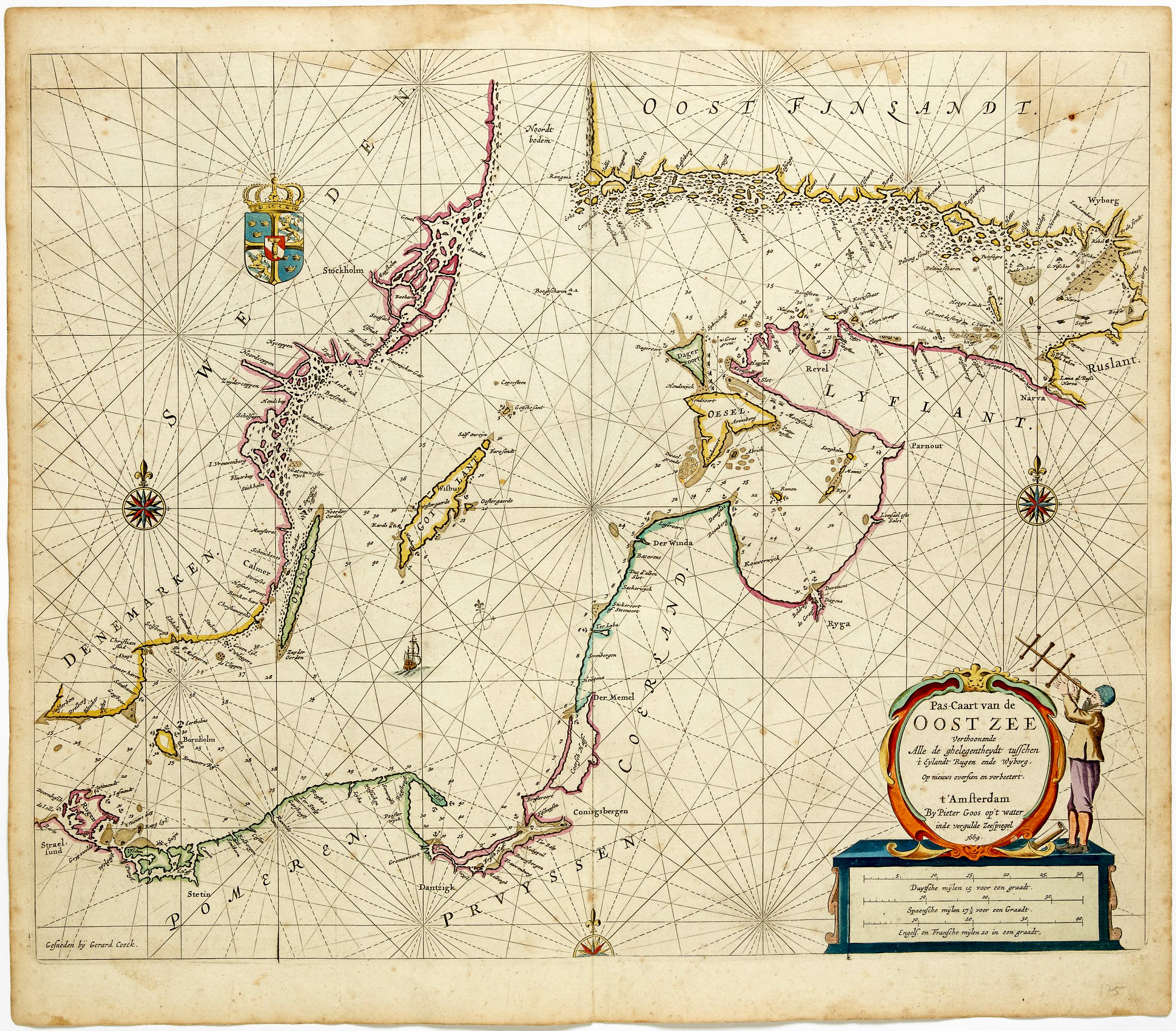
Pas-caart van de Oost zee verthoonende alle de ghelegntheydet tusschen t Eÿlandt Rugen end Wÿborg
- $975
- Striking, original-color nautical chart of the Baltic Sea by Pieter Goos.
-
-
-
-
-
Add to cart
![Fortezza di Soppoto [Albania].](https://neatlinemaps.com/wp-content/uploads/2023/05/NL-01333_thumbnail-300x300.jpg) Quick View
Quick View - Europe, Greece & the Balkans
Fortezza di Soppoto [Albania].
- $850
- Bertelli’s view of the Venetian siege of Ottoman Soppoto in 1570.
-
-
-
-
Add to cart
 Quick View
 - Pacific Northwest - Hawaii - Alaska, United States, Europe, Russia & Eastern Europe, Atlases & Books
Account of the Russian discoveries between Asia and America. To which is added the conquest of Siberia and the history of the transactions and commerce between Russia and China.
- $900
- The most comprehensive English assessment of Russian explorations in the Arctic and Pacific ever written.
-
-
-
-
Add to cart
 Quick View
 - Bird's-eye-views, British Isles, Europe
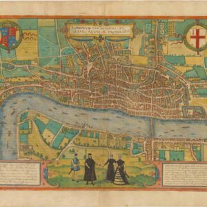
Londinum Feracissimi Angliae Regni Metropolis.
- $8,500
- Braun & Hogenberg’s extraordinary rendition of Elizabethan London as Shakespeare knew it.
-
-
-
-
Add to cart
 Quick View
 - Europe, Spain & Portugal
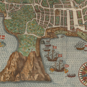
A Cidade De Angra. Na Ilha De Iesu Xpoda Tercera Que Esta Em 39 Graos.
- $2,000
- The first printed plan of the Atlantic frontier port of Angra in the Azores.
-
-
-
-
Add to cart
![[LA ROCHELLE] Il vero sito della Rocella hora occupata da heretici et Ribelli di sua Maestà Christianissima della Quale sono Assediati.](https://neatlinemaps.com/wp-content/uploads/2022/11/NL-01639_thumbnail-scaled-300x300.jpg)
![[LA ROCHELLE] Il vero sito della Rocella hora occupata da heretici et Ribelli di sua Maestà Christianissima della Quale sono Assediati.](https://neatlinemaps.com/wp-content/uploads/2022/11/NL-01639_thumbnail-scaled.jpg) Quick View
Quick View - Curiosities - Miscellanea, Europe, France & Switzerland
[LA ROCHELLE] Il vero sito della Rocella hora occupata da heretici et Ribelli di sua Maestà Christianissima della Quale sono Assediati.
- $6,500
- Den of the Templars: a rare and exciting plan of the great French port of La Rochelle.
-
-
-
-
-
Add to cart

 Quick View
 - Europe, World War I and World War II
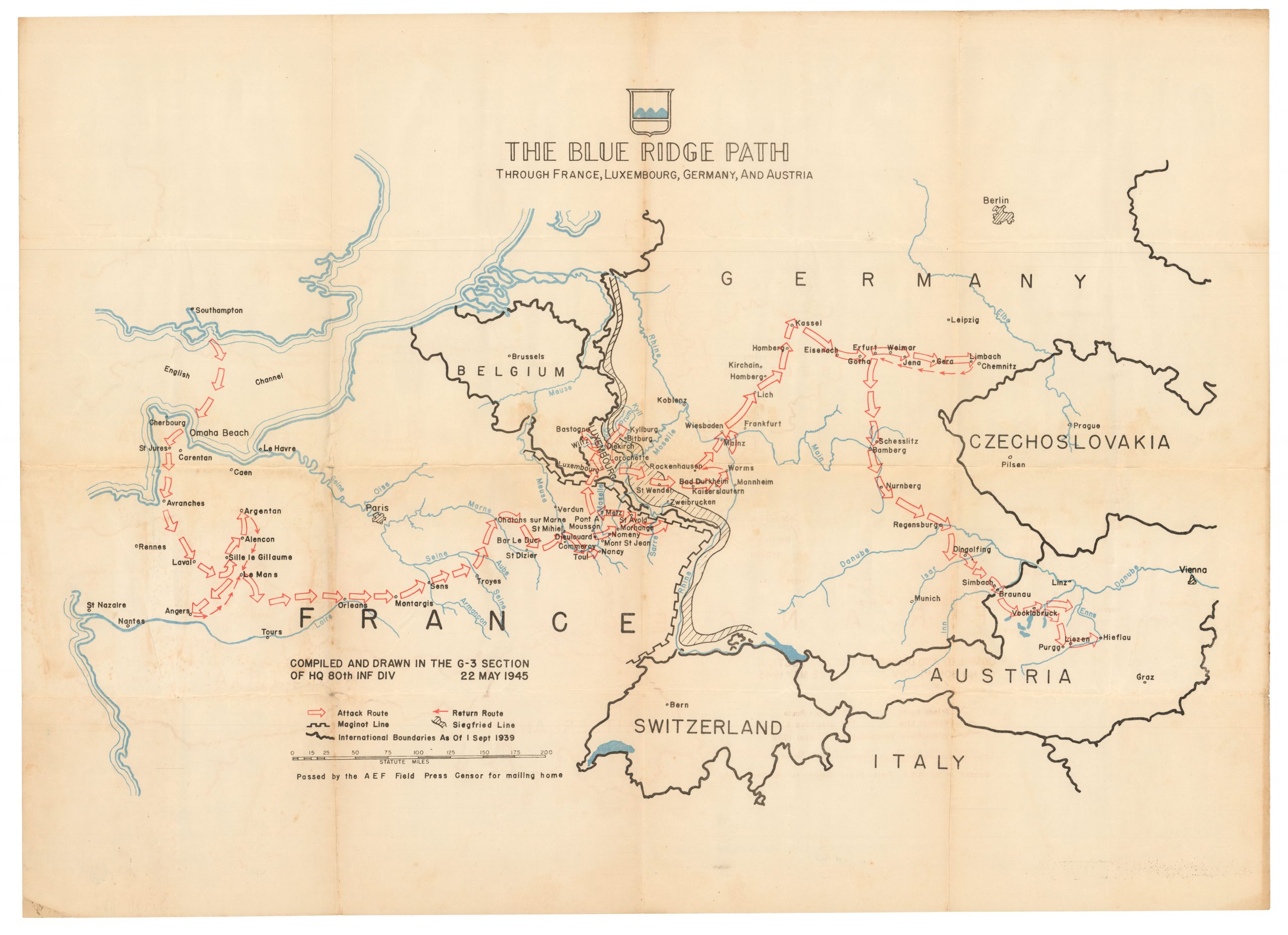
The Blue Ridge Path through France, Luxembourg, Germany, and Austria.
- $200
- Patton’s 80th Infantry Division -- liberators of two concentration camps!
-
-

-
-
-
Add to cart

 Quick View
 - Curiosities - Miscellanea, Europe, Iran - Persia - Central Asia, Russia & Eastern Europe
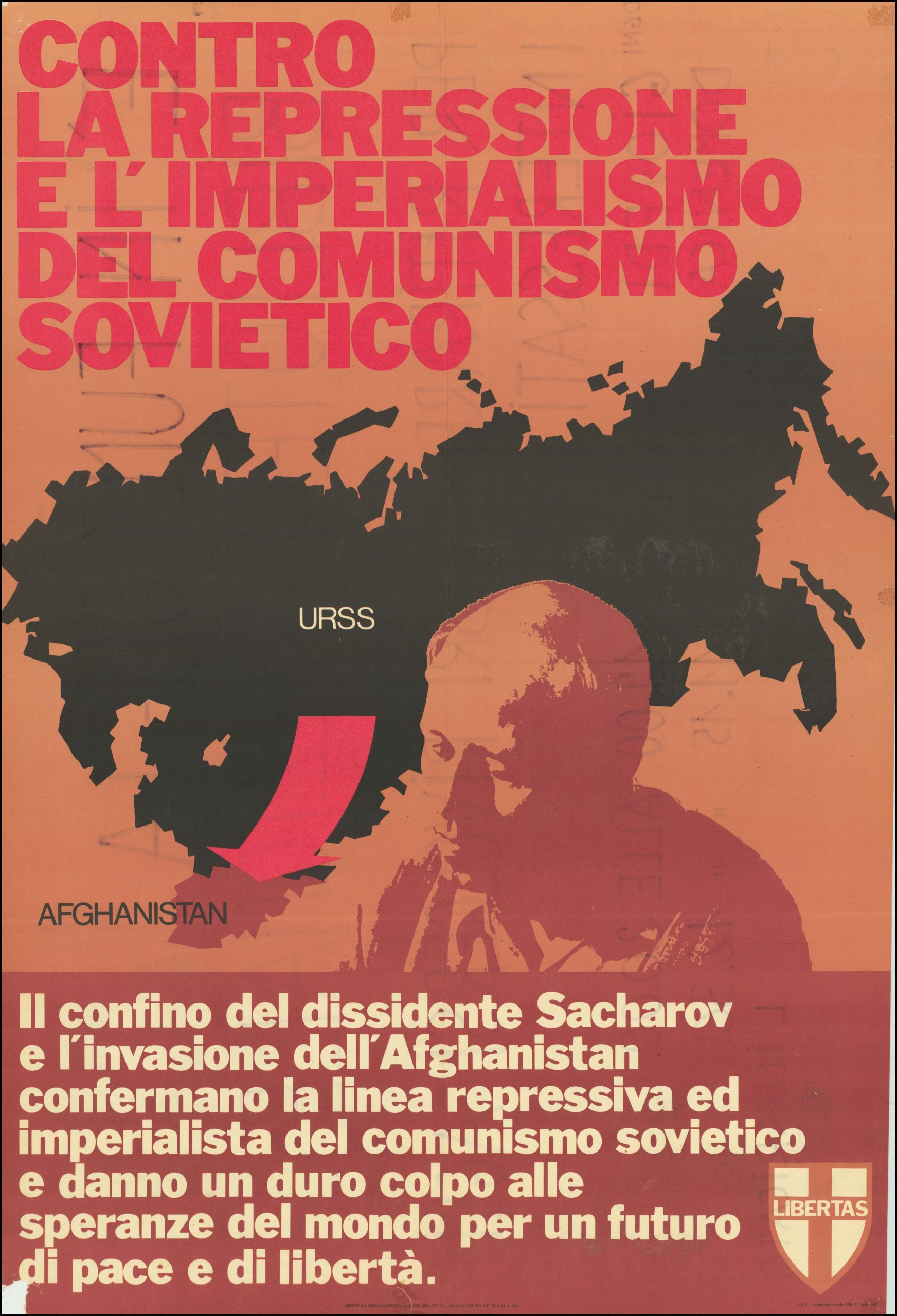
Contro La Repressione e L’Imperialismo del Comunismo Sovietico.
- $750
- Italian Anti-Communist Poster protesting the Soviet invasion of Afghanistan and the arrest of peace activist and nuclear physicist, Andrey Sakharov.
-
-
-
-
-
Add to cart
 Quick View
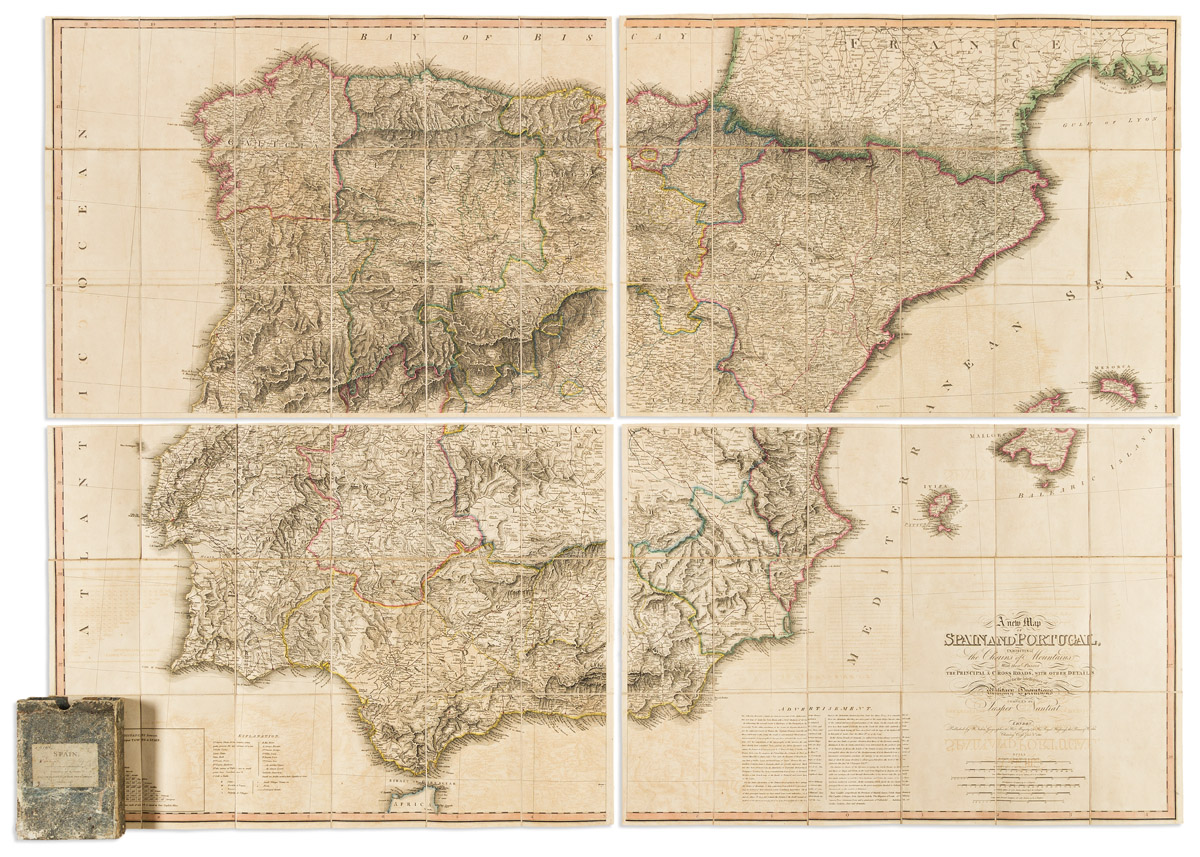
 - Europe, Spain & Portugal
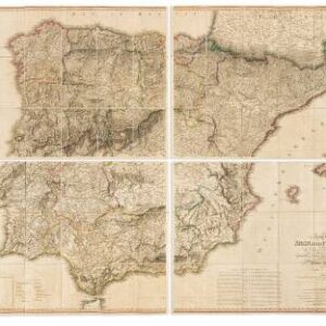
A New Map of Spain and Portugal, Exhibiting the Chains of Mountains with Their Passes, the Principal & Cross Roads, with Other Details Requisite for the Intelligence of Military Operations.
- $2,200
- Napoleonic War military intelligence.
-
-
-
-
-
Add to cart
 Quick View
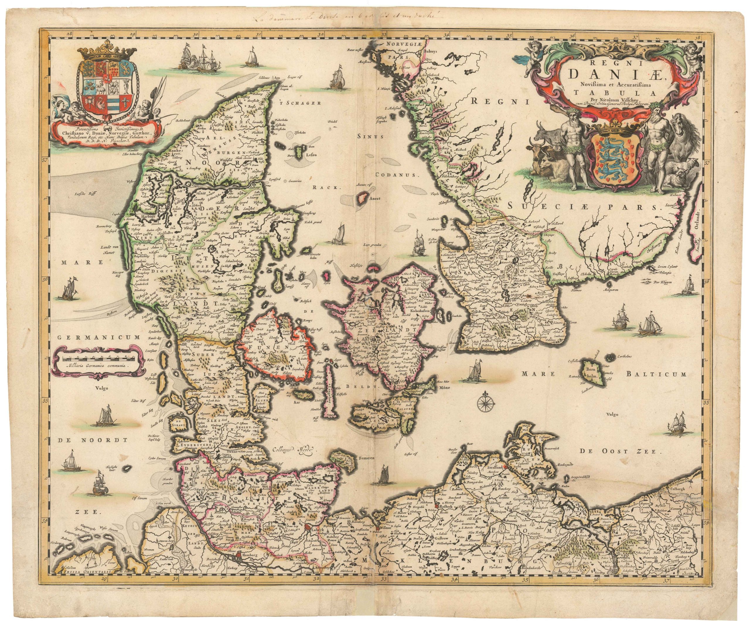
 - Europe, Iceland & Scandinavia
Regni Daniae, Novissima et Accuratissima Tabula
- $450
- Visscher’s seminal map of the Kingdom of Denmark, borne out of the ashes of the Thirty-Year-War.
-
-
-