-

World War I and World War II (7)
Antique maps and views related to World War I & World War II. -
-
Add to cart
 Quick View
 - Featured Maps & Views, Railroad Maps, United States
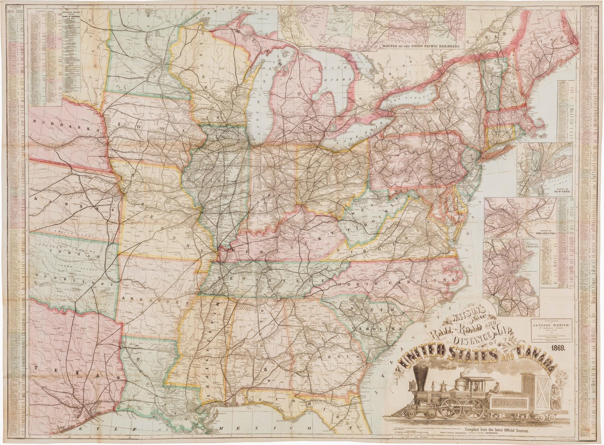
Watson’s New Rail Road and Distance Map of the United States and Canada.
- $3,800
- Among the finest railroad maps of America made in the 19th century.
-
-

-
-
-
Add to cart
 Quick View
 - Pictorial maps, Texas and The West, United States
The Indian-detour; Santa Fe; Harveycars.
- $1,400
- The Roots of Romanticism of the American Southwest.
-
-
-
-
Add to cart
 Quick View
 - Bird's-eye-views, East & Midwest United States, United States
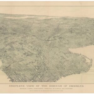
Bird’s-eye view of the borough of Brooklyn showing parks, cemeteries, principal buildings, and suburbs.
- $2,000
- A stunning view of Brooklyn, heralding consolidation with New York City.
-
-
-
-
Add to cart
 Quick View
 - Bird's-eye-views, East & Midwest United States, United States
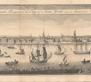
The South Prospect of the City of New York, in America.
- $5,500
- One of the Earliest Acquirable Views of New York City.
-
-
-
-
Add to cart
 Quick View
 - Turkey - Ottoman Empire, Bird's-eye-views
Byzantium nunc Constantinopolis.
- $3,000
- Gorgeous original color 1582 bird's-eye-view of Istanbul.
-
-
-
-
Add to cart

 Quick View
 - Europe, Italy, Bird's-eye-views
Venetia.
- $3,500
- Gorgeous 1577 Braun & Hogenberg bird's-eye-view of Venice.
-
-
-
-
-
Add to cart

 Quick View
 - United States, Texas and The West, Railroad Maps
Williams New Trans-Continental Map of The Pacific R.R. and Routes of Overland Travel To Colorado, Nebraska, The Black Hills, Utah, Idaho, Nevada, Montana California and the Pacific Coast.
- $3,500
- 1876 Pacific Railroad map with references to notorious stagecoach robber Black Bart.
-
-

-

-
-
-
Add to cart
 Quick View
 - Bird's-eye-views, Pacific Northwest - Hawaii - Alaska
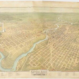
Spokane. Washington.
- $4,500
- A scarce and gorgeous bird’s-eye-view of Spokane during its heyday as the railroad hub of the Northern Plains.
-
-
-
-
Add to cart

 Quick View
 - California, Bay Area & Silicon Valley, Pictorial maps, Bird's-eye-views
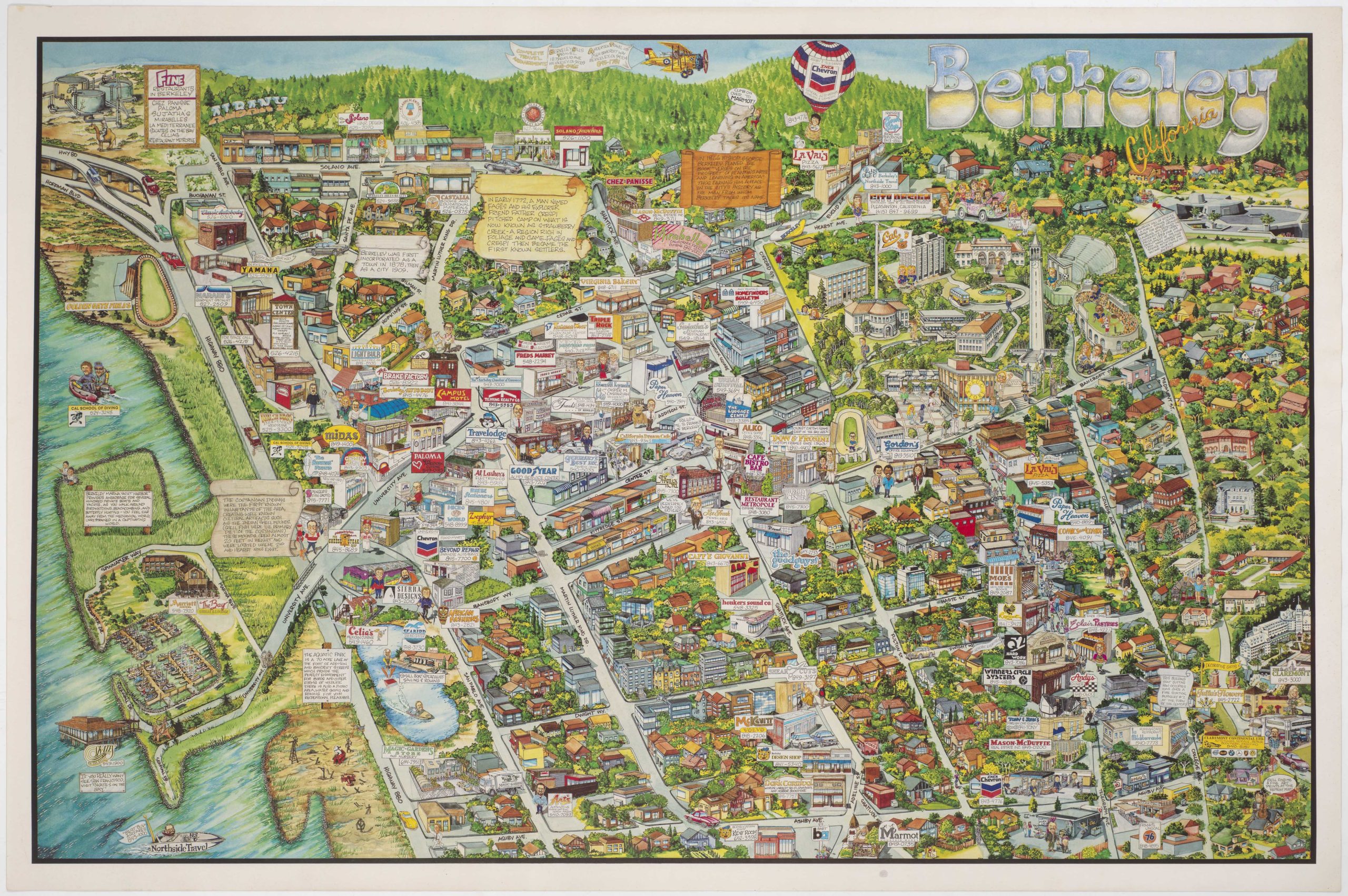
Berkeley California.
- $750
- Rich pictorial bird's-eye-view of Berkeley, including the University of California.
-
-
-
-
-
Add to cart

 Quick View
 - California, San Francisco, Bird's-eye-views
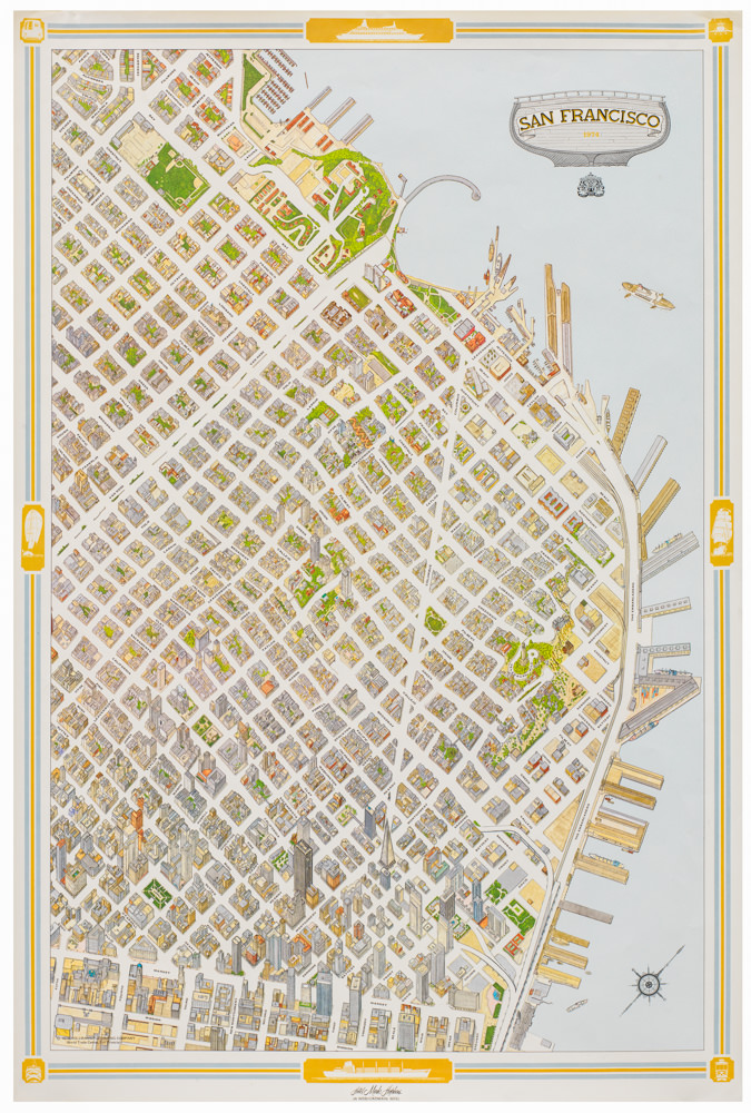
San Francisco.
- $950
- Special 1974 pictorial map of San Francisco issued by the Mark Hopkins Hotel.
-
-
-
-
-
Add to cart
 Quick View
 - Bird's-eye-views, East & Midwest United States, Featured Maps & Views, Michael's Collection, United States
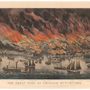
The Great Fire at Chicago. Octr. 8th 1871.
- $9,500
- Currier & Ives 1871 Great Chicago Fire.
-
-
-
-
Add to cart
 Quick View
 - California, San Francisco, Bird's-eye-views
Site of Golden Gate-International Exposition: “A pageant of the Pacific”
- $1,200
- A masterfully-composed 1939 color panorama of San Francisco and its newly built bridges.
-
-