-
-
Add to cart
 Quick View
 - Featured Maps & Views, Railroad Maps, United States
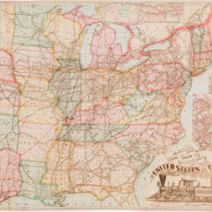
Watson’s New Rail Road and Distance Map of the United States and Canada.
- $3,800
- Among the finest railroad maps of America made in the 19th century.
-
-

-
-
-
Add to cart

 Quick View
 - United States, Texas and The West, Railroad Maps
Williams New Trans-Continental Map of The Pacific R.R. and Routes of Overland Travel To Colorado, Nebraska, The Black Hills, Utah, Idaho, Nevada, Montana California and the Pacific Coast.
- $3,500
- 1876 Pacific Railroad map with references to notorious stagecoach robber Black Bart.
-
-

-

-
-
-
Add to cart
 Quick View
 - Bay Area & Silicon Valley, California, Railroad Maps
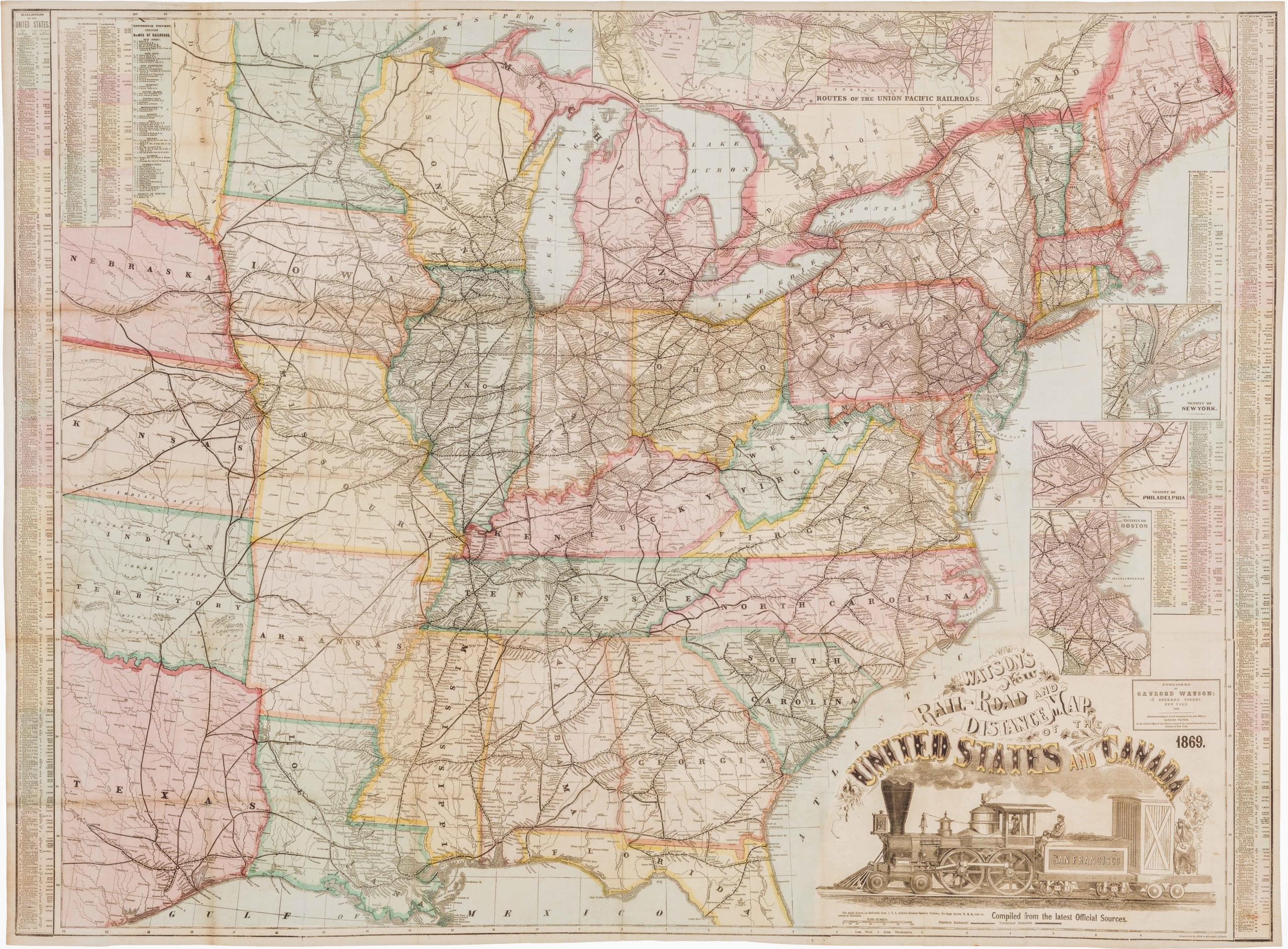
Hiking map of Marin County.
- $675
- 1930 Northwestern Pacific Railroad promotional hiking map of Marin County.
-
-
-
-
Add to cart
 Quick View
 - Bay Area & Silicon Valley, California, Railroad Maps
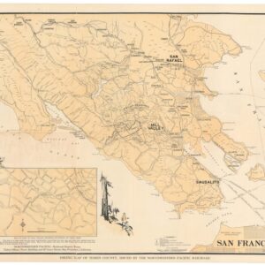
Sonoma & Marin Rail-Road Map, May 1875.
- $3,800
- Railroad manuscript map with early Petaluma town plan and survey work down to Marin County.
-
-
-
-
Add to cart
 Quick View
 - Railroad Maps, San Francisco
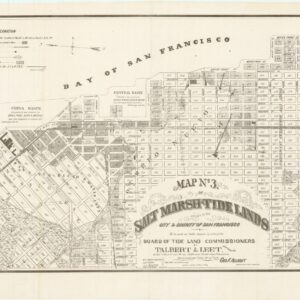
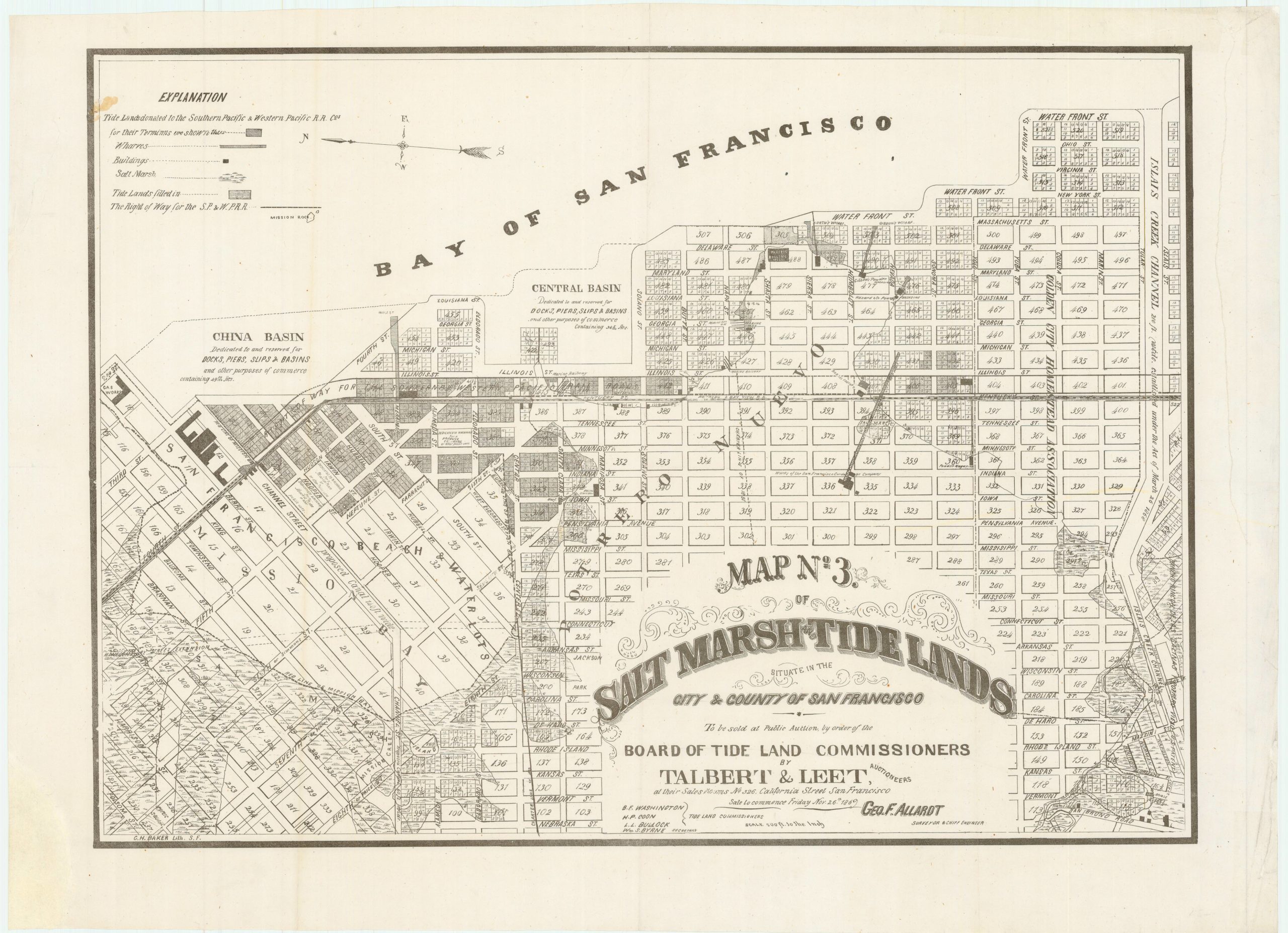
Map no. 3. Salt marsh and tide lands situate in the city and county of San Francisco. To be sold at public auction by order of the Board of Tide Land Commissioners by Talbert & Leet, auctioneers, at their sales rooms no. 526 California Street, San Francisco. Sale to commence Friday Nov. 26th, 1869.
- $3,400
- Rare cadastral and Southern Pacific Railroad right-of-way tidal lands map of Mission Bay.
-
-
-
-
-
Add to cart
 Quick View
 - Atlases & Books, Bay Area & Silicon Valley, California, Railroad Maps
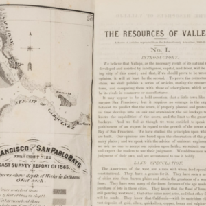
The Resources of Vallejo: A series of articles, reprinted from the Solano County Advertiser, 1868-69
- $3,200
- An early promotional booklet on Vallejo with two very rare folding maps.
-
-
-
-
Add to cart
 Quick View
 - United States, Railroad Maps
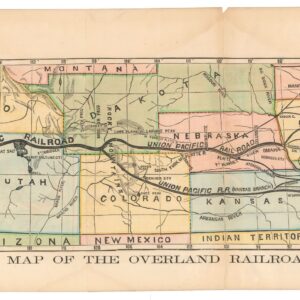
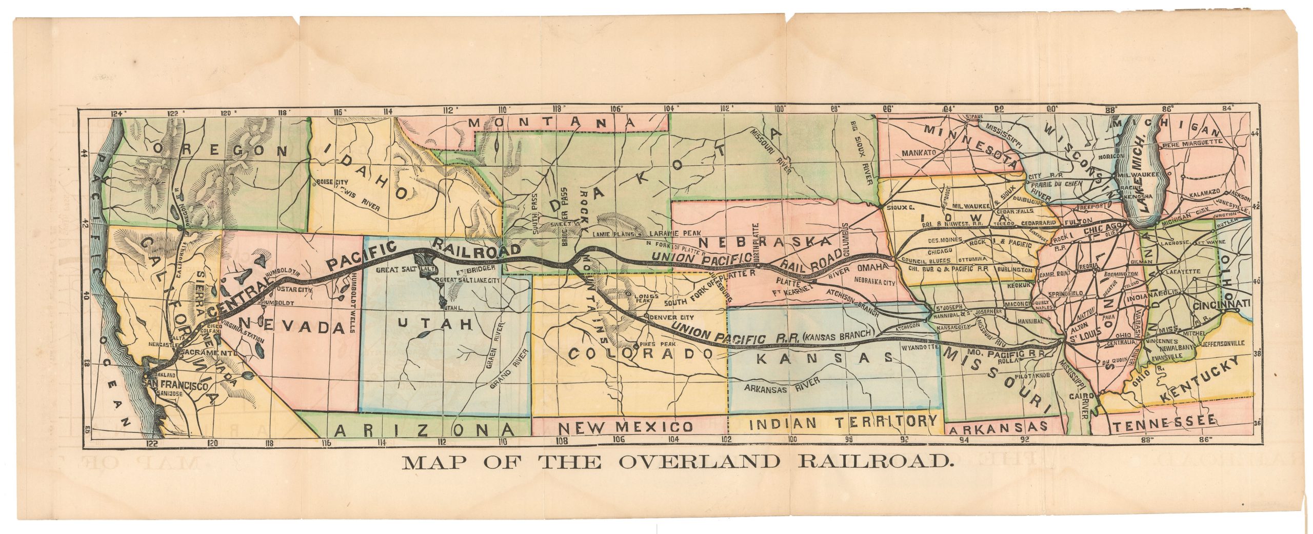
Map of the Overland Railroad
- $850
- Rare early map showing the proposed route of the Central Pacific Railroad during a relatively early period of its construction.
-
-
-
-
-
Add to cart

 Quick View
 - Americas, Mexico - Central & South America, Railroad Maps
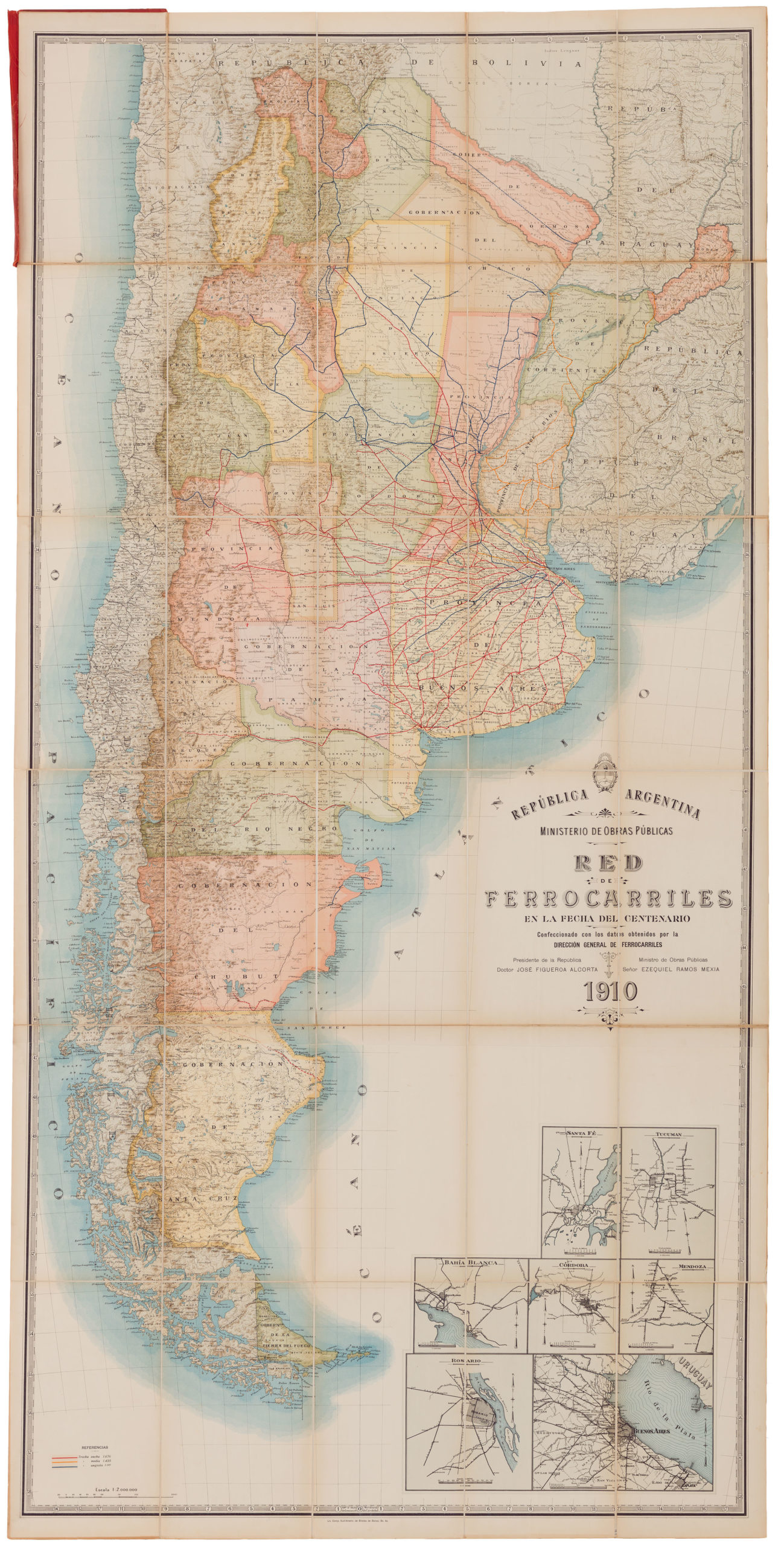
República Argentina / Ministerio de Obras Publicas / Red de ferrocarriles en la fecha del centenario / Confeccionado con los dalos obtenidos por la dirección general de ferrocarriles…
- $1,600
- A fabulous large-format official Ministry of Public Works 1910 railroad map of Argentina.
-
-
-
-
-
Add to cart
 Quick View
 - Texas and The West, Railroad Maps
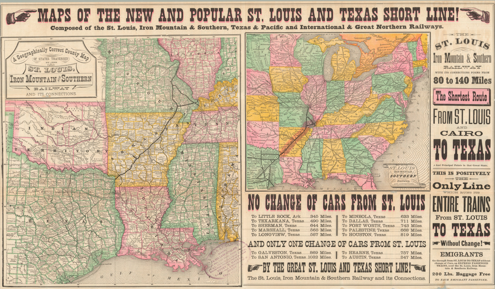
Maps of the New and Popular St. Louis and Texas Short Line!
- $1,800
- An eye-catching 1878 broadside inviting people to come and settle in Texas; a state in which a formal civilian government had only been restored eight years earlier.
-
-
-
-
-
Add to cart
![[Map of Steamship Routes and the Railways and Post Roads of the Russian Empire]](https://neatlinemaps.com/wp-content/uploads/2020/04/NL-00827_Thumbnail-300x300.jpg)
![[Map of Steamship Routes and the Railways and Post Roads of the Russian Empire]](https://neatlinemaps.com/wp-content/uploads/2020/04/NL-00827-scaled.jpg) Quick View
Quick View - Europe, Russia & Eastern Europe, Railroad Maps
[Map of Steamship Routes and the Railways and Post Roads of the Russian Empire]
- $1,850
- In-progress construction of the Trans-Siberian Railway: a scarce wall map depicting the transportation network of the Russian Empire at the end of the 19th century.
-
-
![[Map of Steamship Routes and the Railways and Post Roads of the Russian Empire]](https://neatlinemaps.com/wp-content/uploads/2020/04/NL-00827-scaled-300x300.jpg)
-
-
-
Add to cart

 Quick View
 - California, Railroad Maps
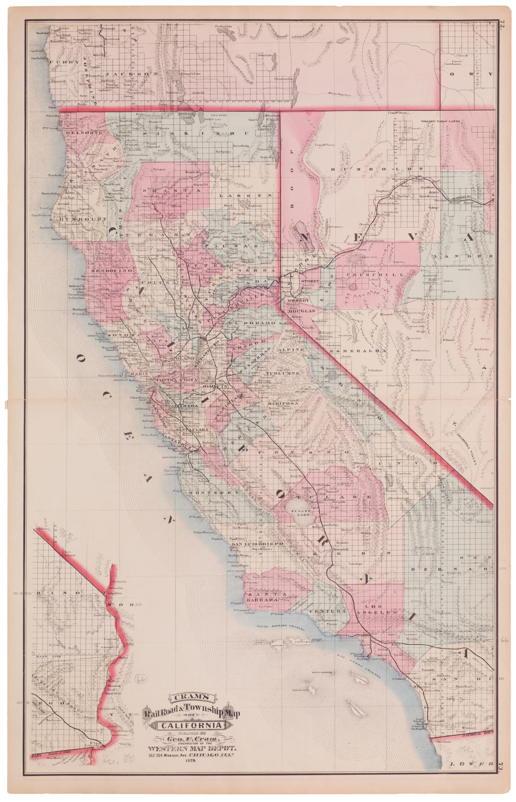
Cram’s Railroad & Township Map of California
- $775
- Excellent 1879 large-format edition railroad map of California.
-
-

-