-
-
Add to cart
 Quick View
 - United States
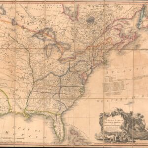
The United States of North America: with the British Territories and Those of Spain.
- $6,500
- With the proto-State of Franklin and the colony of New Iberia (Morgania)!
-
-
-
-
Add to cart
 Quick View
 - East & Midwest United States, United States
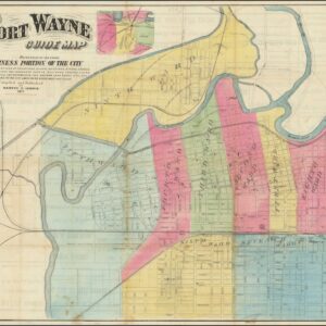
Fort Wayne Guide Map (location of First Professional Baseball Game shown).
- $6,500
- Earliest recorded printed map to locate the site of the world’s first professional baseball game.
-
-
-
-
Add to cart
 Quick View
 - Bird's-eye-views, East & Midwest United States, Featured Maps & Views, Michael's Collection, United States
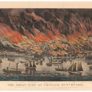
The Great Fire at Chicago. Octr. 8th 1871.
- $8,500
- Currier & Ives 1871 Great Chicago Fire.
-
-
-
-
Add to cart
 Quick View
 - Pictorial maps, Texas and The West
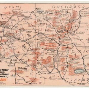
Harveycar Motor Cruises Through the Great Southwest.
- $975
- A vibrant testimony to the birth of the American Road Trip.
-
-
-
-
Add to cart
 Quick View
 - East & Midwest United States, United States
Buy Homes of J.W. Wilbur Co.
- $100
- An invitation to settle in New England.
-
-
-
-
Add to cart
 Quick View
 - Bird's-eye-views, Pacific Northwest - Hawaii - Alaska, Texas and The West
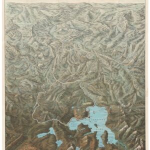
Yellowstone National Park. Northern Pacific Railway / Northern Pacific Railway Company for Yellowstone National Park Puget Sound and Alaska.
- $700
- A magnificent view of one of America's most majestic parks in its original envelope.
-
-
-
-
Add to cart
 Quick View
 - East & Midwest United States, United States
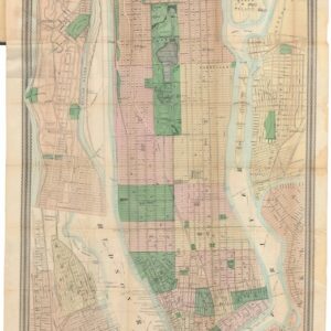
Map of New York and Vicinity.
- $950
- From city to metropolis: Matthew Dripps’ rare folding map of New York.
-
-
-
-
Add to cart
 Quick View
 - California, Mexico - Central & South America, Texas and The West
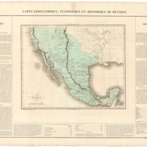
Carte Geographique, Statistique, et Historique du Mexique (incl. Alta California).
- $475
- The First Mexican Empire, including Alta California.
-
-
-
-
Add to cart
 Quick View
 - Texas and The West
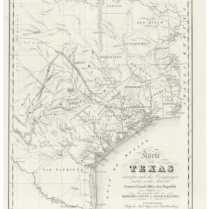
Karte von Texas.
- $6,000
- Highly sought after by collectors of Texas and German-American history.
-
-
-
-
Add to cart
 Quick View
 - East & Midwest United States
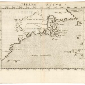
Tierra Nueva.
- $1,200
- A true first state of one of the earliest maps of the Eastern Seaboard.
-
-
-
-
Add to cart
 Quick View
 - Pacific Northwest - Hawaii - Alaska
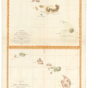
Carte des Parties des Îles Sandwich & Carte des Îles Sandwich.
- $1,600
- History’s second mapping of Hawaii.
-
-
-
-
Add to cart
 Quick View
 - Pictorial maps, United States
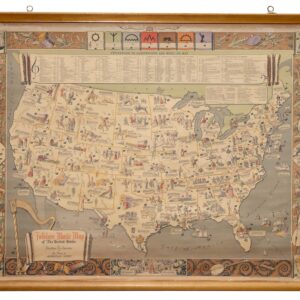
Folklore Music Map of the United States.
- $975
- A fantastic folklore map of America.
-
-