-
-
Add to cart
 Quick View
 - Bird's-eye-views, Pacific Northwest - Hawaii - Alaska, Texas and The West
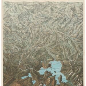
Yellowstone National Park. Northern Pacific Railway / Northern Pacific Railway Company for Yellowstone National Park Puget Sound and Alaska.
- $700
- A magnificent view of one of America's most majestic parks in its original envelope.
-
-
-
-
Add to cart
 Quick View
 - United States, East & Midwest United States
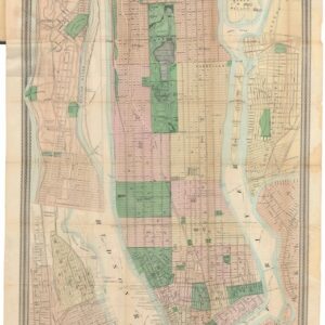
Map of New York and Vicinity.
- $950
- From city to metropolis: Matthew Dripps’ rare folding map of New York.
-
-
-
-
Add to cart
 Quick View
 - California, Mexico - Central & South America, Texas and The West
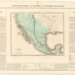
Carte Geographique, Statistique, et Historique du Mexique (incl. Alta California).
- $475
- The First Mexican Empire, including Alta California.
-
-
-
-
Add to cart
 Quick View
 - Texas and The West
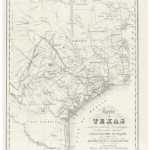
Karte von Texas.
- $6,000
- Highly sought after by collectors of Texas and German-American history.
-
-
-
-
Add to cart
 Quick View
 - East & Midwest United States
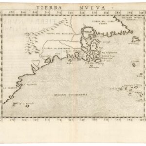
Tierra Nueva.
- $1,200
- A true first state of one of the earliest maps of the Eastern Seaboard.
-
-
-
-
Add to cart
 Quick View
 - Pacific Northwest - Hawaii - Alaska
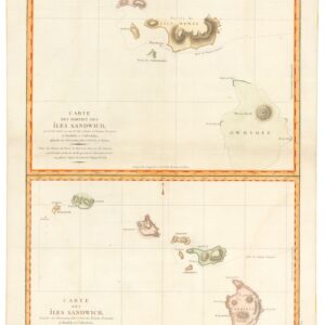
Carte des Parties des Îles Sandwich & Carte des Îles Sandwich.
- $1,600
- History’s second mapping of Hawaii.
-
-
-
-
Add to cart
 Quick View
 - East & Midwest United States, United States
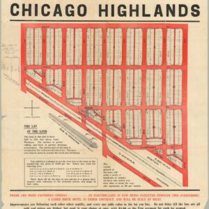
The Central Subdivision at Chicago Highlands.
- $775
- Promotional broadside for the industrial community of Chicago Highlands.
-
-
-
-
Add to cart
![[AMERICAN REVOLUTION] Boston, George Washington, Franklin, Philadelphia, Washington, D.C.](https://neatlinemaps.com/wp-content/uploads/2024/05/NL-02090a_thumbnail-300x300.jpg) Quick View
Quick View - United States, East & Midwest United States
[AMERICAN REVOLUTION] Boston, George Washington, Franklin, Philadelphia, Washington, D.C.
- $600
- A set of six hand-colored plates from Guilio Ferrario’s iconic encyclopedia showcasing the American Revolution.
-
-
-
-
Add to cart
 Quick View
 - East & Midwest United States
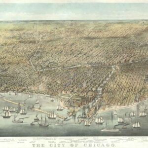
The City of Chicago.
- $6,500
- Probably the most iconic view of Chicago ever made…
-
-
-
-
Add to cart
 Quick View
 - Pacific Northwest - Hawaii - Alaska, United States, Pictorial maps
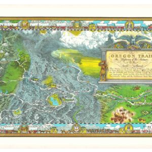
The Oregon Trail: The Highway of the Pioneers to the Pacific Northwest.
- $575
- William Forsyth McIlwraith’s vibrant and historically rich Oregon Trail map.
-
-
-
-
Add to cart
 Quick View
 - Texas and The West
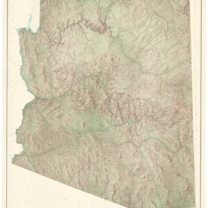
State of Arizona.
- $650
- A large, exquisite topographical map of Arizona, produced after World War II by the most reliable mapping agency on the planet.
-
-
-
-
Add to cart
![[Morenci, Arizona Photograph Album]](https://neatlinemaps.com/wp-content/uploads/2024/05/NL-01915_thumbnail-300x300.jpg) Quick View
Quick View - Texas and The West
[Morenci, Arizona Photograph Album]
- $675
- An unrecorded early 20th-century photo album of mining operations in Arizona.
-
-