-
-
Add to cart
 Quick View
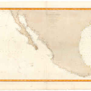
 - Americas, Mexico - Central & South America, Texas and The West
Carte de la côte occidentale d’Amérique…
- $875
- Nautical chart of Mexico, including San Diego and the Texas coast.
-
-
-
-
Add to cart
![[1838 Republic of Texas manuscript document detailing the votes for elected office, including President].](https://neatlinemaps.com/wp-content/uploads/2023/06/NL-01852-front_thumbnail-300x300.jpg) Quick View
Quick View - Michael's Collection, Texas and The West
[1838 Republic of Texas manuscript document detailing the votes for elected office, including President].
- $6,500
- Original Republic of Texas referendum document stipulating the results of the 1838 election of Mirabeau Lamar.
-
-
-
-
Add to cart
 Quick View
 - Pacific Northwest - Hawaii - Alaska, United States, Europe, Russia & Eastern Europe, Atlases & Books
Account of the Russian discoveries between Asia and America. To which is added the conquest of Siberia and the history of the transactions and commerce between Russia and China.
- $900
- The most comprehensive English assessment of Russian explorations in the Arctic and Pacific ever written.
-
-
-
-
Add to cart
 Quick View
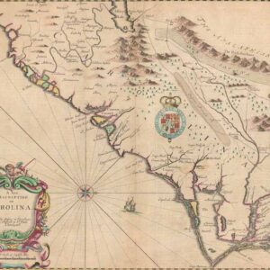
 - East & Midwest United States
A New Description of Carolina.
- $4,000
- A beautiful example of Speed's notable mapping of the interior of Carolina.
-
-
-
-
Add to cart
 Quick View
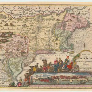
 - East & Midwest United States
Recens Edita totius Novi Belgii, in America Septenrionali siti, delineatio cura et sumptibus
- $4,000
- The most widely emulated map of colonial North America, with one of the earliest views of New York City.
-
-
-
-
Add to cart
 Quick View
 - Atlases & Books, Texas and The West
Three Years in Texas. Including a View of the Texan Revolution, and an Account of the Principal Battles, Together With Descriptions of the Soil, Commercial and Agricultural Advantages.
- $32,000
- Streeter's own copy of what he considered to be the most sought-after book for the Texas Revolution as a whole.
-
-
-
-
Add to cart
 Quick View
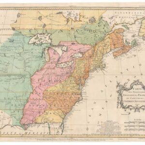
 - United States
Carte des Possessions Angloises & Francoises du Continent de L’Amerique Septentrionale 1755.
- $7,500
- An early state of Jean Palairet’s map depicting English and French possessions in America.
-
-
-
-
Add to cart
 Quick View
 - Bird's-eye-views, Texas and The West
Salt Lake City, 1887.
- $2,900
- The Bustling New Jerusalem of the American West.
-
-
-
-
Add to cart
 Quick View
 - Texas and The West
Map of That Portion of the Boundary between the United States and Mexico From the Pacific Coast To The Junction of the Gila and Colorado Rivers… Showing also the Limits of the Treaty Negotiated by the Hon. James Gadsden
- $3,200
- Gray's 1855 map of the Gadsden Purchase.
-
-
-
-
Add to cart
 Quick View
 - East & Midwest United States, Texas and The West
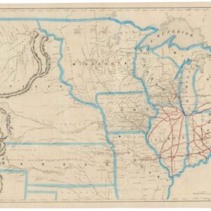
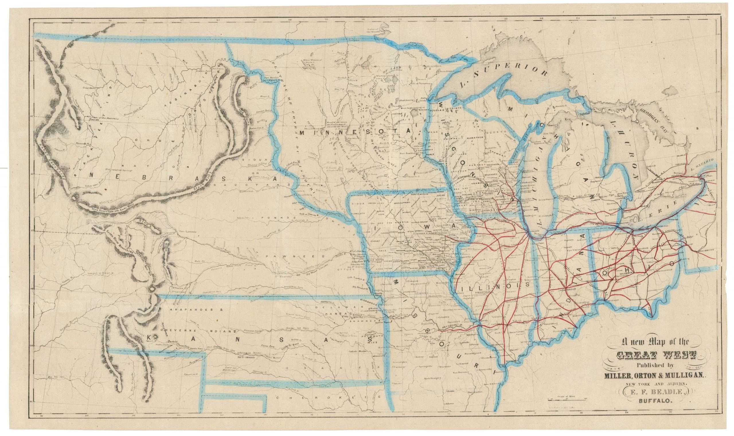
A New Map of the Great West
- $775
- From the creator of the dime-novel and the pulp fiction genre: this is Erastus Flavel Beadle’s rare and highly desirable map of the Great West.
-
-
-
-
-
Add to cart
 Quick View
 - East & Midwest United States
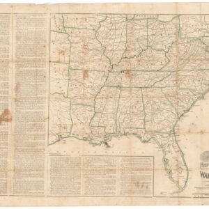
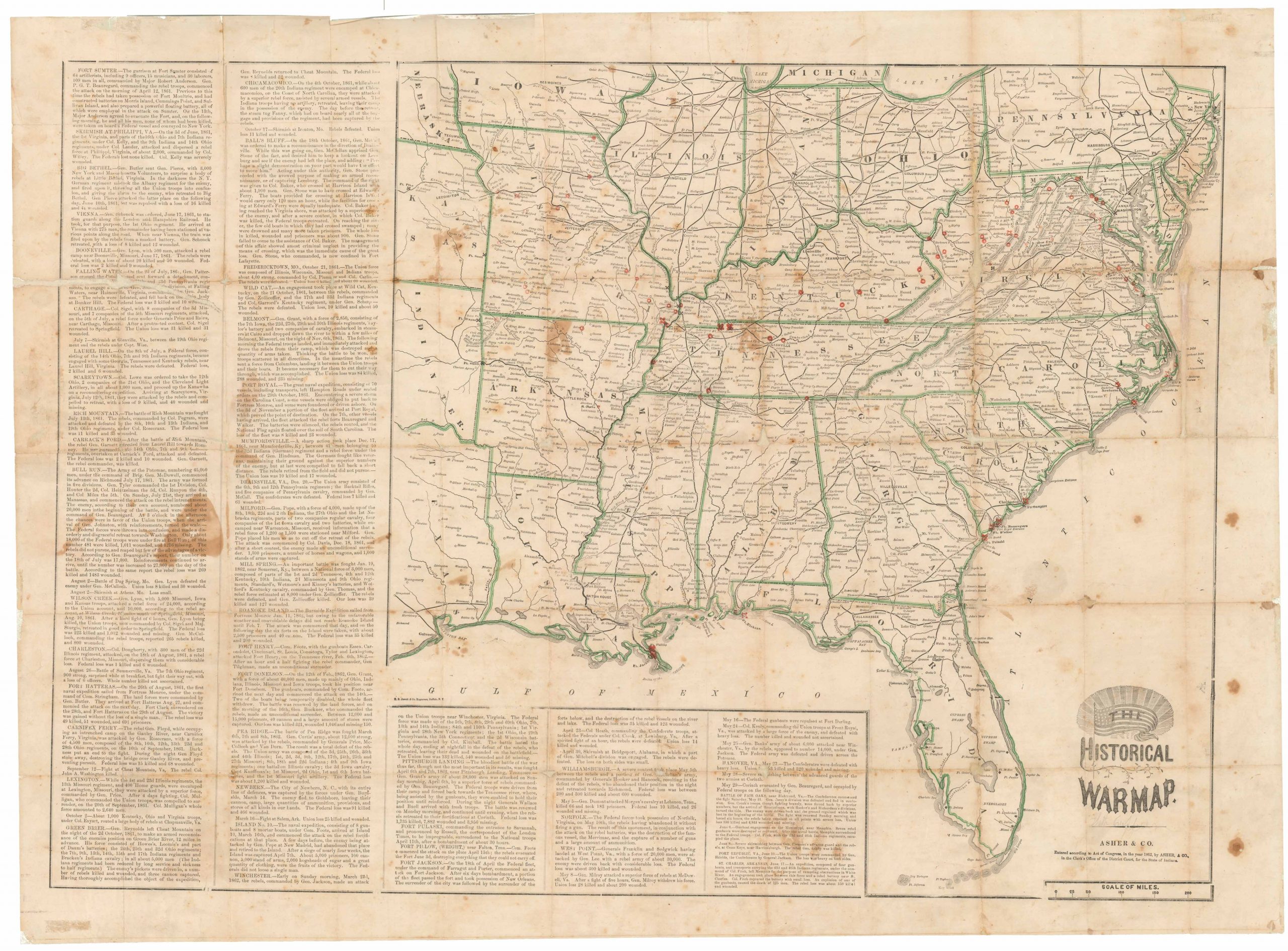
The Historical War Map.
- $975
- Printed broadside that provided the American public with a comprehensive overview of the Civil War, with an extensive narrative on the war’s progress.
-
-
-
-
-
Add to cart
 Quick View
 - East & Midwest United States
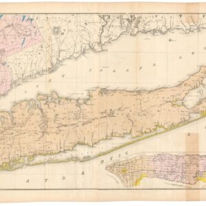
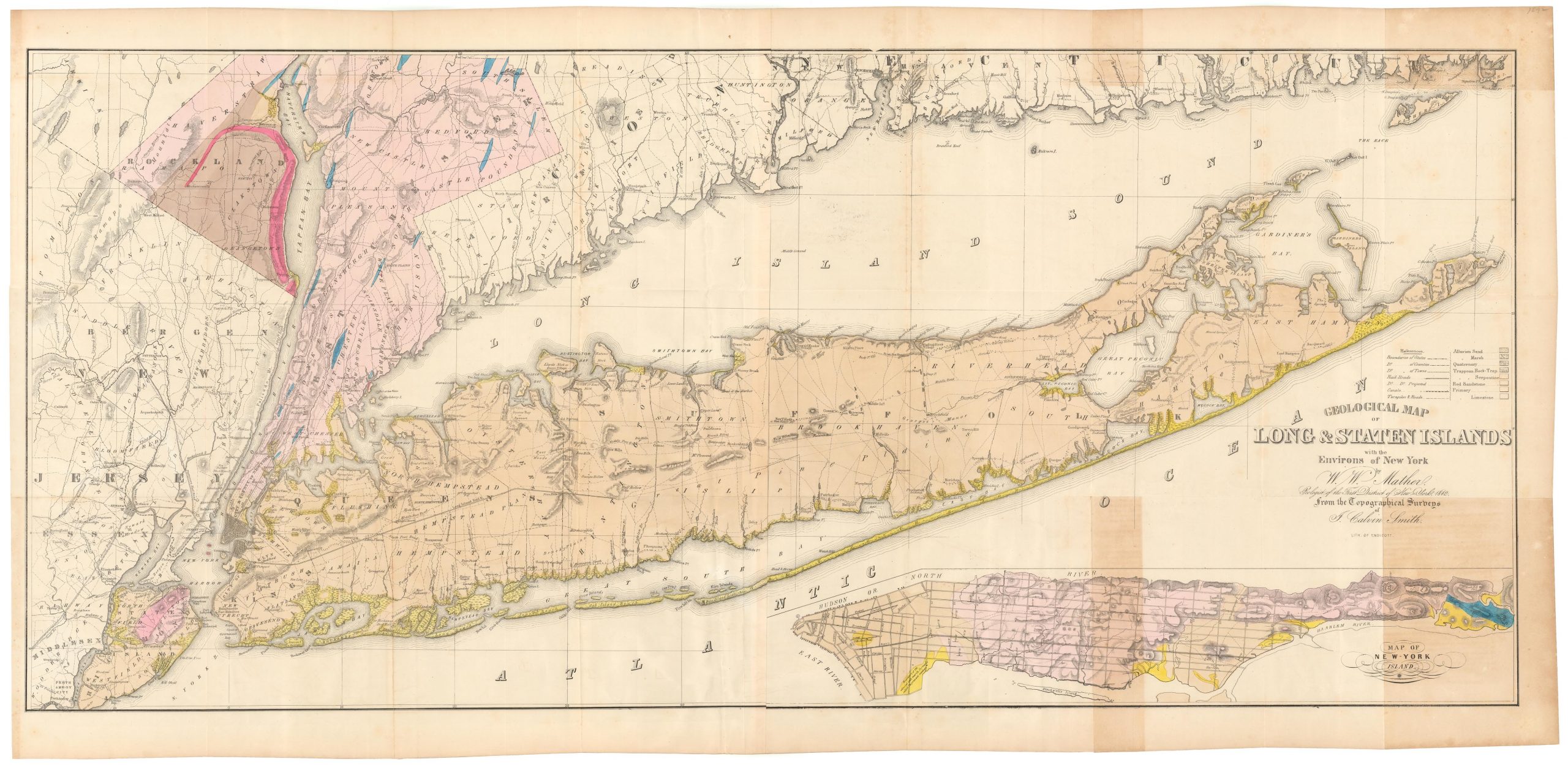
Geological map of Long & Staten islands with the environs of New York
- $1,700
- The first systematic mapping of the geology of Long Island.
-
-
-