-
-
Add to cart
 Quick View
 - Atlases & Books, Texas and The West
Three Years in Texas. Including a View of the Texan Revolution, and an Account of the Principal Battles, Together With Descriptions of the Soil, Commercial and Agricultural Advantages.
- $32,000
- Streeter's own copy of what he considered to be the most sought-after book for the Texas Revolution as a whole.
-
-
-
-
Add to cart
 Quick View
 - Pacific Northwest - Hawaii - Alaska
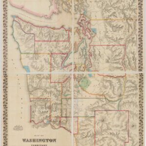
Map of Washington Territory West of the Cascade Mountains.
- $12,000
- The first large-format map of Washington Territory and a masterpiece of American cartography.
-
-
-
-
Add to cart
 Quick View
 - East & Midwest United States
Road and Property Map showing the Towns of Stamford and Greenwich Conn. Together with Surrounding Territory Compiled from Actual Surveys, Private Plans & Official Records…
- $24,500
- The greatest and most impressive 19th-century map of Connecticut.
-
-
-
-
Add to cart
 Quick View
 - United States
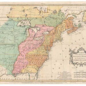
Carte des Possessions Angloises & Francoises du Continent de L’Amerique Septentrionale 1755.
- $7,500
- An early state of Jean Palairet’s map depicting English and French possessions in America.
-
-
-
-
Add to cart
 Quick View
 - Bird's-eye-views, Texas and The West
Salt Lake City, 1887.
- $2,900
- The Bustling New Jerusalem of the American West.
-
-
-
-
Add to cart
 Quick View
 - Texas and The West
Map of That Portion of the Boundary between the United States and Mexico From the Pacific Coast To The Junction of the Gila and Colorado Rivers… Showing also the Limits of the Treaty Negotiated by the Hon. James Gadsden
- $3,200
- Gray's 1855 map of the Gadsden Purchase.
-
-
-
-
Add to cart
 Quick View
 - East & Midwest United States, Texas and The West
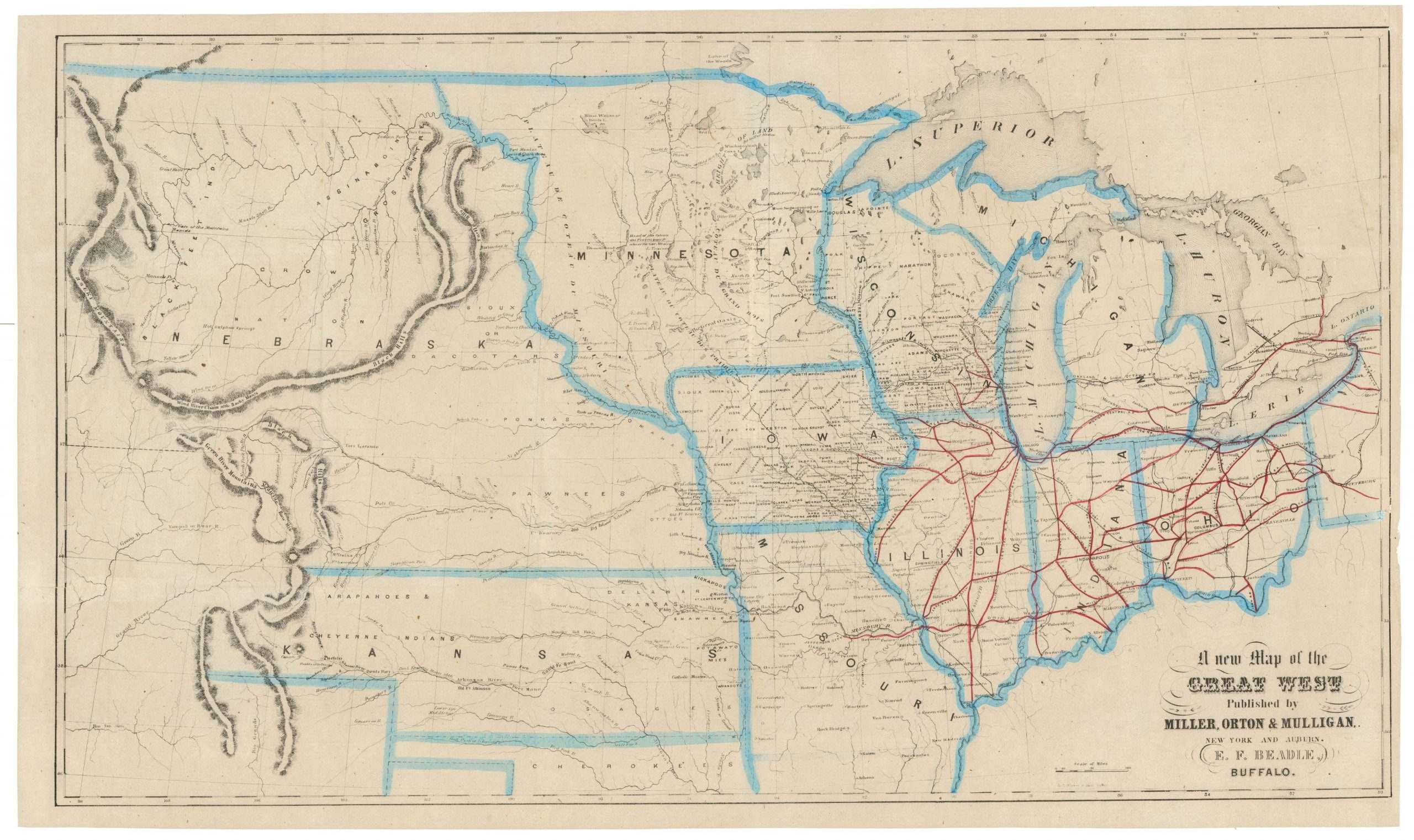
A New Map of the Great West
- $775
- From the creator of the dime-novel and the pulp fiction genre: this is Erastus Flavel Beadle’s rare and highly desirable map of the Great West.
-
-
-
-
-
Add to cart
 Quick View
 - United States, Texas and The West, East & Midwest United States, Americas, Cuba, West Indies, Caribbean
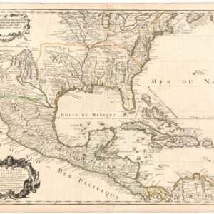
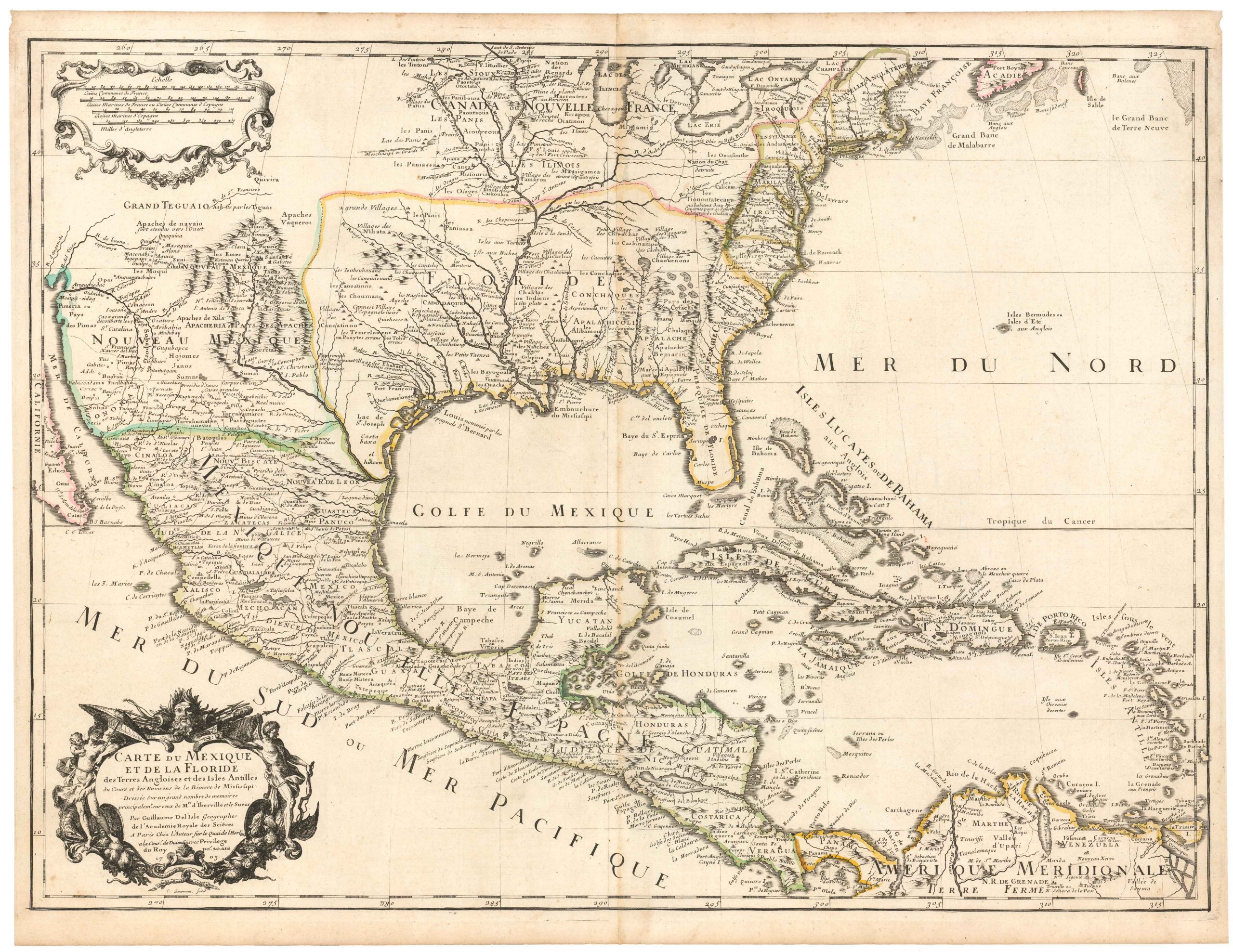
Carte Du Mexique et de la Floride des Terres Angloises et des Isles Antilles du Cours et des Environs de la Riviere Mississipi
- $1,800
- De l’Isle’s paradigm-setting chart of the Gulf of Mexico, the first accurate plotting of the full course of the Mississippi River.
-
-
-
-
-
Add to cart
 Quick View
 - Texas and The West
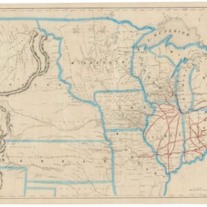
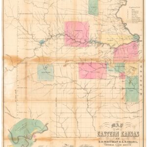
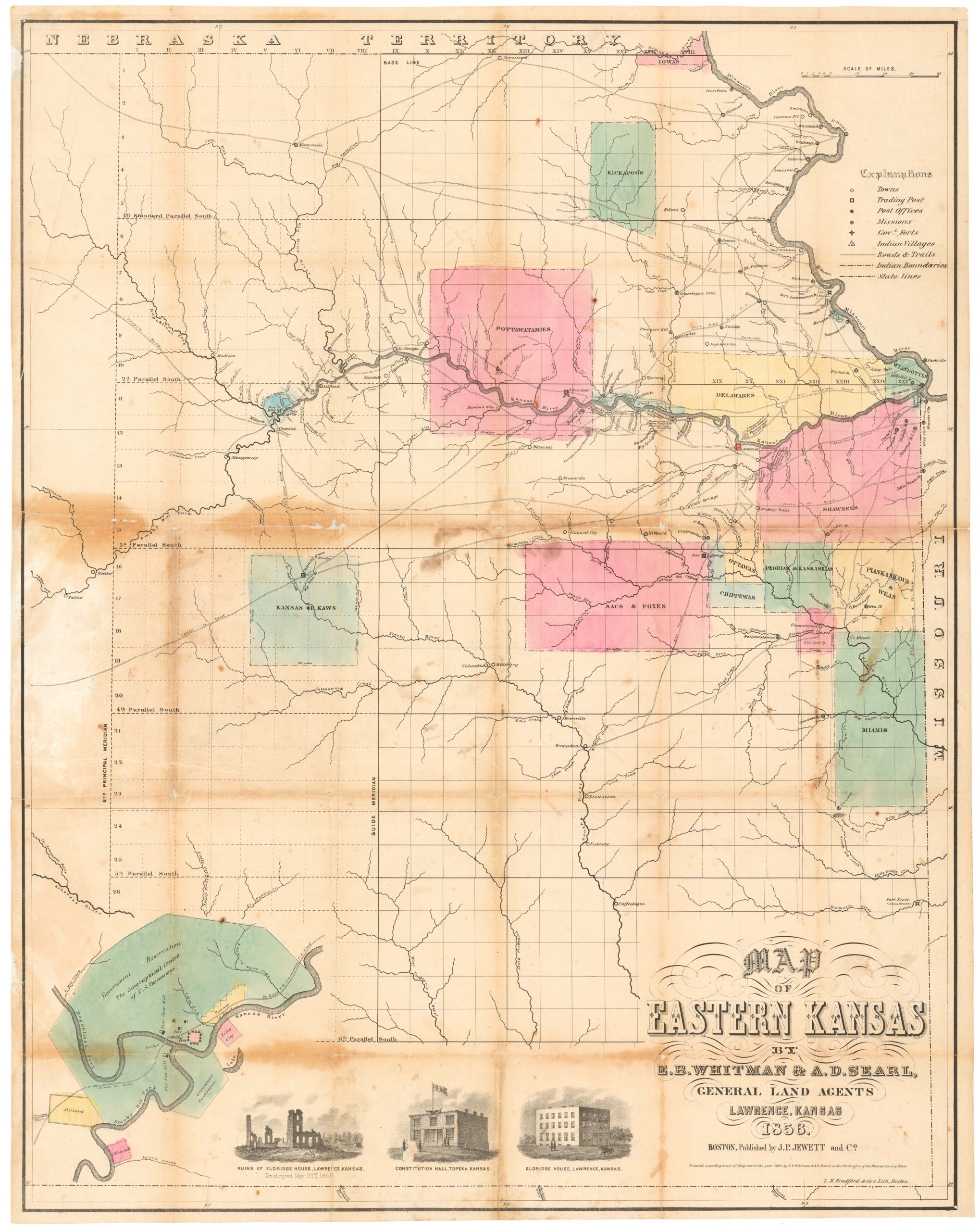
Map of Eastern Kansas.
- $2,800
- Iconic 1856 map of East Kansas, published just a month after the sacking of Lawrence and in the midst of the tumultuous ‘Bloody Kansas’ era.
-
-
-
-
-
Add to cart
 Quick View
 - California, Pacific Northwest - Hawaii - Alaska
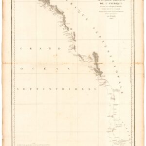
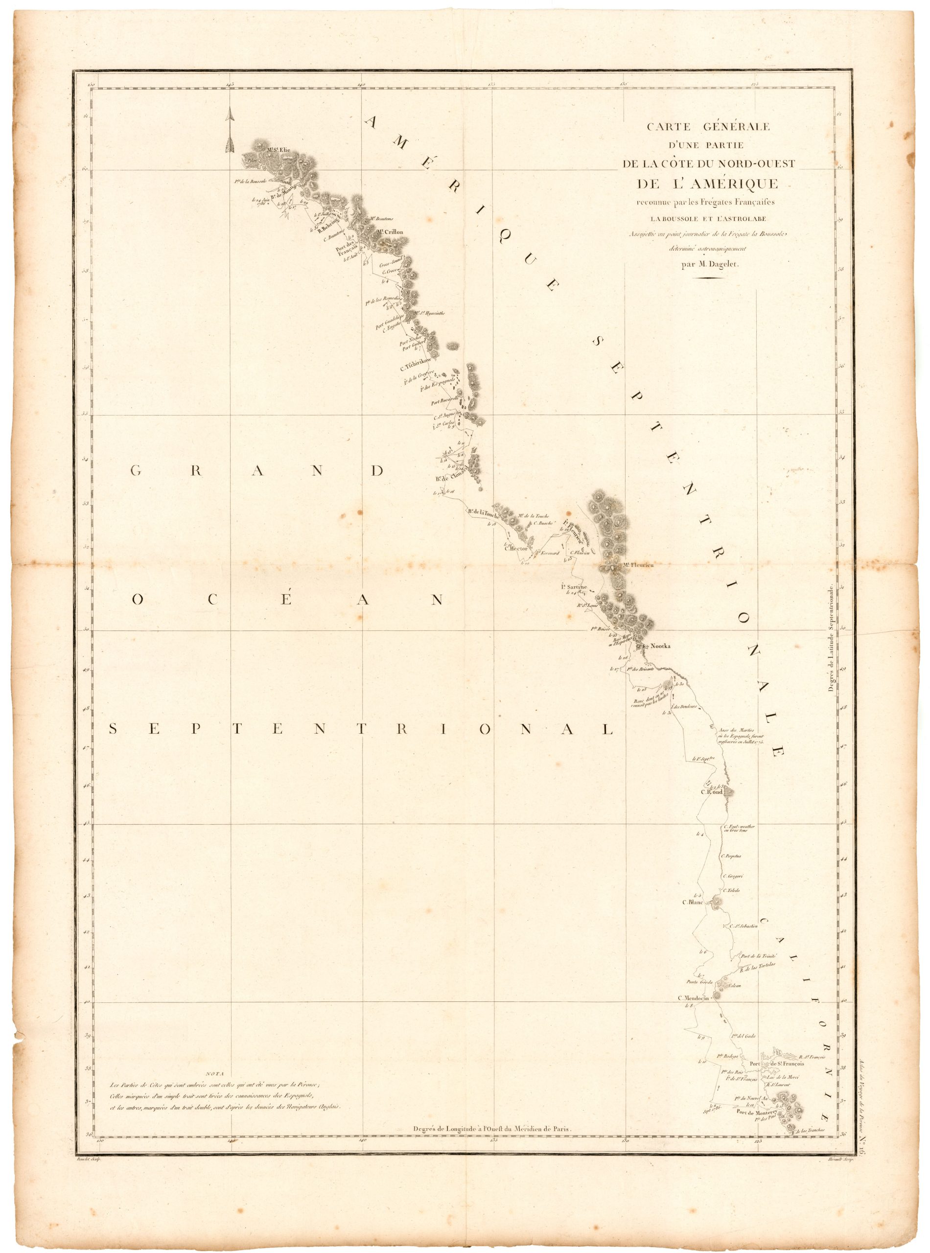
Carte de la Partie de la Cote Nord-Ouest de L’Amerique Reconnue pendant Etes de 1792, 1793, et 1794.
- $1,200
- Vancouver's chart of America’s Pacific coastline: the first printed map to identify the Columbia River estuary and Vancouver Island.
-
-
-
-
-
Add to cart
![[Vietnamese Maps of North America: Mexico, Canada, USA]](https://neatlinemaps.com/wp-content/uploads/2022/04/NL-01262-USA_thumbnail-scaled-300x300.jpg) Quick View
Quick View - United States, Americas, Canada and The Great Lakes, Mexico - Central & South America, Curiosities - Miscellanea
[Vietnamese Maps of North America: Mexico, Canada, USA]
- $675
- Three curious maps of North America made in South Vietnam.
-
-
-
-
Add to cart
 Quick View
 - East & Midwest United States
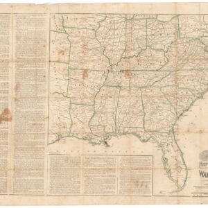
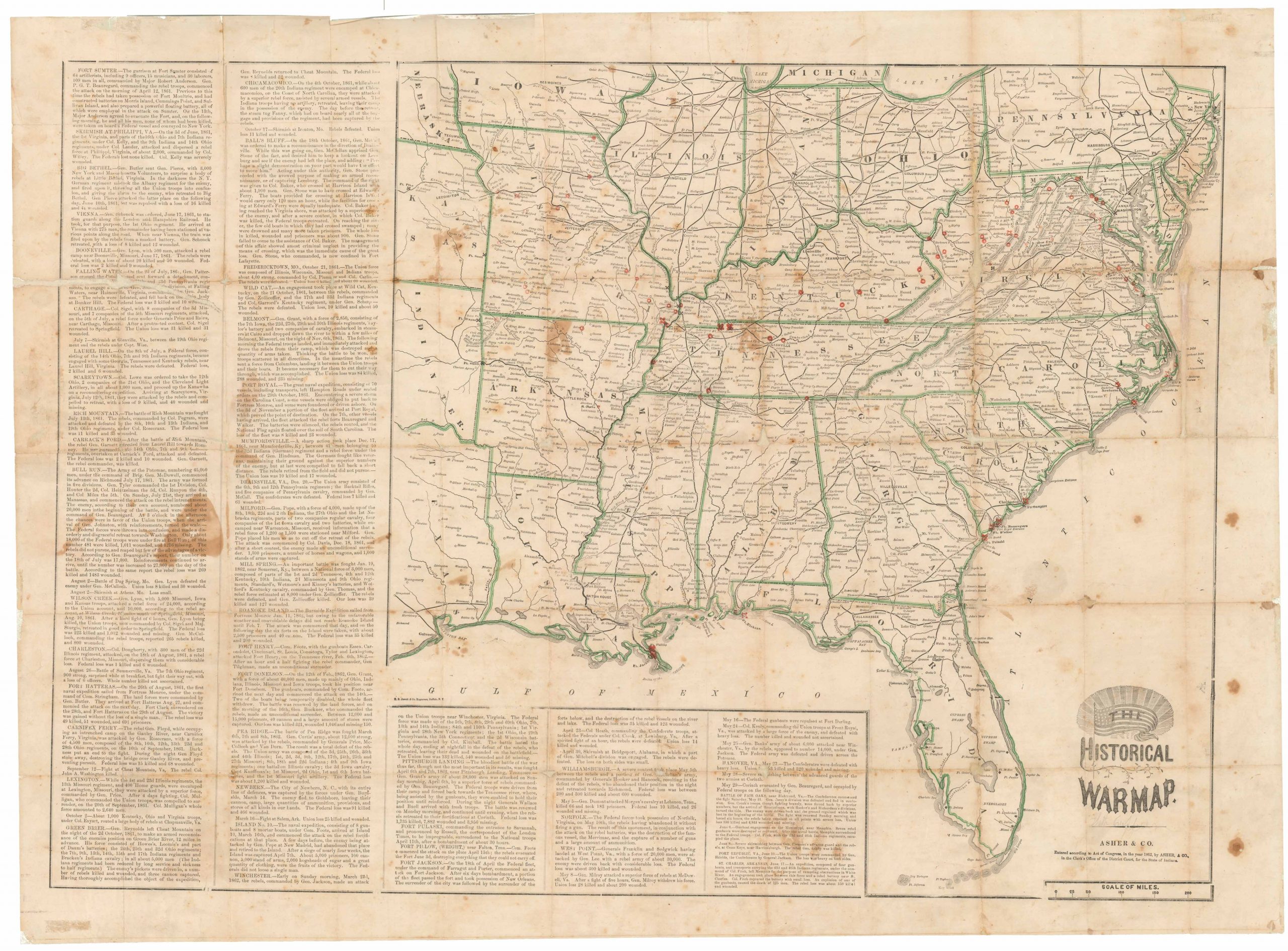
The Historical War Map.
- $975
- Printed broadside that provided the American public with a comprehensive overview of the Civil War, with an extensive narrative on the war’s progress.
-
-
-