Antique maps and views related to World War I & World War II.
-
-
Add to cart
![Wehrmacht Sonderausgabe VI-1940: Einheitsblatt Nr. 29 [Caen] & Einheitsblatt Nr. 30 [Lisieux].](https://neatlinemaps.com/wp-content/uploads/2025/11/NL-01431_thumbnail-300x290.jpg) Quick View
Quick View - France & Switzerland, Germany & the Netherlands, World War I and World War II
Wehrmacht Sonderausgabe VI-1940: Einheitsblatt Nr. 29 [Caen] & Einheitsblatt Nr. 30 [Lisieux].
- $3,500
- A rare window into the operational thinking behind Hitler's Atlantikwall.
-
-
-
-
Add to cart
 Quick View
 - Asia, Southeast Asia & Australia, World War I and World War II
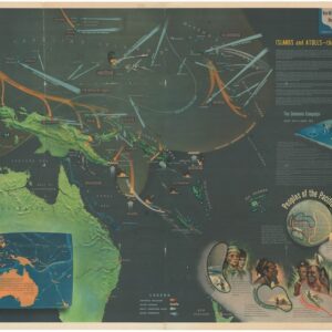
NavWarMap No. 5. Southwest Pacific.
- $1,000
- Large-format 1944 U.S. Navy “NavWar” training map of the Southwest Pacific, illustrating Japan’s expansion and the Allied counteroffensive toward victory.
-
-
-
-
Add to cart
 Quick View
 - Europe, World War I and World War II
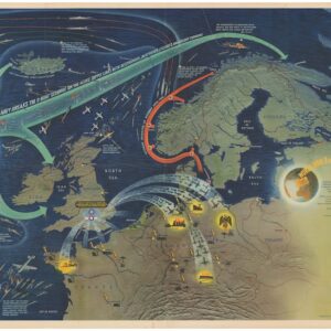
World War 2 in the North Sea Area. NavWar Map No. 3.
- $1,000
- Large-format 1944 U.S. Navy “NavWar” training map of the North Sea, celebrating Allied victory over the German U-boat threat.
-
-
-
-
Add to cart
 Quick View
 - Atlases & Books, California, World War I and World War II
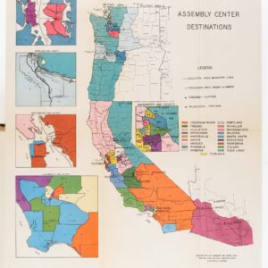
Japanese evacuation from the West Coast, 1942: Final Report.
- $775
- A chronicle of one of the most infamous events in American history.
-
-
-
-
Add to cart
 Quick View
 - Iran - Persia - Central Asia, Middle East - Holy Land Maps, World War I and World War II
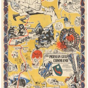
The Persian Gulf Command.
- $2,600
- Rare 1945 Allied propaganda map published in Tehran, vividly depicting the Persian Gulf Command’s vital WWII supply route through Iran to the Soviet Union.
-
-
-
-
Add to cart
![[Mısır Haritası / Map of Egypt]](https://neatlinemaps.com/wp-content/uploads/2025/06/NL-02391_thumbnail-2-300x300.jpg) Quick View
Quick View - Africa, Middle East - Holy Land Maps, Turkey - Ottoman Empire, World War I and World War II
[Mısır Haritası / Map of Egypt]
- $1,800
- Strategic Ottoman map of Lower Egypt.
-
-
-
-
Add to cart
 Quick View
 - Russia & Eastern Europe, World War I and World War II
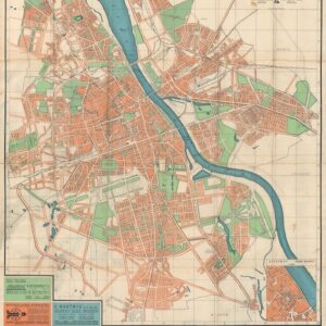
Stadtplan von Warschau / Plan Warszawy.
- $2,800
- With blue over-print highlighting the Jewish Ghetto.
-
-
-
-
Add to cart
![[Persuasive Cartography] Ubootswirkung im Mittelmeer.](https://neatlinemaps.com/wp-content/uploads/2024/05/NL-01997_thumbnail-300x300.jpg) Quick View
Quick View - Europe, World War I and World War II
[Persuasive Cartography] Ubootswirkung im Mittelmeer.
- $1,900
- World War I propaganda map of German submarine attacks.
-
-
-
-
Add to cart
 Quick View
 - Asia, World War I and World War II
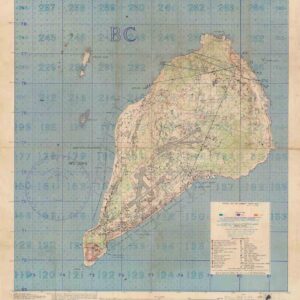
Special Air and Gunnery Target Map. Iwo Jima.
- $4,000
- The scarce and historically important secret targeting map for the U.S. invasion of Iwo Jima.
-
-
-
-
Add to cart

 Quick View
 - Europe, World War I and World War II
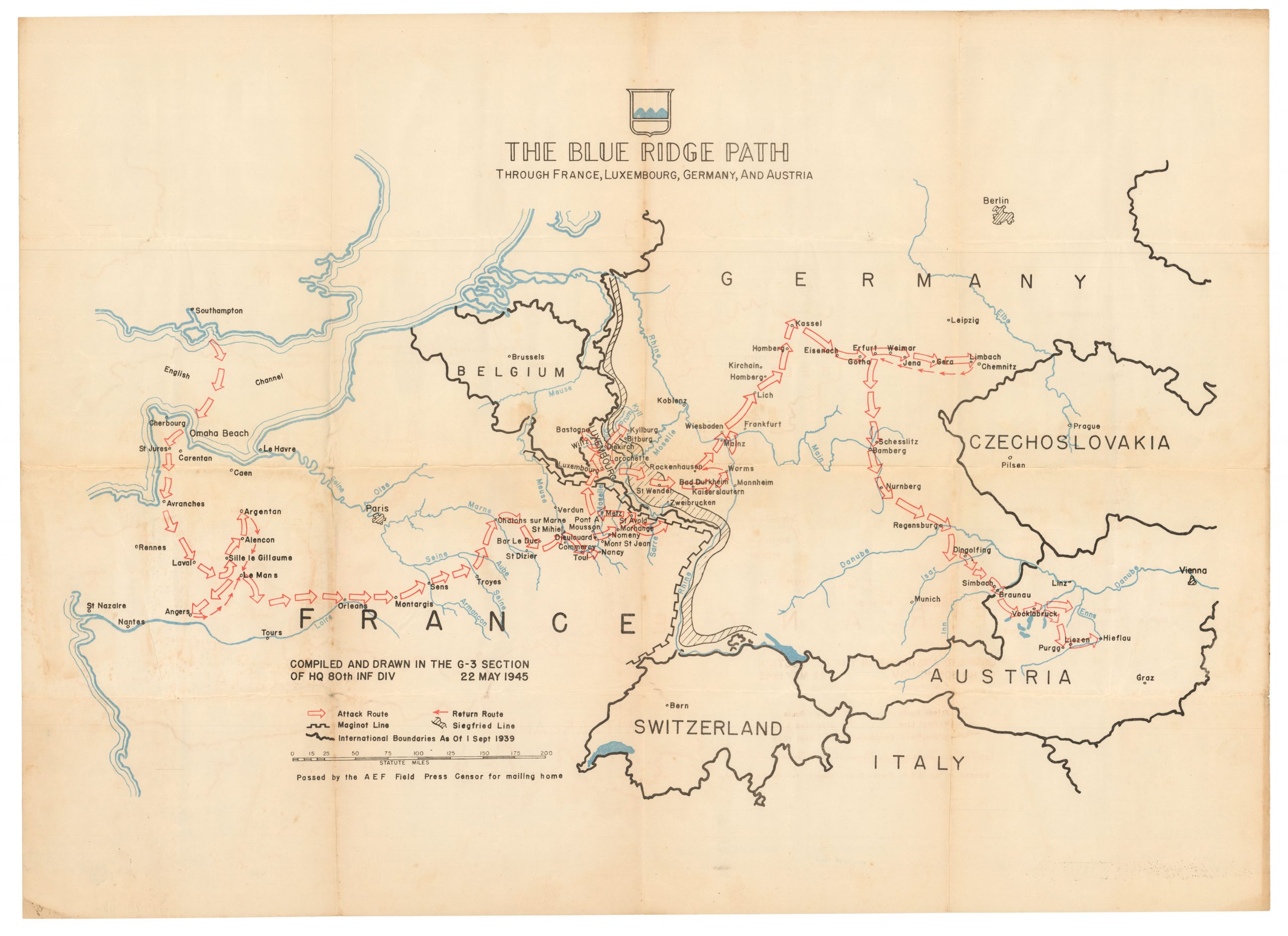
The Blue Ridge Path through France, Luxembourg, Germany, and Austria
- $1,000
- Patton’s 80th Infantry Division -- liberators of two concentration camps!
-
-

-
-
-
Add to cart

 Quick View
 - Curiosities - Miscellanea, World War I and World War II
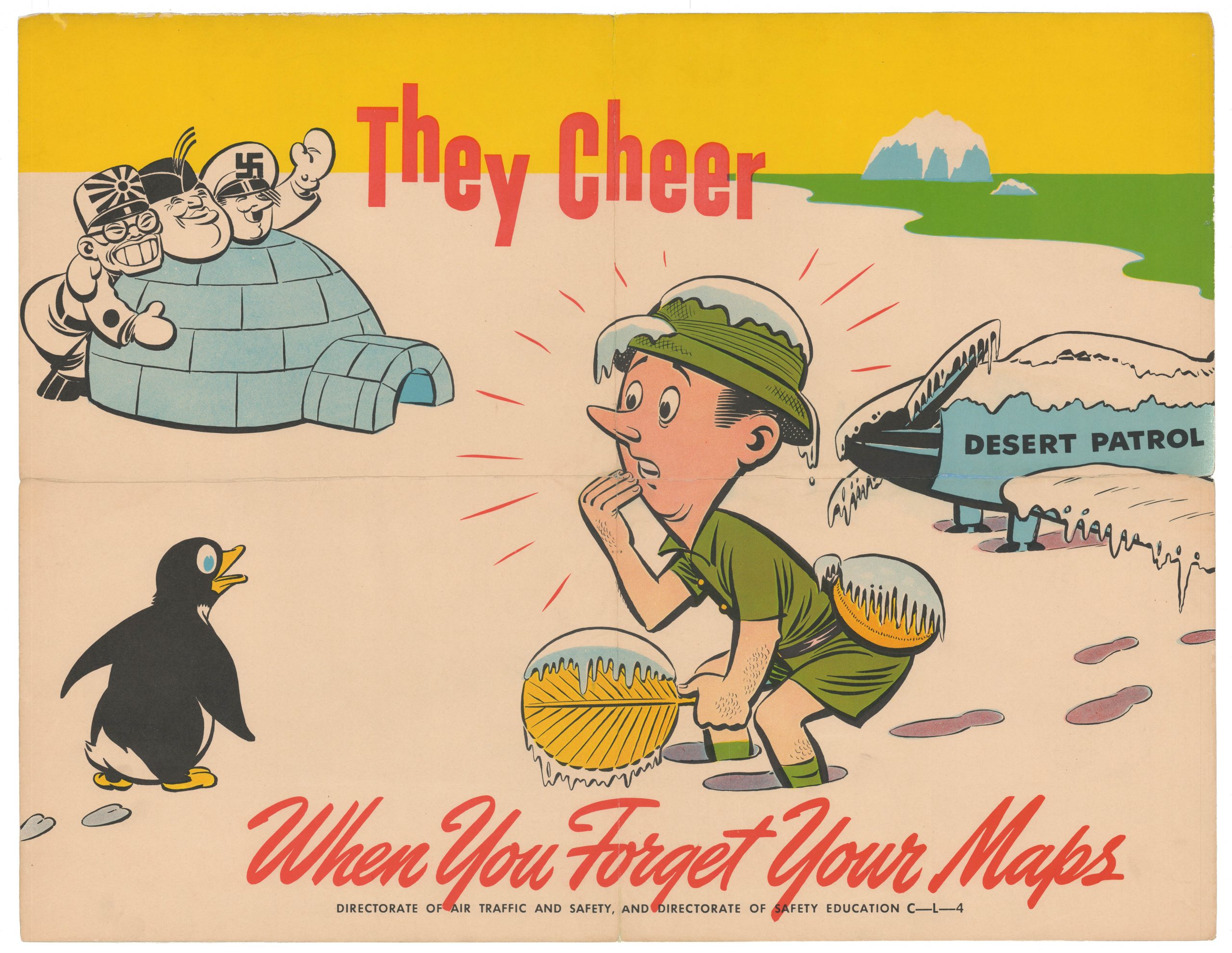
They Cheer When You Forget Your Maps
- $775
- This whimsical World War II poster, promoting aviation safety practices with US Air Force pilots, is as charming as it is rare.
-
-
-
-
-
Add to cart
![Delimitation de la Zone Occupee [German Occupation of France]](https://neatlinemaps.com/wp-content/uploads/2019/12/NL-00782-scaled-300x300.jpg)
![Delimitation de la Zone Occupee [German Occupation of France]](https://neatlinemaps.com/wp-content/uploads/2019/12/NL-00782-scaled.jpg) Quick View
Quick View - Europe, France & Switzerland, World War I and World War II
Delimitation de la Zone Occupee [German Occupation of France]
- $1,000
- After the Fall of France: administrative map of German occupation published during World War II.
-
-
-