-
-
Add to cart
![[With Extensive Contemporary Annotations] Ordnance Survey of the Peninsula of Sinai Made in 1868-9.](https://neatlinemaps.com/wp-content/uploads/2020/05/NL-00842_Thumbnail-300x300.jpg)
![[With Extensive Contemporary Annotations] Ordnance Survey of the Peninsula of Sinai Made in 1868-9.](https://neatlinemaps.com/wp-content/uploads/2020/05/NL-00842-scaled.jpg) Quick View
Quick View - Africa, Arabia and the Red Sea
[With Extensive Contemporary Annotations] Ordnance Survey of the Peninsula of Sinai Made in 1868-9.
- $3,500
- An annotated map of the Sinai from the height of the British Empire.
-
-
![[With Extensive Contemporary Annotations] Ordnance Survey of the Peninsula of Sinai Made in 1868-9.](https://neatlinemaps.com/wp-content/uploads/2020/05/NL-00842-scaled-300x300.jpg)
-
-
-
Add to cart
 Quick View
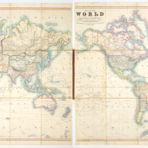
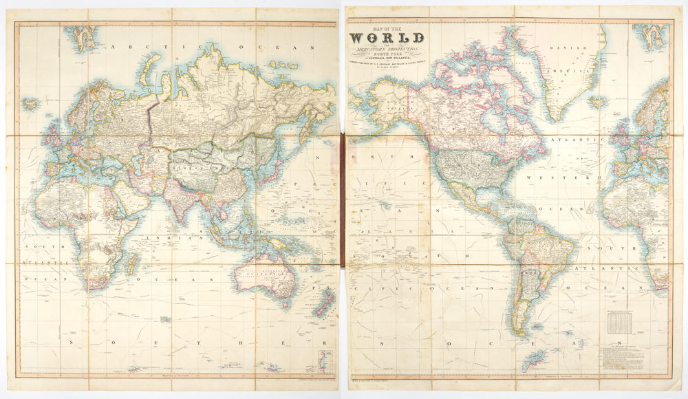
 - World
Map of the World on Mercator’s Projection showing the Discoveries at the North Pole and the New Settlements in Australia and New Zealand &c. additions to 1855
- $3,800
- Cruchley's 1855 map of the world in original boards and marbled backing -- a distinctive addition to any world map collection.
-
-
-
-
-
Add to cart
 Quick View
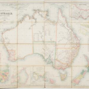
 - Asia, Southeast Asia & Australia
The British Colonies of Australia, New Zealand and Tasmania Shewing the Latest Discoveries and Travellers Routes.
- $2,800
- Britain’s Austral Colonies in the Victorian Era.
-
-
-
-
Add to cart
 Quick View
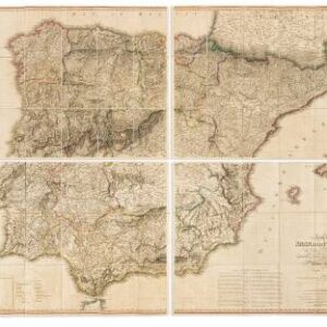
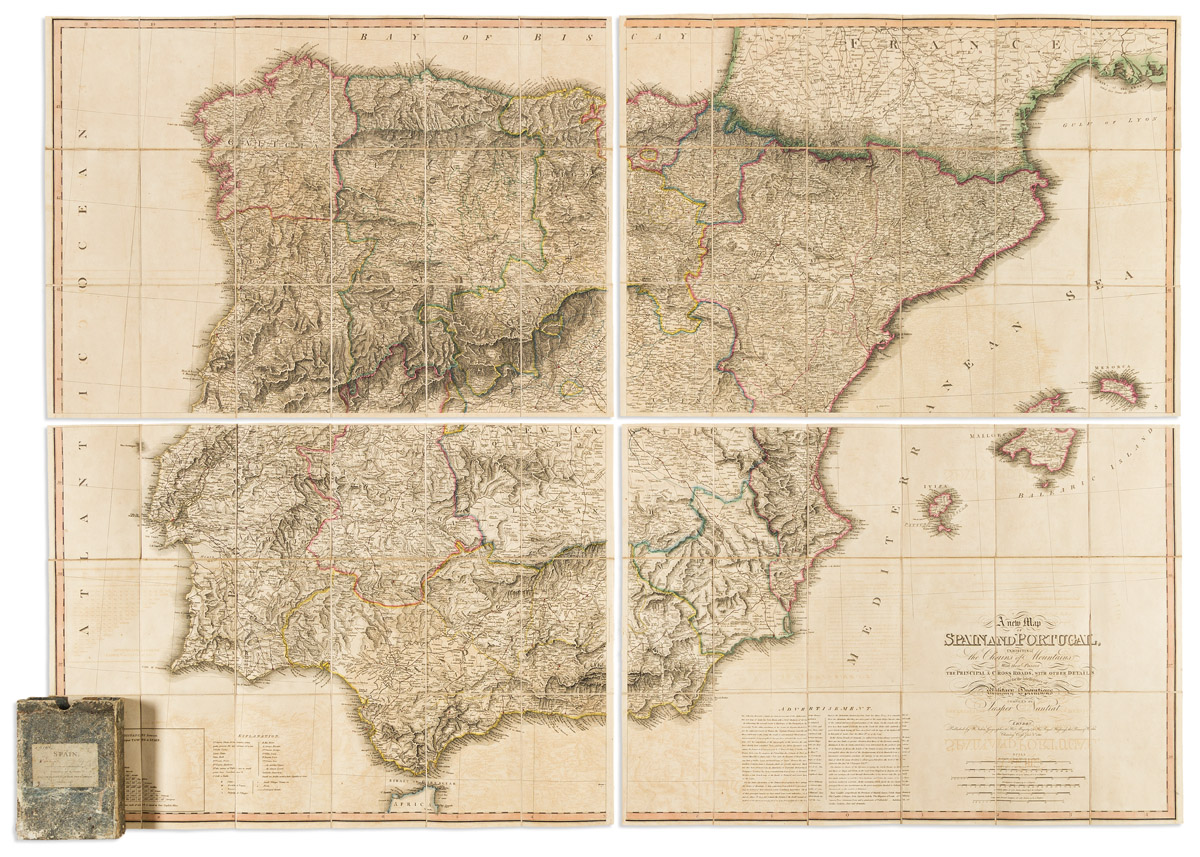
 - Europe, Spain & Portugal
A New Map of Spain and Portugal, Exhibiting the Chains of Mountains with Their Passes, the Principal & Cross Roads, with Other Details Requisite for the Intelligence of Military Operations.
- $2,200
- Napoleonic War military intelligence.
-
-
-
-
-
Add to cart

 Quick View
 - Europe, Italy
A Topographical Map of the Republick of Genoua, Taken from the Celebrated Map by Chaffrion…1764.
- $3,400
- A spectacular and historically significant 18th-century folding case map of the Republic of Genoa.
-
-
-
-
-
Add to cart

 Quick View
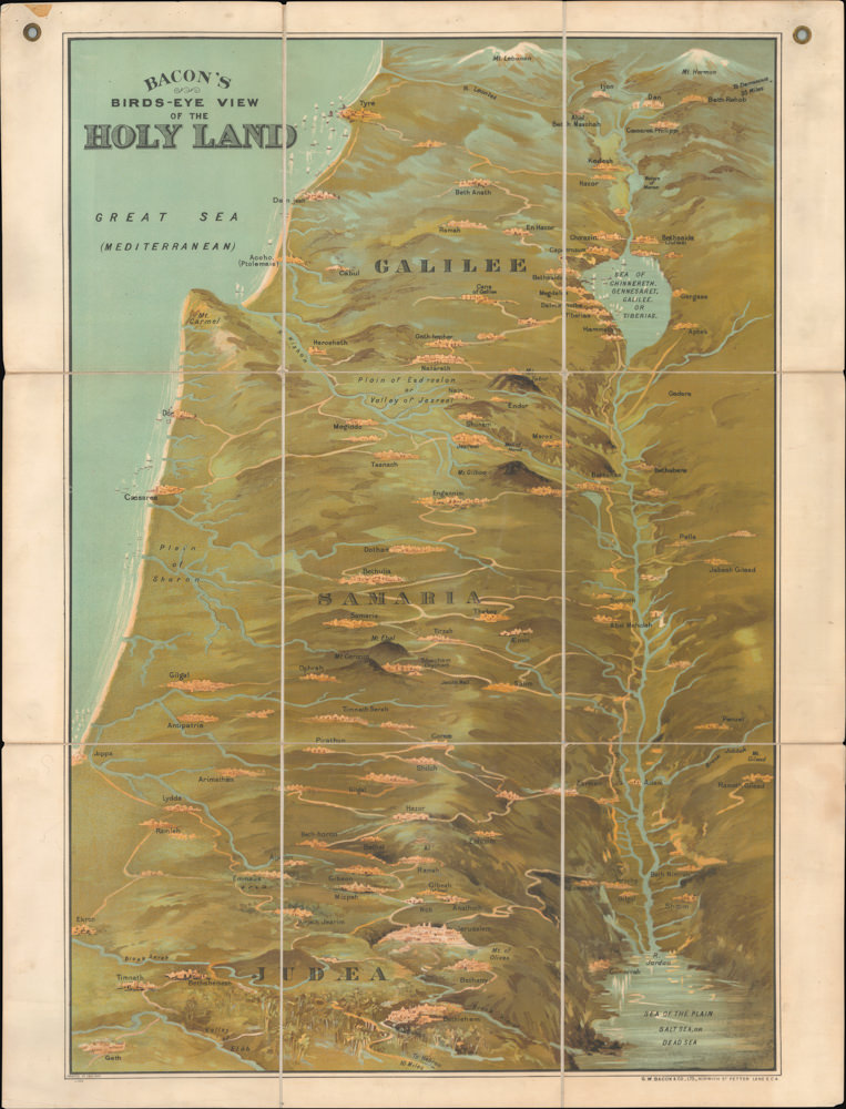
 - Bird's-eye-views, Eastern Mediterranean - Holy Land
Bacon’s Bird’s-Eye View of the Holy Land
- $2,600
- George Washington Bacon’s iconic bird’s-eye-view of the Holy Land.
-
-
-
-
-
Add to cart
 Quick View
 - East & Midwest United States
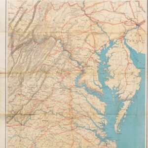
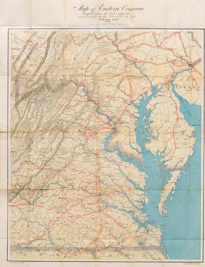
Map of Eastern Virginia Compiled from the best authorities and printed at the Coast Survey Office, A.D. Bache, Supdt. 1862.
- $1,700
- Alexander Bache’s Map of Eastern Virginia: a Union map of Washington’s Confederate backyard.
-
-
-
-
-
Add to cart
 Quick View
 - Europe, Spain & Portugal
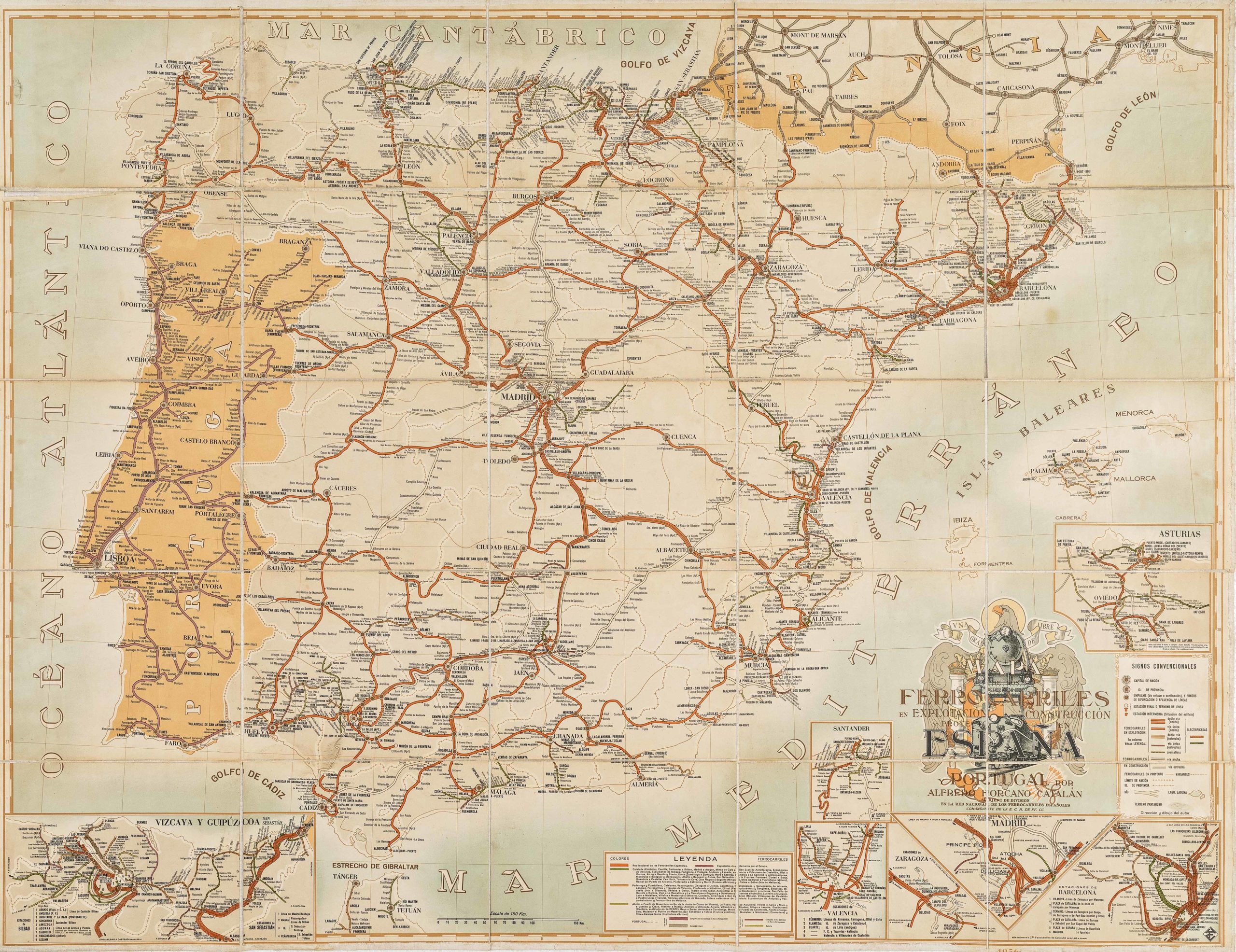
Mapa de los ferrocarriles en explotación, construcción y proyecto en España y Portugal
- $775
- Absolutely gorgeous 1956 railroad map of Spain and Portugal with Francoist coat-of-arms.
-
-
-
-
-
-
Add to cart

 Quick View
 - Bird's-eye-views, Europe, France & Switzerland
Klassischer Boden oder Malerisches Relief des Vierwaldstättersees / Plan Pittoresque du Lac des IV Cantons 1853. Lith Frères Eglin à Lucerne.
- Spectacular panoramic view of Lake Lucerne, with dynamic topographic relief and pictorial cities and towns.
-
-
-

-
-
-
Add to cart
 Quick View
 - Germany & the Netherlands
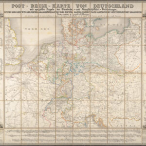
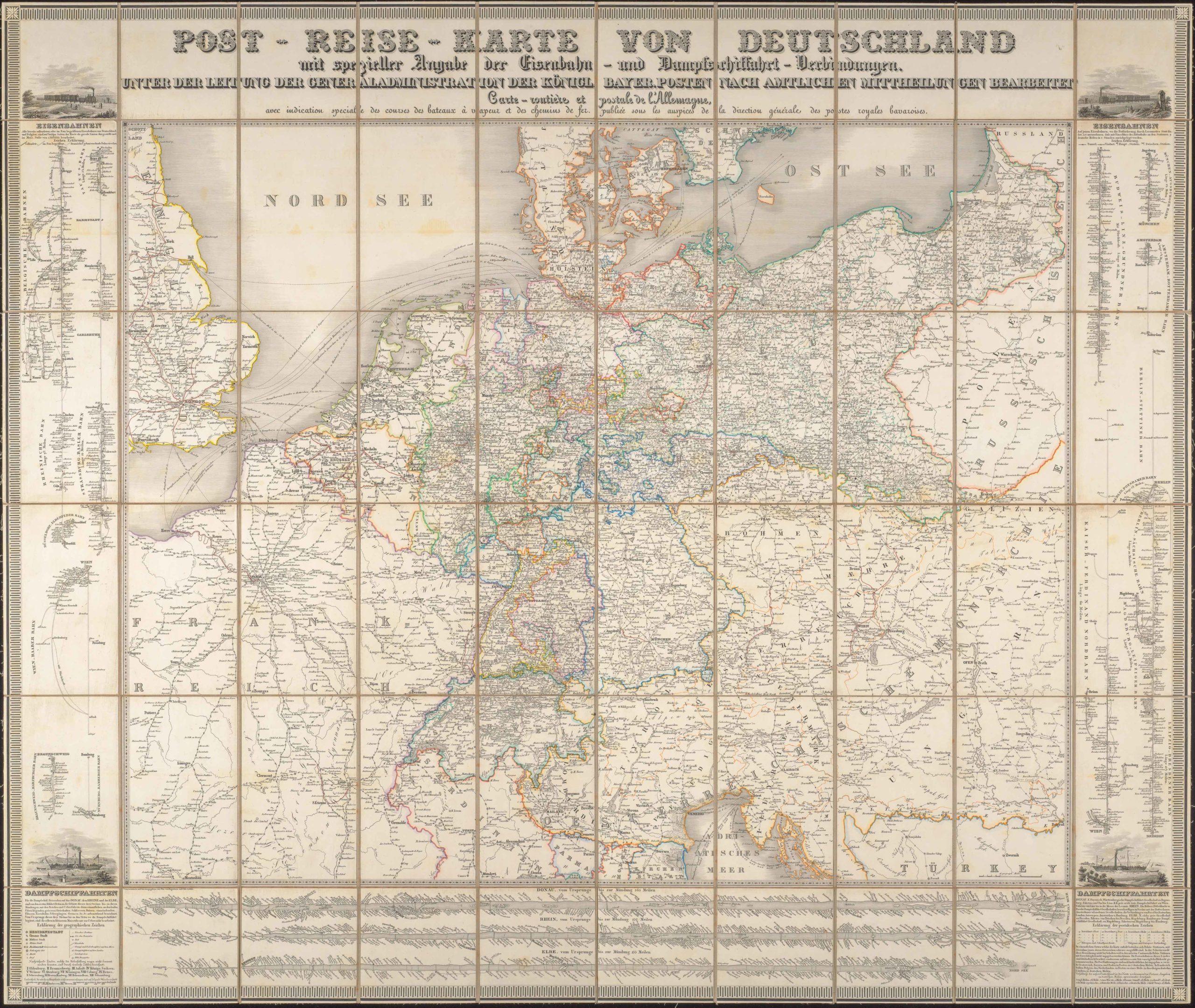
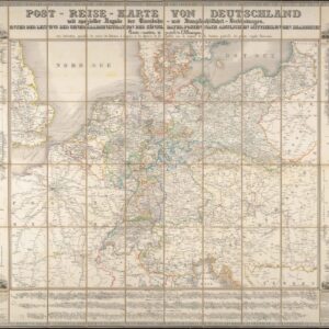
Post-Reise-Karte von Deutschland mit spezieller Angabe der Eisenbahn- und Dampfschiffahrt-Verbindungen, unter der Leitung der Generaladministration der Königl. Bayer. Posten nach amtlichen Mittheilungen bearbeitet. Carte routi’ere et postale de l’Allemagne.
- $425
- A large-format 1843 post-road and transportation map of the German Confederation.
-
-
-