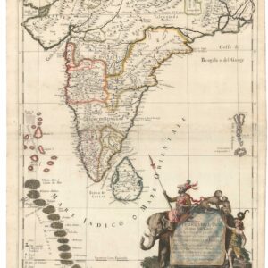
First map of India published in India?
A New and Improved Map of Hindoostan.
$3,600
1 in stock
Description
Unrecorded Indian Map of India Pre-Dating Tassin’s Maps. Compiled and Engraved in Calcutta.
This medium-format map of Hindoostan, published by Samuel Smith & Co. at the Bengal Harkuru Press in Calcutta in 1824, is among the earliest lithographed general maps of the Indian subcontinent produced in India, and very possibly the earliest known.
The map appeared barely two years after James Nathaniel Rind introduced lithography to India in August 1822, at a moment when the technique had scarcely been attempted for cartographic purposes on the subcontinent. Its execution, which consciously mimics the conventions of copperplate engraving, is itself evidence of its pioneering character.
We are aware of only one other example having appeared on the market, and no institutional example has been definitively confirmed.
The Map in Detail
The map covers the great majority of the Indian subcontinent and its approaches, extending from the Indus in the northwest to the Gulf of Siam in the southeast, and from the Himalayas in the north to Ceylon in the south. Coastlines are carefully delineated, major rivers depicted, and relief rendered by hachures, with swampy ground indicated by wavy lines. All major cities are labeled, and key roads are shown throughout. The territories under East India Company control are divided into labeled military districts, each colored in a distinct hue of watercolor, with the princely states — Hyderabad, labeled the Nizam’s Dominions, among them — distinguished separately. A note in the Remarks explains the map’s coding of military and civil stations: those with more than five companies are named in common print; smaller stations are marked with a four-petalled flower symbol; black dots indicate civil stations in Bengal.
Historical Context
The map presents India at a precise and consequential moment. The Third Anglo-Maratha War of 1817–18 had just completed the East India Company’s dominance over the subcontinent, and the military-district coloring reflects the resulting territorial settlement. Only the northwest (the Punjab and Sindh) remains outside British control; these territories would be conquered in the 1840s. The map also captures the subcontinent on the eve of the First Anglo-Burmese War of 1824–26, which would add southern Burma to the empire; the Birman Empire appears on the map uncolored and intact.
Lithography had arrived in India only in August 1822, when Rind opened the Asiatic Lithographic Company Press in Calcutta. The medium was far better suited to the subcontinent than copper engraving, which suffered in the humid climate: printing stones could be sourced locally, the process worked well in tropical conditions, and Bengali craftsmen — experienced in textile printing — proved adept at the technique. The result was a dramatic expansion in the scale and ambition of maps that could be produced in India. Samuel Smith & Co. was one of the first commercial publishers to exploit this. Smith had acquired the Bengal Harkuru Press in 1821, making himself a significant figure in Calcutta’s English-language print world; his firm specialized in almanacs, directories, and guides, with the New Annual Bengal Directory and Calcutta Kalendar as its flagship titles.
Map publishing in India would not become widespread until the 1830s, when lithographers such as Jean-Baptiste Tassin expanded production, and the Survey of India did not publish in significant quantity until the period of the First Anglo-Afghan War. This map precedes all of that.
Publication History and Census
Published in Calcutta by Samuel Smith & Co. at the Bengal Harkuru Press, 1824, as a folding plate within the New Annual Bengal Directory and Calcutta Kalendar for the Year 1824. The directory itself notes: This map has been compiled from the best authorities at very considerable trouble and expense, expressly for their Work. The Publishers beg to assure the Public it may be fully relied on and they challenge the discovery of an error of importance in it: it has been divided into Military Divisions, and all the Civil and Military Stations and public roads are accurately laid down.
Two institutional examples of the directory are known: one has been confirmed to lack the map, and the remaining copy at the British Library has not been consulted.
We are aware of only one other example of the map having appeared on the market. The map is not recorded in the literature or in online catalogs.
Cartographer(s):
Samuel Smith & Co. was one of the most active commercial print and publishing houses in early nineteenth-century Calcutta, operating from the Bengal Harkuru Press — itself one of the oldest and most durable English-language newspapers in colonial India. The Bengal Harkaru (the spelling varied across its long life) was founded in 1795, in the generation after James Augustus Hicky’s pioneering Bengal Gazette had demonstrated that a colonial press could function in Calcutta, and it remained in continuous publication until 1866, outlasting most of its rivals by decades.
Samuel Smith acquired the press in 1821, at a moment when Calcutta’s English-language print trade was expanding rapidly alongside the growth of the colonial administration, and he developed it into a diversified publishing operation.
Condition Description
Lithograph with original wash hand color, printed on 2 joined sheets (Good, repaired loss of upper right corner, abrasion to neatline upper left corner, otherwise some small stains and some areas of toning, a few minor old repairs on verso).
References
![[Sri Lanka] Tabula Duodecima Dasia.](https://neatlinemaps.com/wp-content/uploads/2023/03/NL-01721_thumbnail-300x300.jpg)