-
-
Add to cart
 Quick View
 - Curiosities - Miscellanea
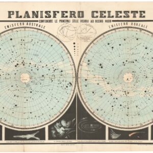
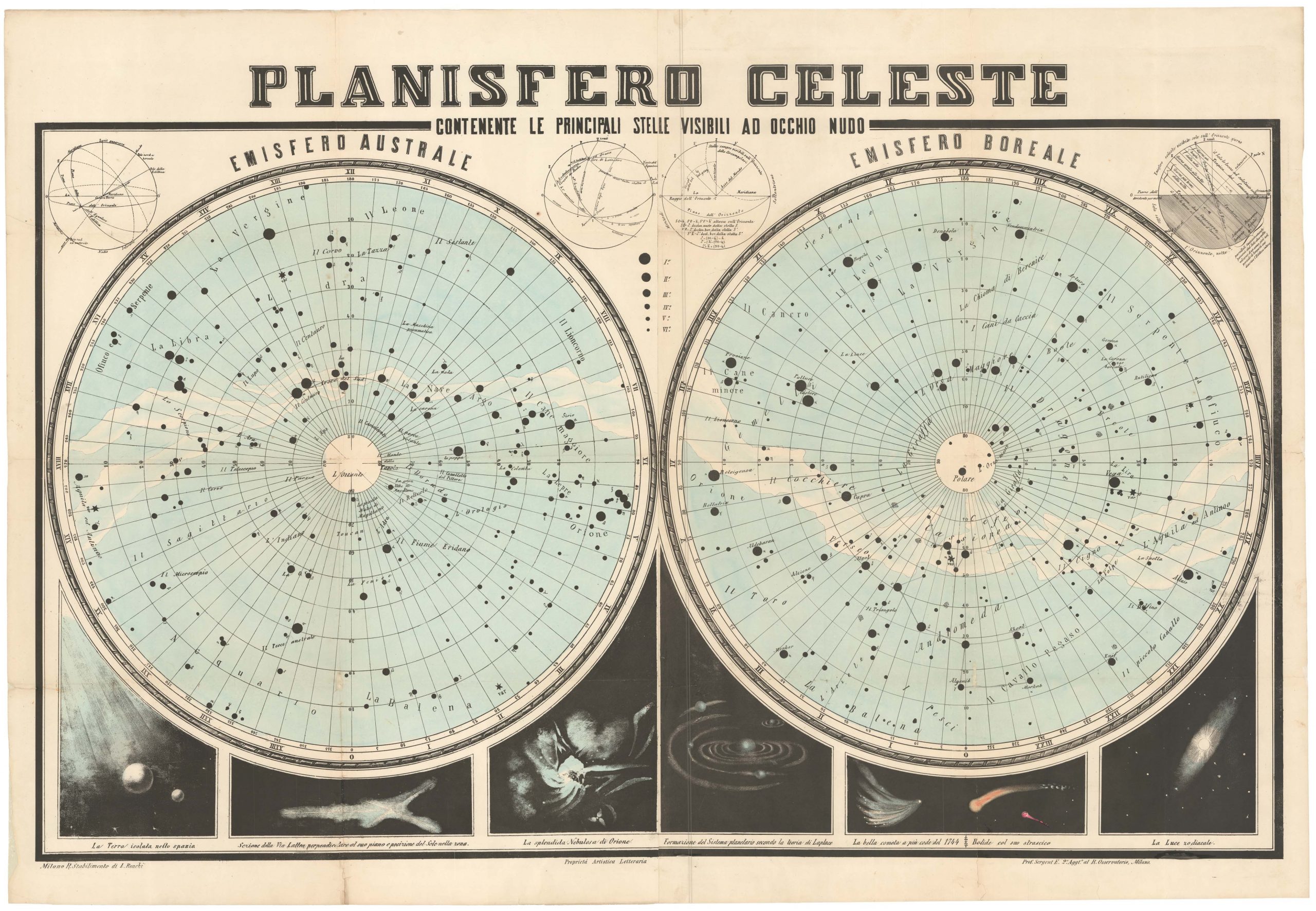
PLANISFERO CELESTE. Contenente le principali stelle visibili ad occhino nudo.
- $975
- A splendid mid-19th century Celestial Planisphere from Italy.
-
-
-
-
-
Add to cart

 Quick View
 - Europe, Italy, Bird's-eye-views
Lago di Como
- $3,000
- Francesco Citterio's fantastic mid-19th century panorama of Lake Como.
-
-
-
-
-
Add to cart
 Quick View
 - Asia
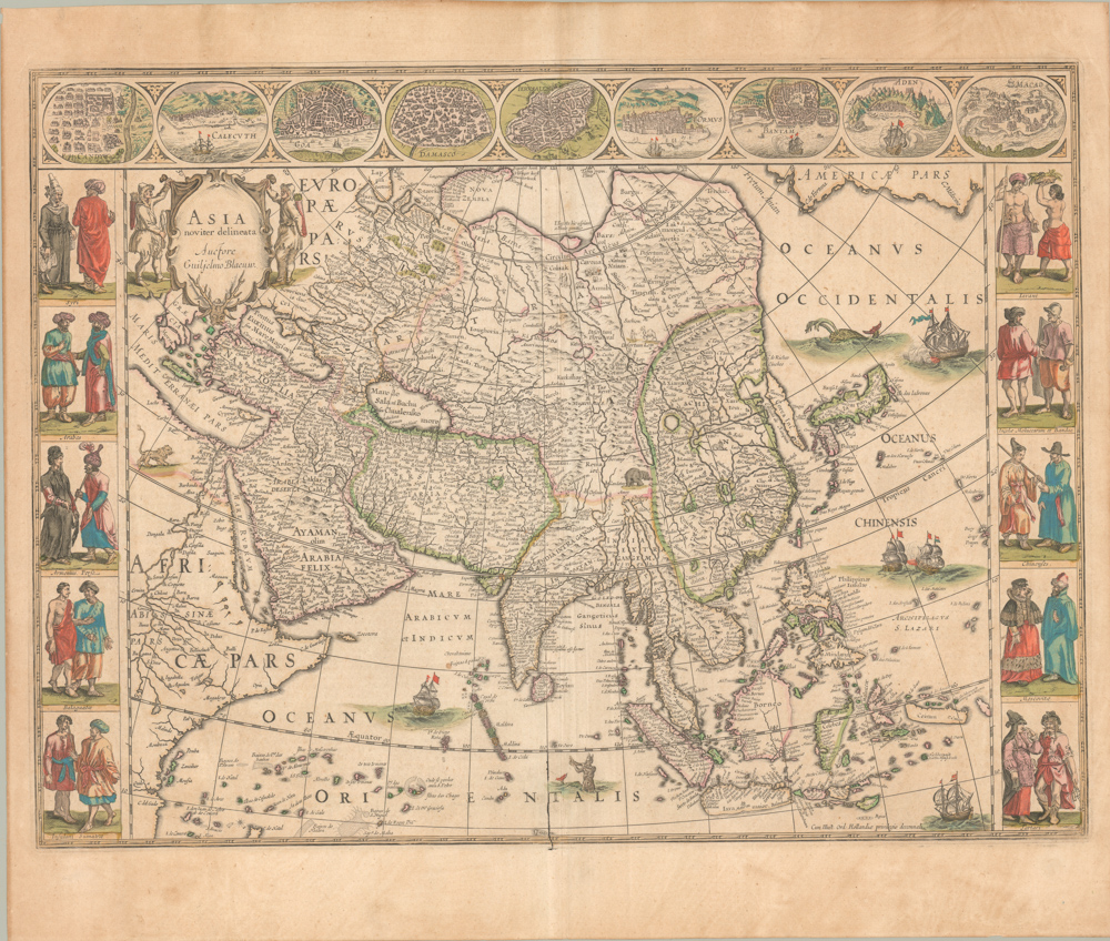
Asia Noviter Delineata
- $2,400
- Excellent old color example of Willem Blaeu’s seminal map of Asia -- one of the 17th century’s most influential depictions of this cartographically complicated continent.
-
-
-
-
-
Add to cart
 Quick View
 - Asia
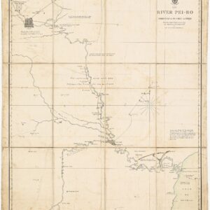
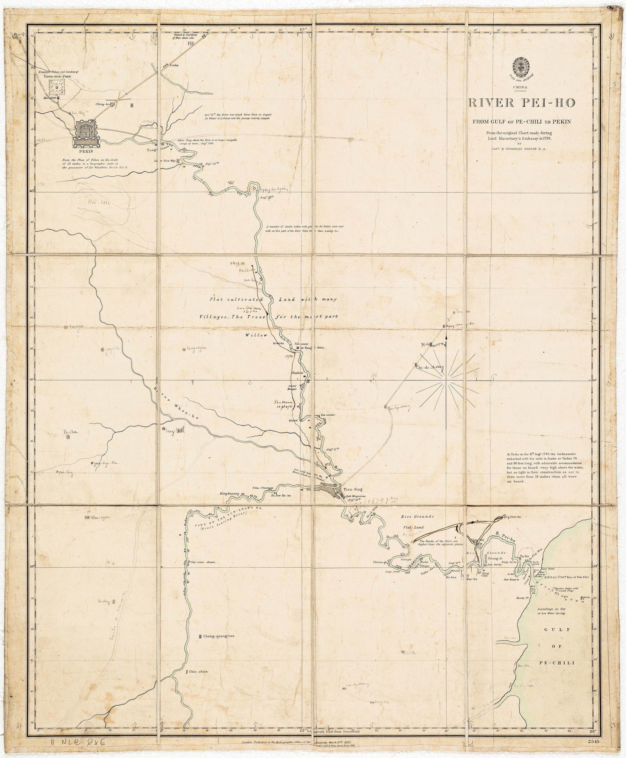
River Pei-Ho From Gulf of Pe-Chili to Pekin
- $1,900
- Admiralty Chart of the Hai River with manuscript additions suggesting use in the field during the Second Opium War.
-
-
-
-
-
Add to cart
![[With Extensive Contemporary Annotations] Ordnance Survey of the Peninsula of Sinai Made in 1868-9 By Captains C.W. Wilson, and H.S. Palmer, R.E. Under The Direction of Major-General Sir Henry James, R.E. F.R.S. &c. Director of the Ordnance Survey](https://neatlinemaps.com/wp-content/uploads/2020/05/NL-00842_Thumbnail-300x300.jpg)
![[With Extensive Contemporary Annotations] Ordnance Survey of the Peninsula of Sinai Made in 1868-9 By Captains C.W. Wilson, and H.S. Palmer, R.E. Under The Direction of Major-General Sir Henry James, R.E. F.R.S. &c. Director of the Ordnance Survey](https://neatlinemaps.com/wp-content/uploads/2020/05/NL-00842-scaled.jpg) Quick View
Quick View - Africa, Arabia and the Red Sea
[With Extensive Contemporary Annotations] Ordnance Survey of the Peninsula of Sinai Made in 1868-9 By Captains C.W. Wilson, and H.S. Palmer, R.E. Under The Direction of Major-General Sir Henry James, R.E. F.R.S. &c. Director of the Ordnance Survey
- $3,500
- The difficult merger between religious belief and scientific thought: an annotated map of the Sinai from the height of the British Empire.
-
-
![[With Extensive Contemporary Annotations] Ordnance Survey of the Peninsula of Sinai Made in 1868-9 By Captains C.W. Wilson, and H.S. Palmer, R.E. Under The Direction of Major-General Sir Henry James, R.E. F.R.S. &c. Director of the Ordnance Survey](https://neatlinemaps.com/wp-content/uploads/2020/05/NL-00842-scaled-300x300.jpg)
-
-
-
Add to cart
 Quick View
 - Texas and The West
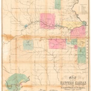
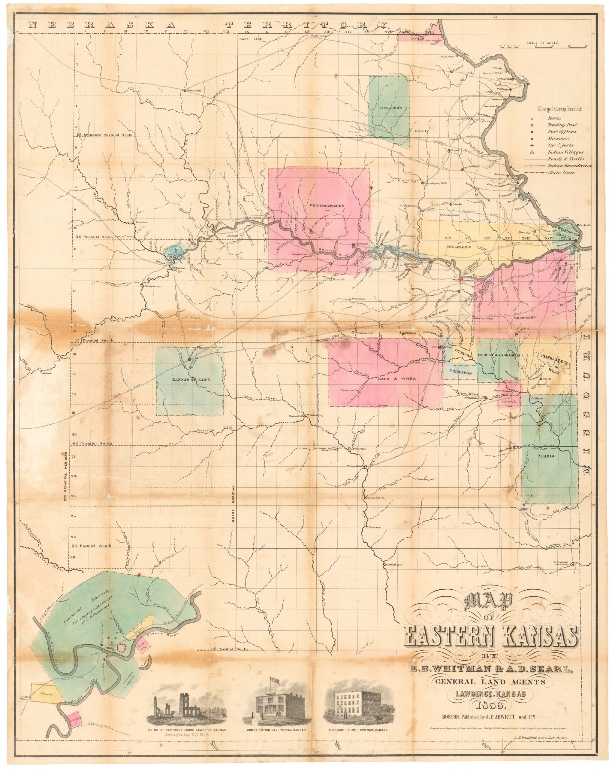
Map of Eastern Kansas.
- $2,800
- Iconic 1856 map of East Kansas, published just a month after the sacking of Lawrence and in the midst of the tumultuous ‘Bloody Kansas’ era.
-
-
-
-
-
Add to cart
 Quick View
 - Southern California, California
B. O. Kendall’s Map of the City of Pasadena, Cal. Corrected to August 1st, 1895.
- $375
- An early map of Pasadena, published by one of its most prominent builders.
-
-
-
-
Add to cart
 Quick View
 - Americas
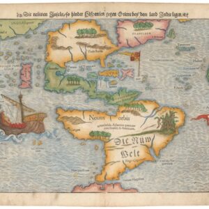
Die neüwe Inseln so hinder Hispanien gegen Orient bey dem land Indie ligen.
- $6,500
- Sebastian Münster’s Iconic Map of the New World.
-
-
-
-
Add to cart
 Quick View
 - Africa
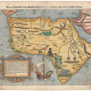
Africa Lybia Morenlandt mit Allen Künigreichen so zu unsern zeiten darin gefunden werden.
- $2,000
- A Seminal and Influential Early Map of Africa.
-
-
-
-
Add to cart
 Quick View
 - Europe, Italy
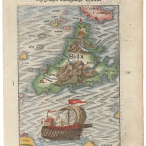
Beschreibung de Inseln und desz gantzen Künigreichs Sicilie / Sardinia Insula / Calaris die Hauptstatt in Sardinia / Neapolis.
- $500
- A Set of Four: Münster’s maps of Sicily and Sardinia, and views of Naples and Cagliari.
-
-
-
-
Add to cart
 Quick View
 - Europe, Germany & the Netherlands
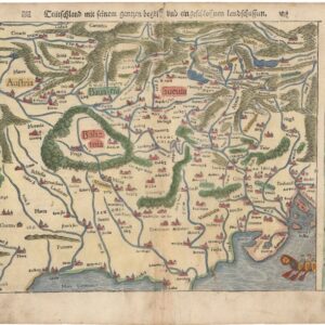
Teutschland mit seinem gantzen gegriff und eingeschlossen Landtsschafften.
- $300
- One of the First “Modern” Maps of Germany and the Czech Republic.
-
-
-
-
Add to cart
 Quick View
 - Europe, France & Switzerland
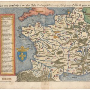
Das gantz Frankreich so vor Zeiten Gallia Narbonensis, Bugunensis, Belgica und Celtica ist genannt worden.
- $450
- Sebastian Münster’s 1567 Map of France.
-
-
Shop
All maps in stock, sorted by latest.