-
-
Add to cart
 Quick View
 - East & Midwest United States, United States
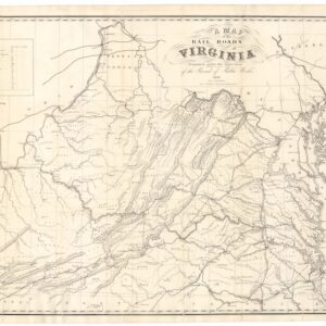
A Map of the Rail Roads of Virginia Prepared Under the Direction of the Board of Public Works.
- $4,800
- Rare Pre-Civil War Virginia Railroad Map Printed in Richmond, 1858.
-
-
-
-
Add to cart
 Quick View
 - East & Midwest United States, United States
Gettysburg. Repulse of Longstreet’s Assault.
- $900
- Bachelder’s magnificent rendering of Longstreet’s Assault (Pickett's Charge).
-
-
-
-
Add to cart
 Quick View
 - East & Midwest United States, Featured Maps & Views, United States
Gettysburg Battle-Field.
- $2,400
- Bachelder's iconic 1863 view of the Battle of Gettysburg.
-
-
-
-
Add to cart

 Quick View
 - Asia, Featured Maps & Views, Southeast Asia & Australia
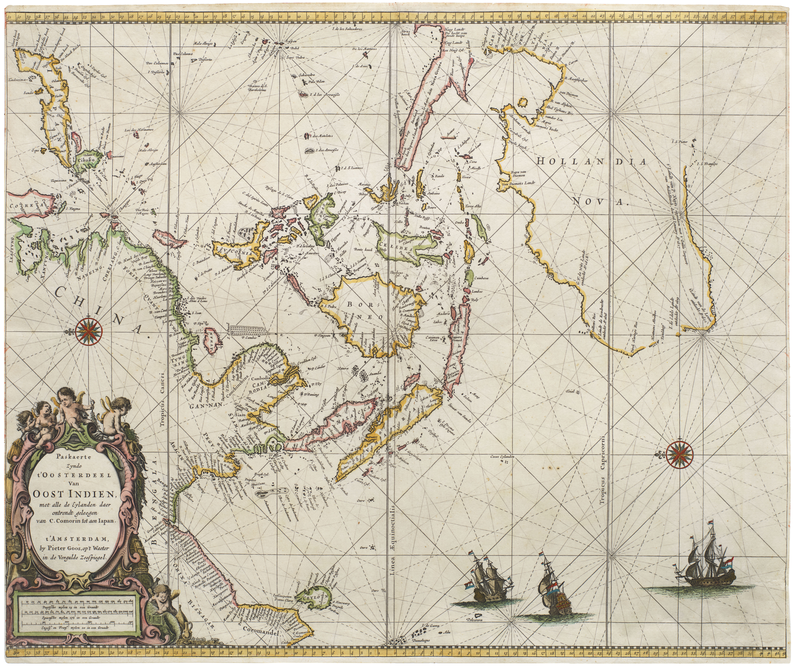
Paskaerte Zynde t’Oosterdeel van Oost Indien, met Alle de Eylanden daer Ontrendt Geleegen van C. Comorin tot aen Japan
- $6,500
- [Early color] Pieter Goos’ Striking Sea Chart of Southeast Asia, Australia, and the Indian Ocean.
-
-

-
-
-
Add to cart

 Quick View
 - California
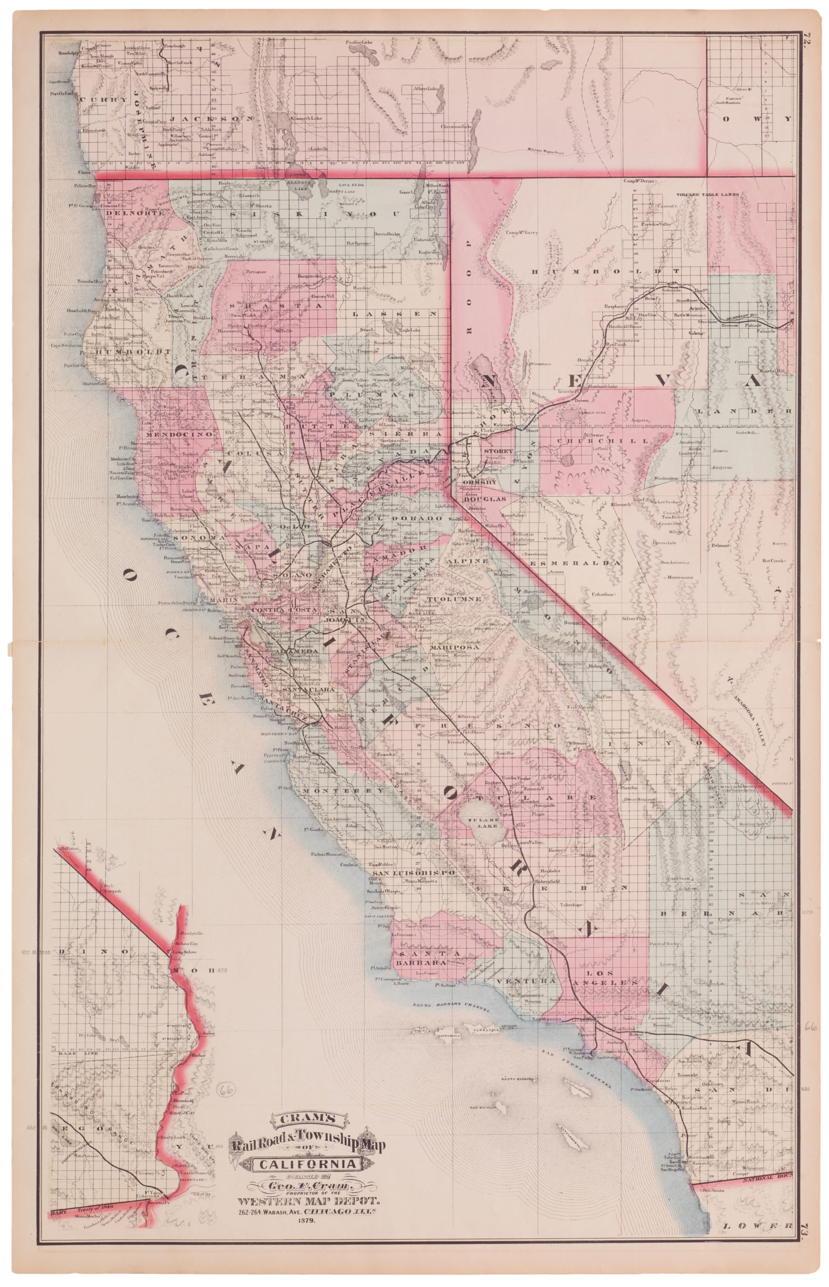
Cram’s Railroad & Township Map of California
- $575
- Excellent 1879 large-format edition railroad map of California.
-
-

-
-
-
Add to cart
 Quick View
 - California, San Francisco
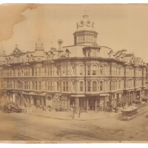
Grand Hotel, Johnson & Co., Proprietors, San Francisco, California.
- $3,200
- Carleton Watkins mammoth plate of San Francisco’s Grand Hotel (CEW 382).
-
-
-
-
Add to cart

 Quick View
 - Asia, Southeast Asia & Australia
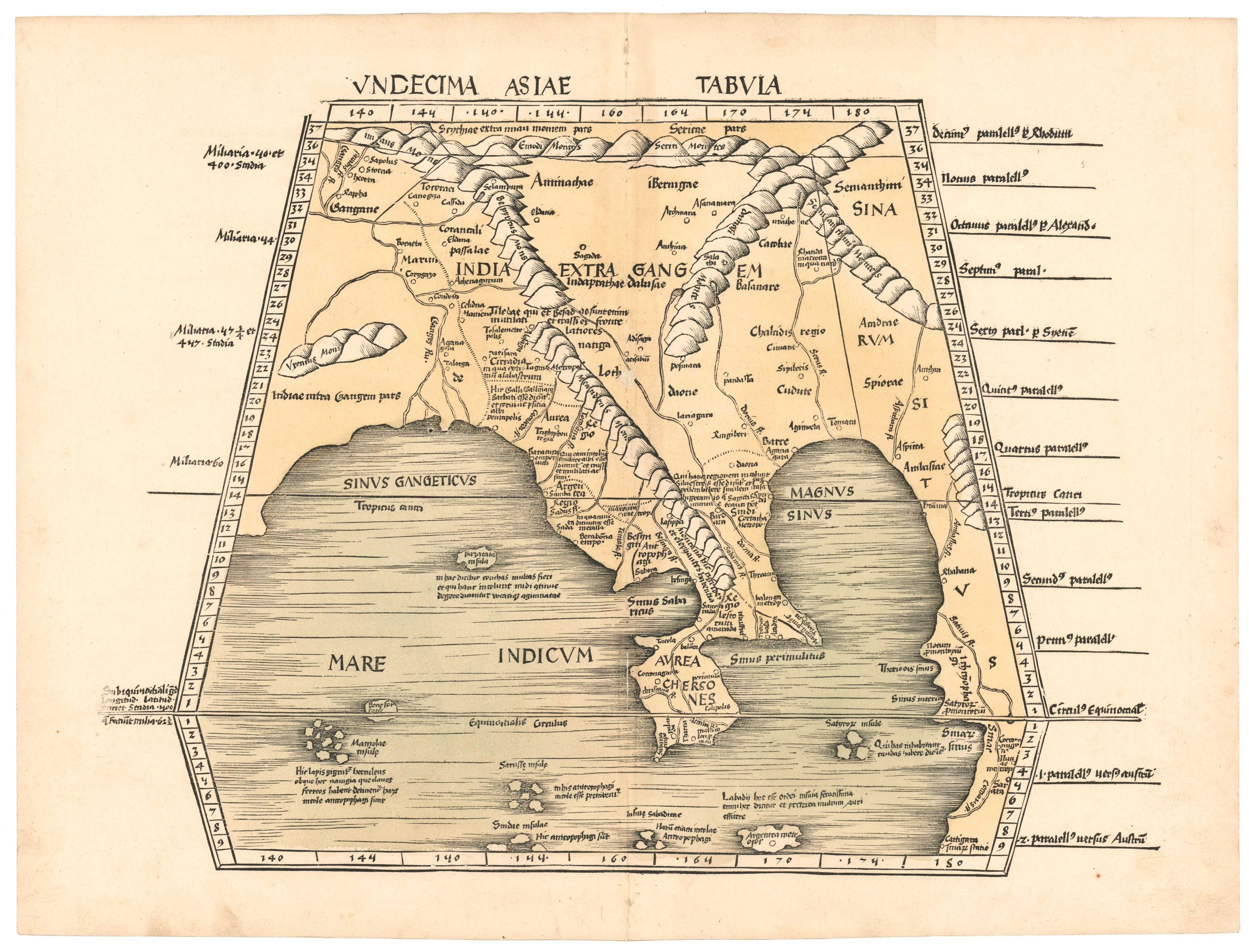
Undecima Asiae Tabula.
- $4,800
- An early printed map of Southeast Asia from the first modern atlas.
-
-

-
-
-
Add to cart
 Quick View
 - Curiosities - Miscellanea, Europe, World War I and World War II
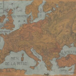
L’instanté de l’Europe et de l’Asie mineure, 1914.
- $1,250
- A fantastic hand-drawn World War I curiosity.
-
-
-
-
Add to cart
 Quick View
 - Bay Area & Silicon Valley
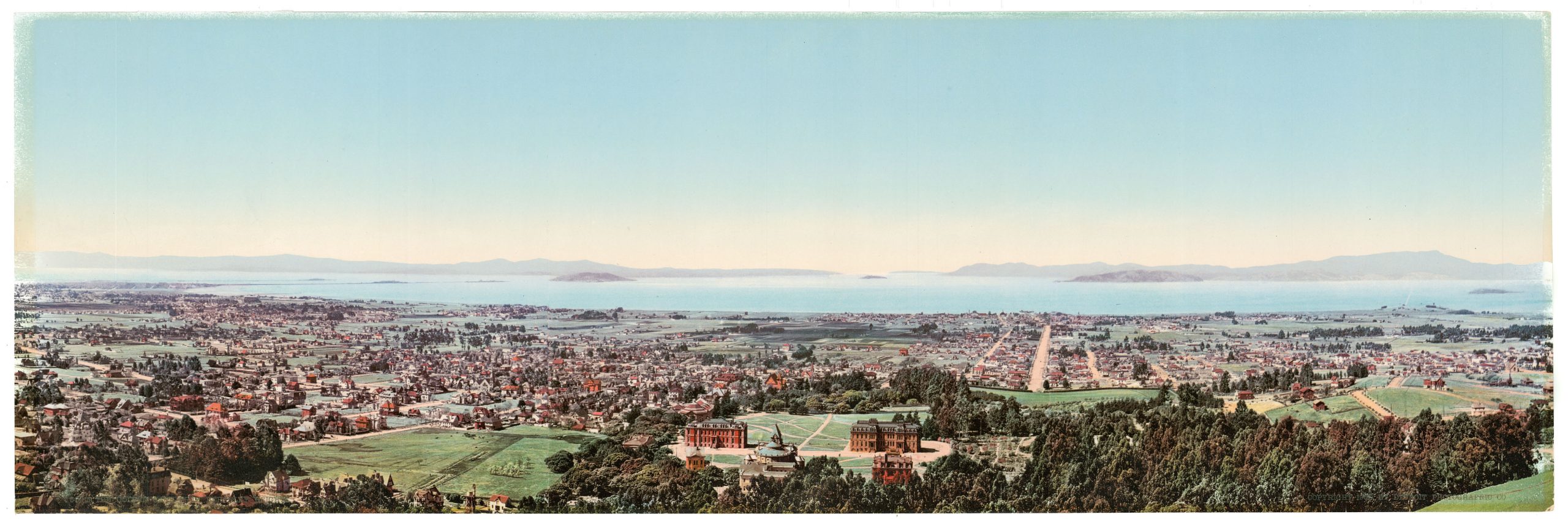
The Golden Gate from Berkeley Heights.
- $975
- William Henry Jackson’s panoramic photochrom of Berkeley and the Bay Area at the dawn of the 20th century.
-
-
-
-
-
Add to cart
 Quick View
 - California, Pictorial maps
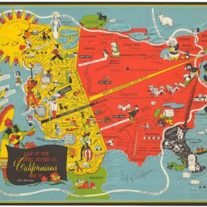
Map of the United States as Californians See It.
- $1,200
- The epitome of a new genre of comedic cartography that developed following the end of World War II.
-
-
-
-
Add to cart
 Quick View
 - Curiosities - Miscellanea, World
Le Microscope moderne.
- $4,000
- Anticipating Flat-Earth Thought.
-
-
-
-
Add to cart
![ОБЩІЙ ВИДЪ СВ. ГРАДА ІЕРУСАЛИМА [General View of the Holy City of Jerusalem].](https://neatlinemaps.com/wp-content/uploads/2026/02/NL-02492_thumbnail-300x300.jpg) Quick View
Quick View - Eastern Mediterranean - Holy Land, Middle East - Holy Land Maps
ОБЩІЙ ВИДЪ СВ. ГРАДА ІЕРУСАЛИМА [General View of the Holy City of Jerusalem].
- $3,200
- A brilliantly colored panoramic view of Ottoman Jerusalem, designed for Russian Orthodox pilgrims.
-
-
Shop
All maps in stock, sorted by latest.