-
-
Add to cart
 Quick View
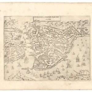
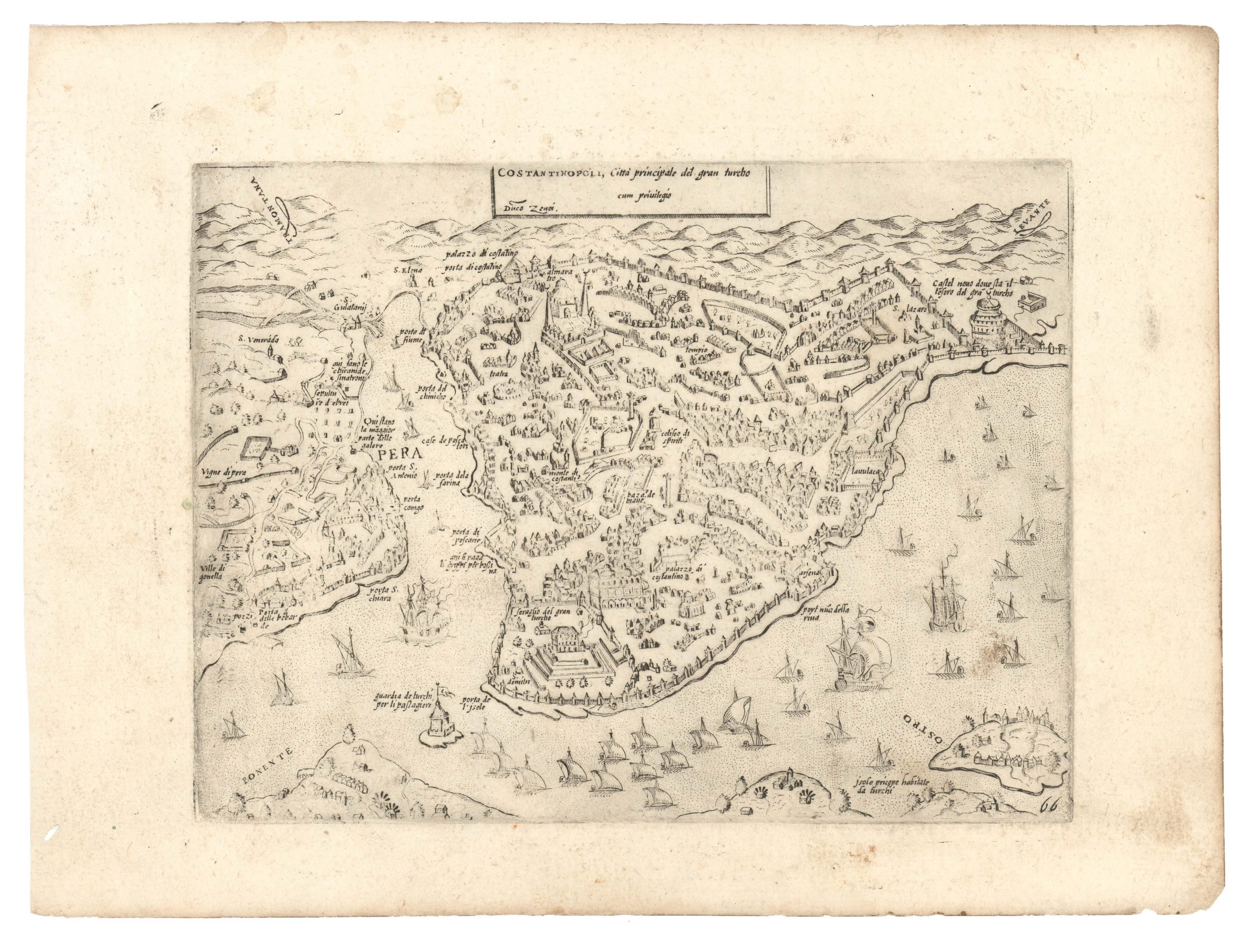
 - Bird's-eye-views, Turkey - Ottoman Empire
Costantinopoli città principale del gran turcho.
- $1,700
- Lafreri-school 1568 Zenoi reverse-image bird's-eye-view of Istanbul.
-
-

-
-
-
Add to cart
 Quick View
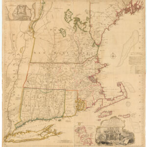
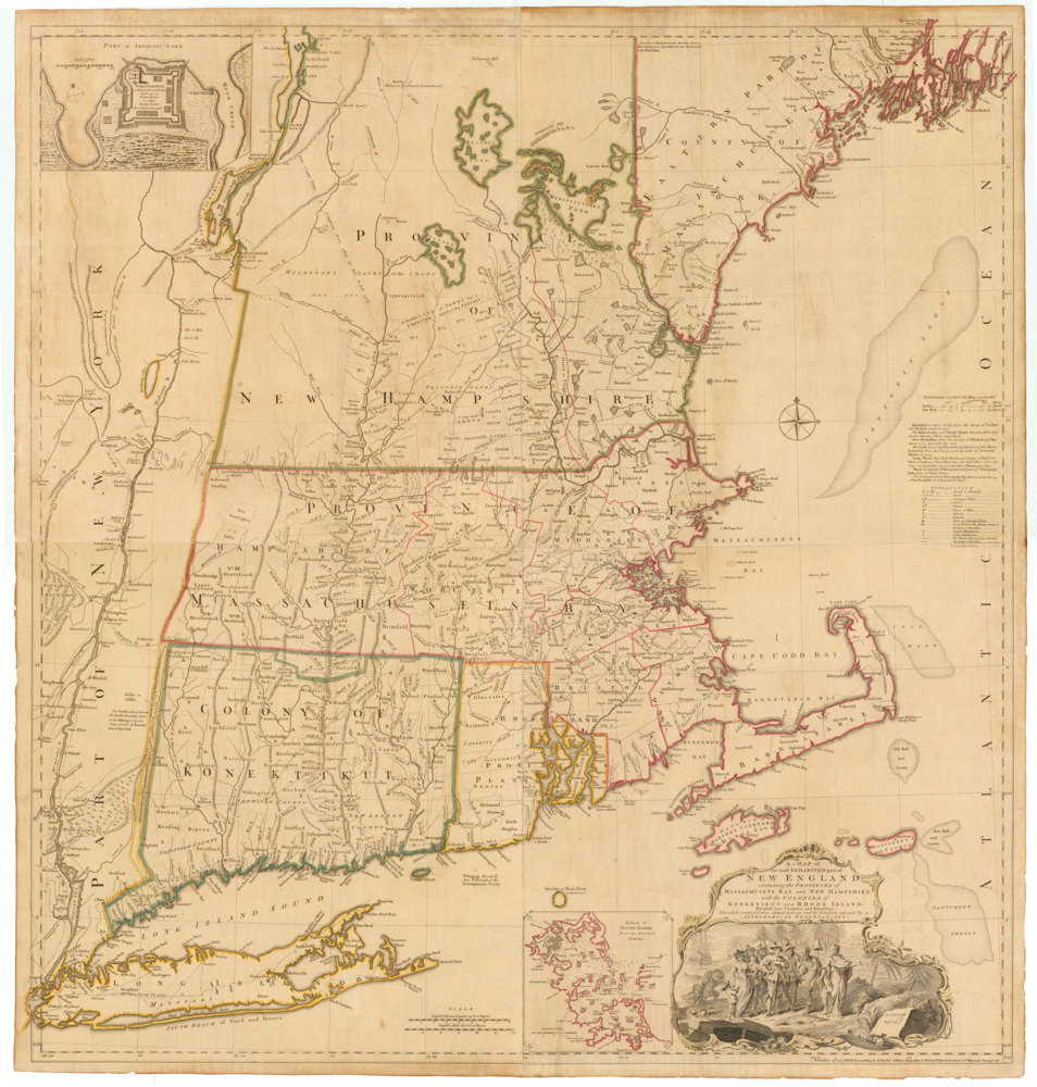
 - East & Midwest United States, Featured Maps & Views
A MAP of the most INHABITED part of NEW ENGLAND, containing the PROVINCES of MASSACHUSETS BAY and NEW HAMPSHIRE, with the COLONIES of KONEKTIKUT AND RHODE ISLAND. Divided into Counties and Townships: The whole composed of Actual Surveys and its situation adjusted by ASTRONOMICAL OBSERVATIONS.
- $55,000
- Unobtainable first state of one of the most influential maps of New England ever made.
-
-
-
-
-
Add to cart
 Quick View
 - Americas, Atlases & Books, Canada and The Great Lakes, North America
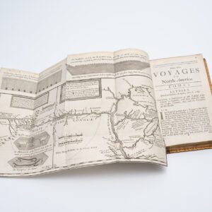
New Voyages to North-America. Containing an Account of the Several Nations of That Vast Continent…
- $8,500
- First English edition of Lahontan's description and mapping of New France, which propagated the myth of the Northwest Passage.
-
-
-
-
Add to cart
 Quick View
 - Americas, Cuba, West Indies, Caribbean, East & Midwest United States
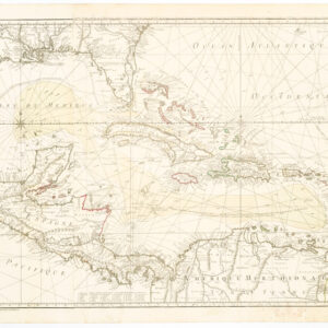
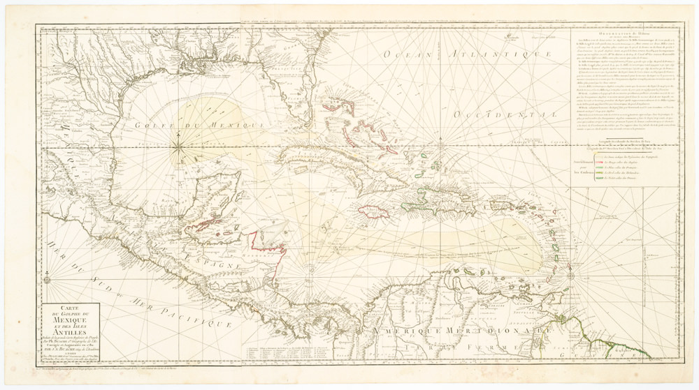
Carte Du Golphe Du Mexique Et Des Isles Antilles Reduite de la grande carte Angloise de Popple, Par PH. Buache…1780.
- $900
- Dezauche's exquisite chart of the Gulf Coast, Florida, and Caribbean Archipelago depicts a French Colonial Empire that is slowly falling apart.
-
-
-
-
-
Add to cart

 Quick View
 - Europe, Italy
A Topographical Map of the Republick of Genoua, Taken from the Celebrated Map by Chaffrion…1764 / To the Right Honourable James Steward Mackenzie, Lord Privy Seal of Scotland, One of His Majesty’s most Honourable Privy Council, and Late His Majesty’s Envoy Extraordinary and Plenipoteniary to the King Of Sardina. This Map is most Humbly Inscribed…
- $4,400
- A spectacular and historically important 18th century wall-map of the Republic of Genoa.
-
-
-
-
-
Add to cart
 Quick View
 - Asia, Southeast Asia & Australia
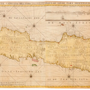
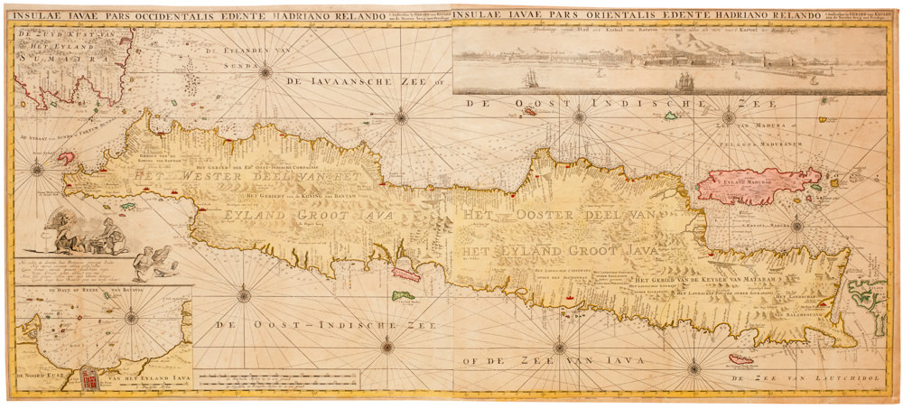
Insulae Iavae Pars Occidentalis Edente Hadriano Relando…Insulae Iavae Pars Orientalis Edente Hadriano Relando
- $4,000
- The beating heart of Dutch East India: a rare and beautiful second state of Gerard van Keulen’s visually overwhelming map of Java.
-
-
-
-
-
Add to cart

 Quick View
 - Americas, California, Michael's Collection, North America
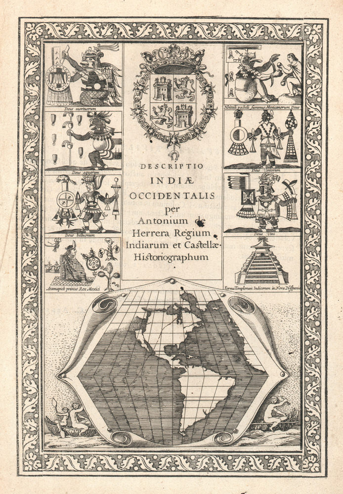
Descriptio Indiae Occidentalis per Antonium de Herrera.
- $3,600
- The first map to show California as an island!
-
-
-
-
-
Add to cart
 Quick View
 - Europe, Greece & the Balkans
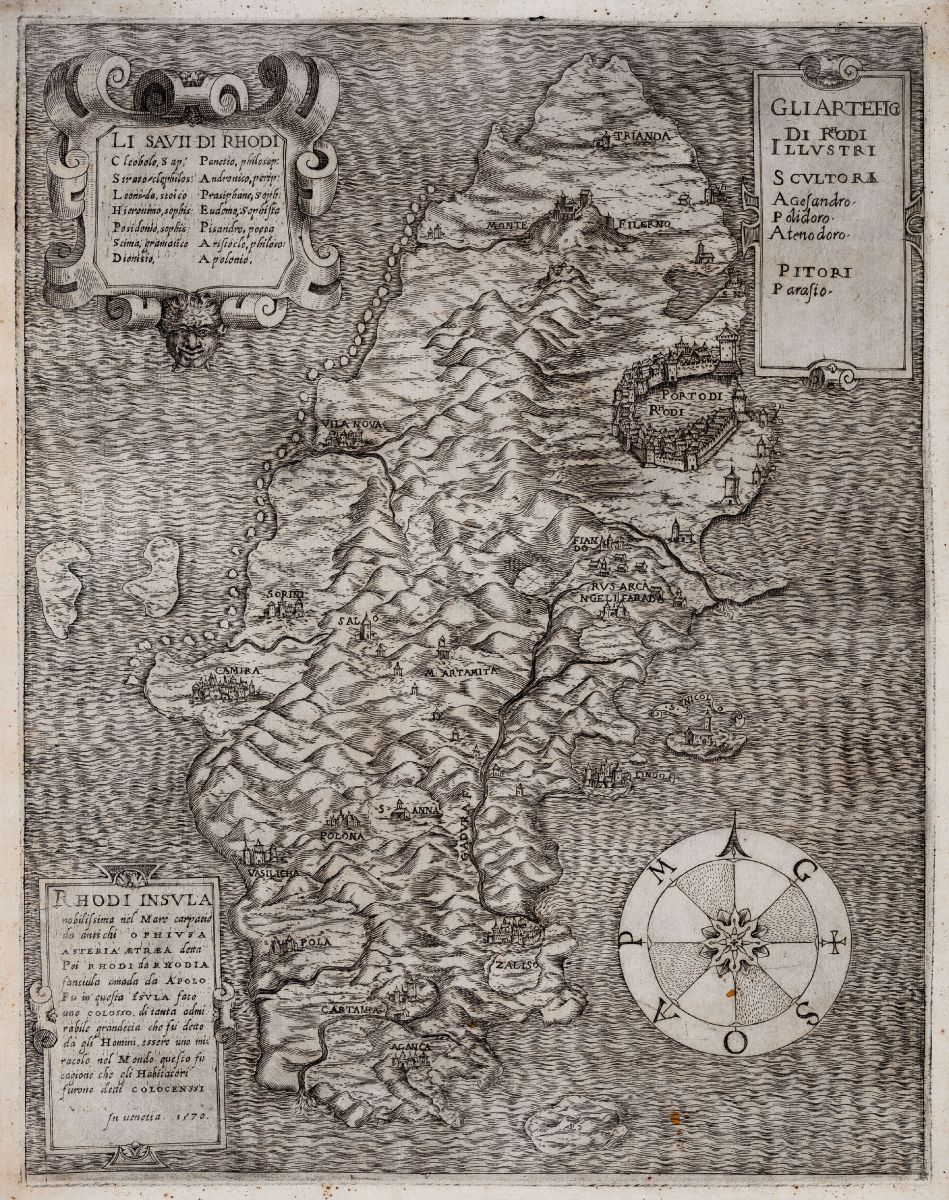
Rhodi Insula nobilissima nel Mare
- $3,400
- A fantastic rarity of the island of Rhodes.
-
-
-
-
-
Add to cart
 Quick View
 - Spain & Portugal
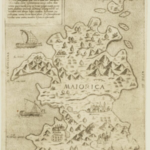
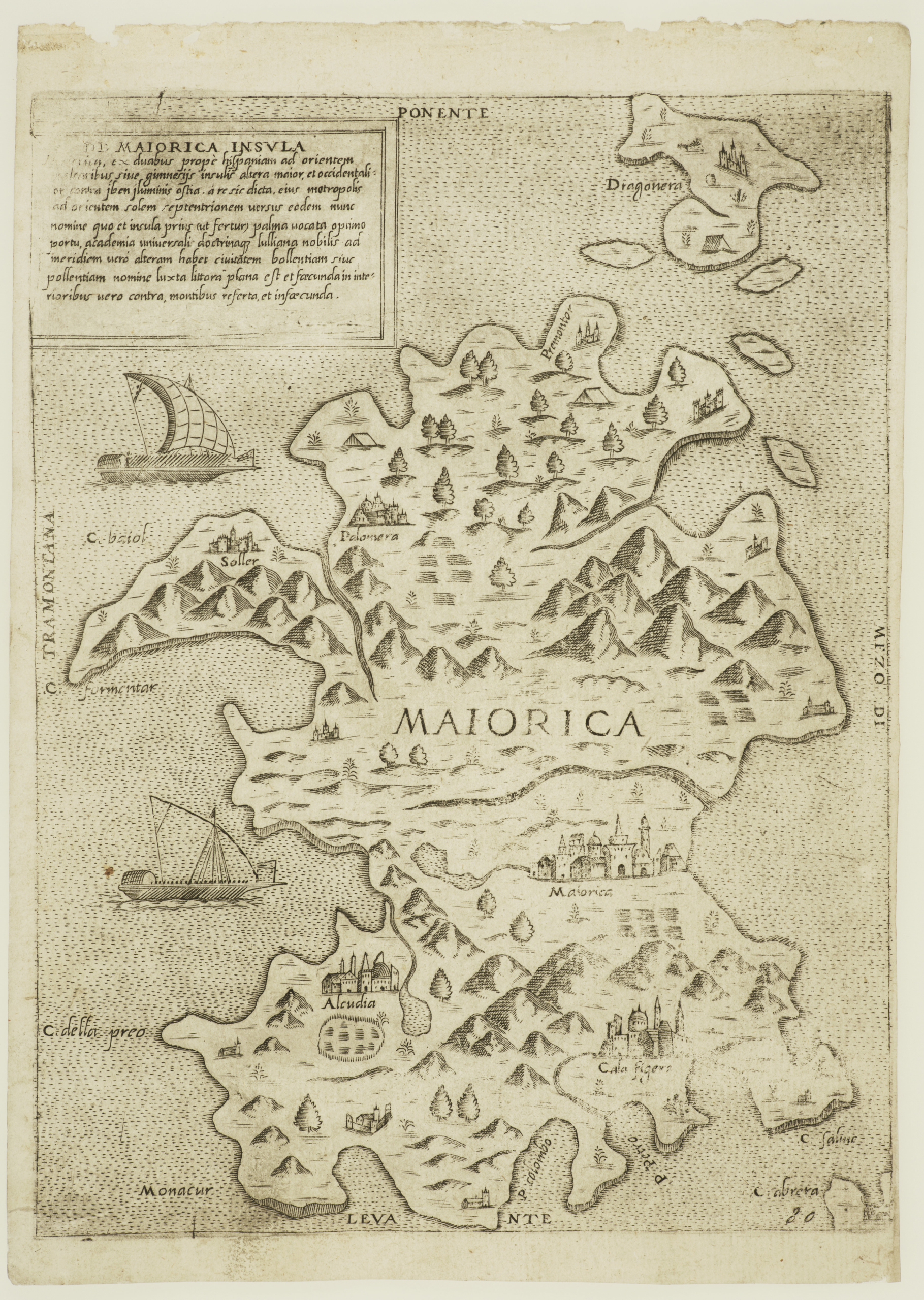
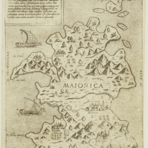
De Maiorica Insula.
- $775
- Rare Lafreri-school map of the island of Mallorca.
-
-
-
-
-
Add to cart
 Quick View
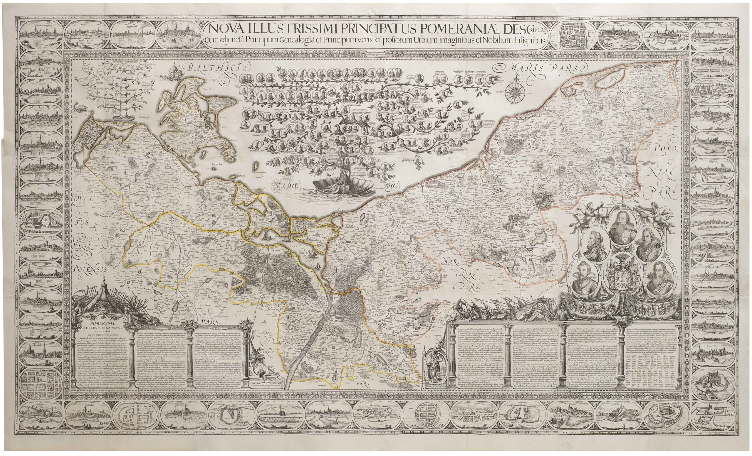
 - Europe, Featured Maps & Views, Germany & the Netherlands
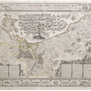
Nova Illustrissimi Principatus Pomeraniae Descriptio
- $27,000
- An exceptionally rare cartographic masterpiece — the finest and most important map of Pomerania, the plates of which were rediscovered in an attic after lost during the Thirty Years’ War.
-
-
-
-
-
Add to cart

 Quick View
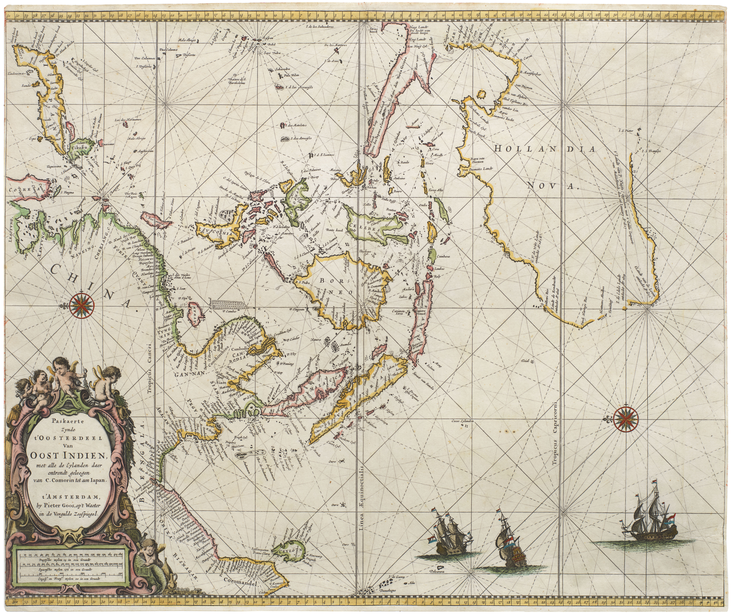
 - Southeast Asia & Australia, Featured Maps & Views, Asia
Paskaerte Zynde t’Oosterdeel van Oost Indien, met Alle de Eylanden daer Ontrendt Geleegen van C. Comorin tot aen Japan
- $9,000
- [Early color] Pieter Goos’ Striking Sea Chart of Southeast Asia, Australia, and the Indian Ocean.
-
-

-
-
-
Add to cart
 Quick View
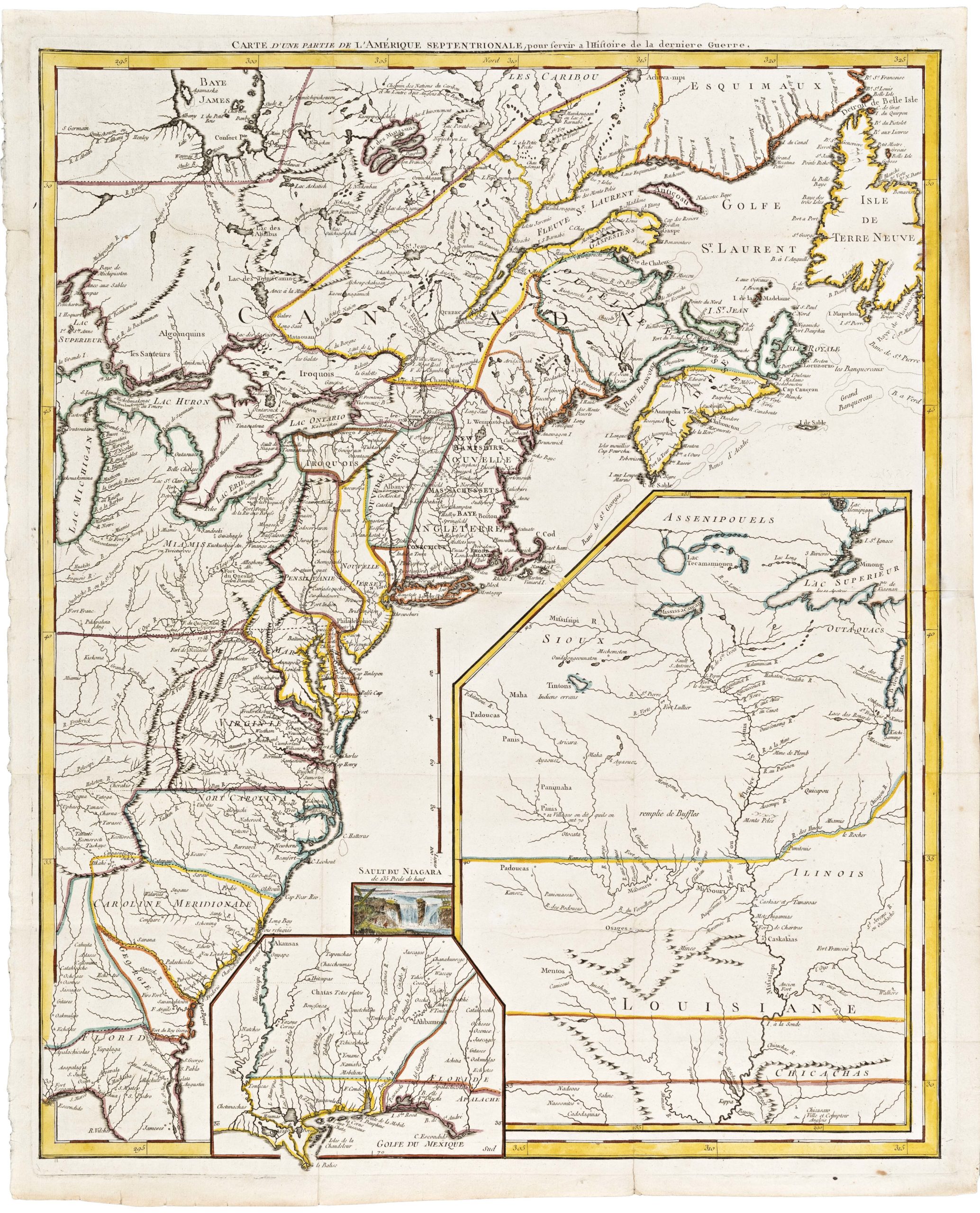
 - East & Midwest United States
Carte D’Une Partie De L’Amerique Septentrionale, pour servir a l’Histoire derniere Guerre
- $1,400
- Mapping post-independence America: 1787 Le Rouge map of the East Coast and the Mississippi Valley.
-
-
-