-
-
Add to cart
 Quick View
 - Americas, North America
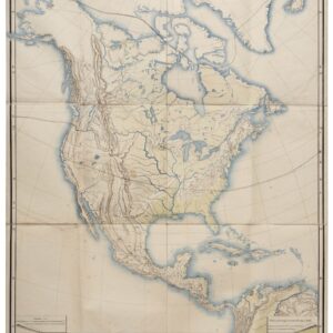
Nord-Amerika.
- $1,200
- Von Sydow’s geophysical wall map of North America.
-
-
-
-
Add to cart
 Quick View
 - Americas, Mexico - Central & South America
World Petroleum Oil Map of Columbia.
- $500
- An American map of oil and petroleum resources in Columbia.
-
-
-
-
Add to cart
 Quick View
 - Americas, North America, Pacific Northwest - Hawaii - Alaska, Texas and The West
Map of Oregon Territory.
- $550
- One of the earliest maps of Oregon Territory.
-
-
-
-
Add to cart
 Quick View
 - Americas, North America, United States
Charte Von Nord America Entworfen und gezeichnet von C.G. Reichard…Erganztr und nach den neuern Entdeckungen desr Hrn. Lewis, Clarke n. Pike…1817.
- $1,600
- A noteworthy and era-specific snapshot of North American geography and exploration during the early 19th century.
-
-
-
-
Add to cart
 Quick View
 - Americas, Mexico - Central & South America
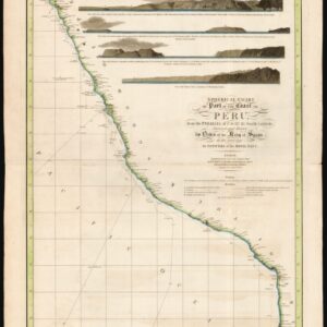
Spherical chart of part of the coast of Peru, from the Parallel of 7.° to 21.° 45.’ South Latititude; Surveyed and Drawn by Order of the King of Spain in the year 1790, By Officers of the Royal Navy.
- $950
- The best coastal view of Peru in the early 19th century.
-
-
-
-
Add to cart
 Quick View
 - Americas, Cuba, West Indies, Caribbean, East & Midwest United States, United States
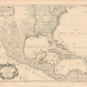
Carte Du Mexique Et Des Etats Unis d’Amerique, Partie Meridionale.
- $1,200
- An Early Mention of the United States of America.
-
-
-
-
Add to cart
 Quick View
 - Americas, Mexico - Central & South America
Archaeological Map of the Guatemala.
- $425
- An archaeological map depicting Guatemala’s extensive Mayan ruins.
-
-
-
-
Add to cart
 Quick View
 - Mexico - Central & South America
Archaeological Map of the Yucatan Peninsula.
- $475
- An archaeological map depicting the extensive Mayan ruins of the Yucatan Peninsula.
-
-
-
-
Add to cart
 Quick View
 - Americas, Atlases & Books, Canada and The Great Lakes, North America
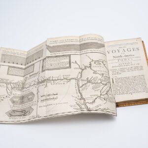
New Voyages to North-America. Containing an Account of the Several Nations of That Vast Continent…
- $8,500
- First English edition of Lahontan's description and mapping of New France, which propagated the myth of the Northwest Passage.
-
-
-
-
Add to cart

 Quick View
 - Americas, North America, Pacific Northwest - Hawaii - Alaska, United States
A Chart of North and South America, Including the Atlantic and Pacific Oceans, with the nearest Coasts of Europe, Africa, and Asia
- $4,200
- Sayer-Bennet-Mead's 1775 chart of the Western Hemisphere with Pacific and Arctic routes of exploration.
-
-
-
-
-
Add to cart
 Quick View
 - Americas, Mexico - Central & South America, Texas and The West
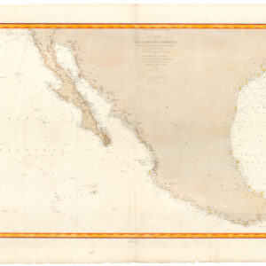
Carte de la côte occidentale d’Amérique…
- $875
- Nautical chart of Mexico, including San Diego and the Texas coast.
-
-
-
-
Add to cart
 Quick View
 - Americas, Mexico - Central & South America
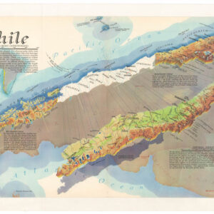
Chile
- $675
- A distinctive, mind-bending view of Chile.
-
-