-
-
Add to cart

 Quick View
 - Europe, Italy
A Topographical Map of the Republick of Genoua, Taken from the Celebrated Map by Chaffrion…1764.
- $2,000
- A spectacular and historically significant 18th-century folding case map of the Republic of Genoa.
-
-
-
-
-
Add to cart
 Quick View
 - Europe, Greece & the Balkans
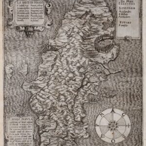
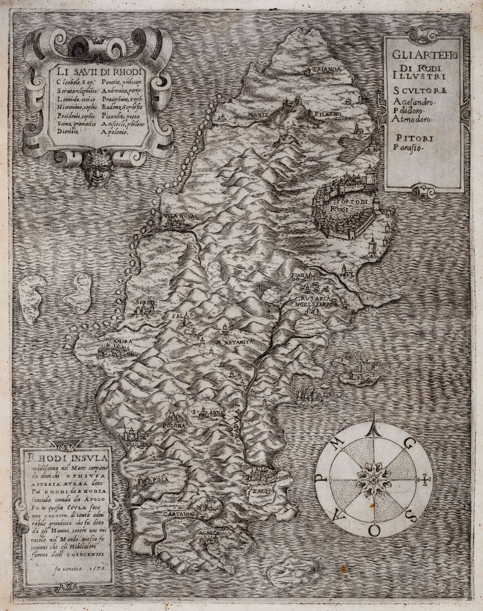
Rhodi Insula nobilissima nel Mare
- $3,400
- A fantastic rarity of the island of Rhodes.
-
-
-
-
-
Add to cart
 Quick View
 - Spain & Portugal
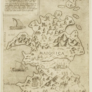
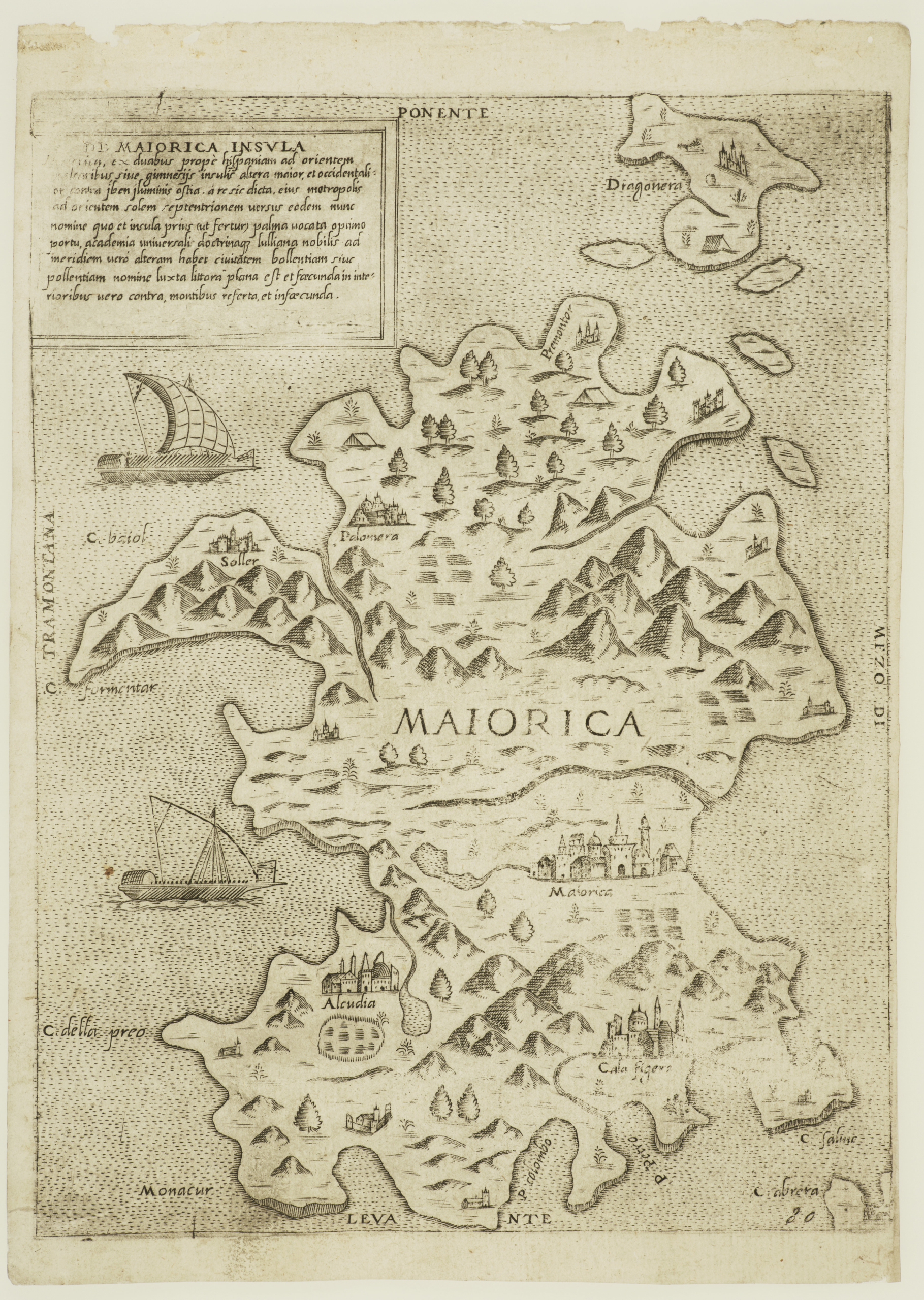
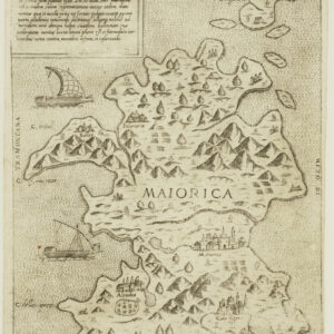
De Maiorica Insula.
- $775
- Rare Lafreri-school map of the island of Mallorca.
-
-
-
-
-
Add to cart
![[Map of Steamship Routes and the Railways and Post Roads of the Russian Empire]](https://neatlinemaps.com/wp-content/uploads/2020/04/NL-00827_Thumbnail-300x300.jpg)
![[Map of Steamship Routes and the Railways and Post Roads of the Russian Empire]](https://neatlinemaps.com/wp-content/uploads/2020/04/NL-00827-scaled.jpg) Quick View
Quick View - Europe, Russia & Eastern Europe
[Map of Steamship Routes and the Railways and Post Roads of the Russian Empire]
- $1,850
- In-progress construction of the Trans-Siberian Railway: a scarce wall map depicting the transportation network of the Russian Empire at the end of the 19th century.
-
-
![[Map of Steamship Routes and the Railways and Post Roads of the Russian Empire]](https://neatlinemaps.com/wp-content/uploads/2020/04/NL-00827-scaled-300x300.jpg)
-
-
-
Add to cart
![[Title in Russian] Russian Empire in the 18th Century (European Section)](https://neatlinemaps.com/wp-content/uploads/2020/04/NL-00822_Thumbnail-300x300.jpg)
![[Title in Russian] Russian Empire in the 18th Century (European Section)](https://neatlinemaps.com/wp-content/uploads/2020/04/NL-00822-scaled.jpg) Quick View
Quick View - Curiosities - Miscellanea, Russia & Eastern Europe
[Title in Russian] Russian Empire in the 18th Century (European Section)
- $675
- Educating school children during the Cold War: Soviet historical wall map of the Russian Empire in the 18th century.
-
-
![[Title in Russian] Russian Empire in the 18th Century (European Section)](https://neatlinemaps.com/wp-content/uploads/2020/04/NL-00822-scaled-300x300.jpg)
-
-
-
Add to cart
 Quick View
 - Europe, Featured Maps & Views, Germany & the Netherlands
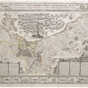
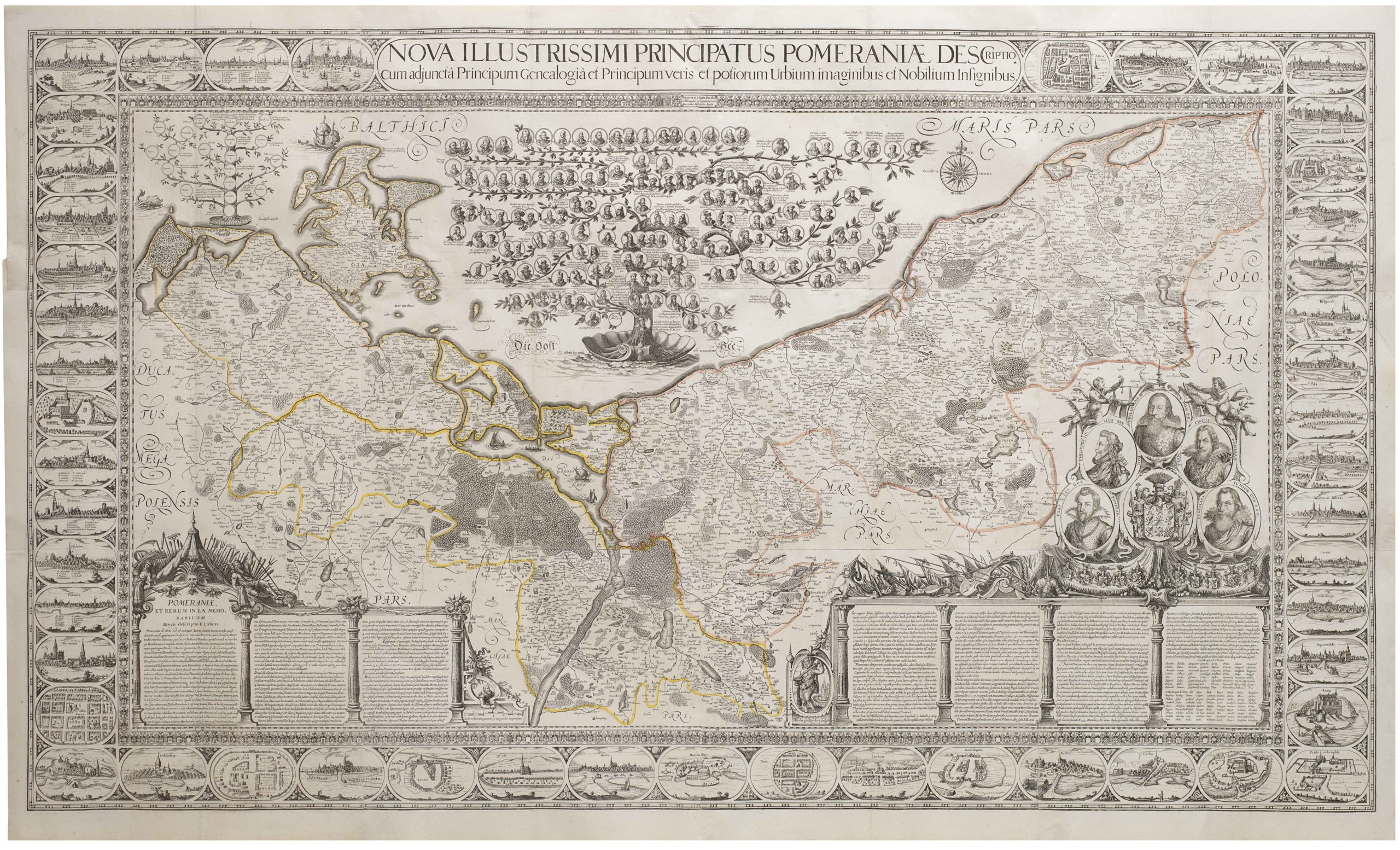
Nova Illustrissimi Principatus Pomeraniae Descriptio.
- $18,000
- An exceptionally rare cartographic masterpiece — the finest and most important map of Pomerania, the plates of which were rediscovered in an attic after lost during the Thirty Years’ War.
-
-
-
-
-
Add to cart
![Delimitation de la Zone Occupee [German Occupation of France]](https://neatlinemaps.com/wp-content/uploads/2019/12/NL-00782-scaled-300x300.jpg)
![Delimitation de la Zone Occupee [German Occupation of France]](https://neatlinemaps.com/wp-content/uploads/2019/12/NL-00782-scaled.jpg) Quick View
Quick View - Europe, France & Switzerland, World War I and World War II
Delimitation de la Zone Occupee [German Occupation of France]
- $1,000
- After the Fall of France: administrative map of German occupation published during World War II.
-
-
-
-
-
Add to cart
 Quick View
 - Europe, Spain & Portugal
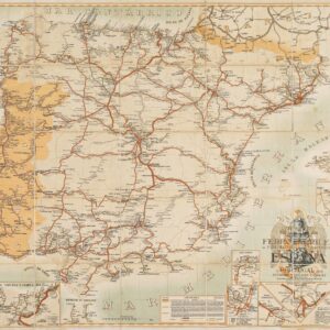
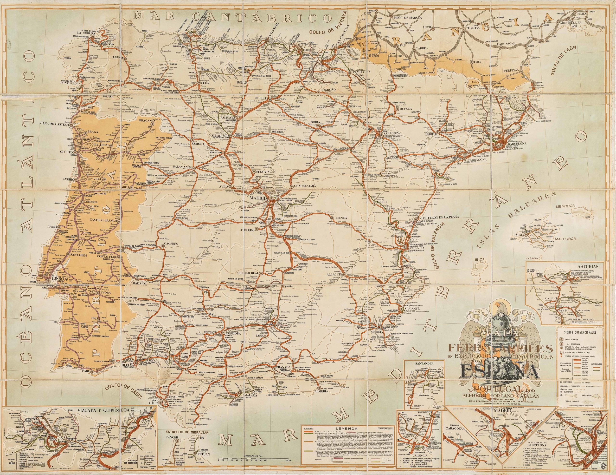
Mapa de los ferrocarriles en explotación, construcción y proyecto en España y Portugal
- $775
- Absolutely gorgeous 1956 railroad map of Spain and Portugal with Francoist coat-of-arms.
-
-
-
-
-
-
Add to cart

 Quick View
 - Bird's-eye-views, Europe, France & Switzerland
Klassischer Boden oder Malerisches Relief des Vierwaldstättersees / Plan Pittoresque du Lac des IV Cantons 1853. Lith Frères Eglin à Lucerne.
- Spectacular panoramic view of Lake Lucerne, with dynamic topographic relief and pictorial cities and towns.
-
-
-

-
-
-
Add to cart
 Quick View
 - Germany & the Netherlands
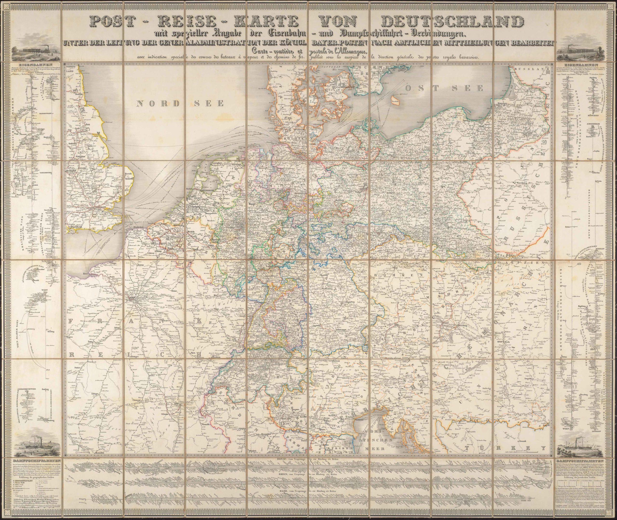
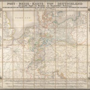
Post-Reise-Karte von Deutschland mit spezieller Angabe der Eisenbahn- und Dampfschiffahrt-Verbindungen, unter der Leitung der Generaladministration der Königl. Bayer. Posten nach amtlichen Mittheilungen bearbeitet. Carte routi’ere et postale de l’Allemagne.
- $425
- A large-format 1843 post-road and transportation map of the German Confederation.
-
-
-
-
-
Add to cart
 Quick View
 -
-
-
-
-
Add to cart
 Quick View
 -
-
-