-
-
Add to cart
 Quick View
 - Featured Maps & Views, Europe, Germany & the Netherlands
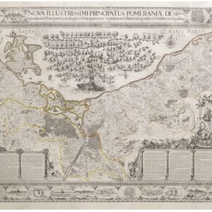
Nova Illustrissimi Principatus Pomeraniae Descriptio
- $27,000
- An exceptionally rare cartographic masterpiece — the finest and most important map of Pomerania, the plates of which were rediscovered in an attic after lost during the Thirty Years’ War.
-
-
-
-
-
Add to cart
![Delimitation de la Zone Occupee [German Occupation of France]](https://neatlinemaps.com/wp-content/uploads/2019/12/NL-00782-scaled-300x300.jpg)
![Delimitation de la Zone Occupee [German Occupation of France]](https://neatlinemaps.com/wp-content/uploads/2019/12/NL-00782-scaled.jpg) Quick View
Quick View - Europe, France & Switzerland, World War I and World War II
Delimitation de la Zone Occupee [German Occupation of France]
- $1,000
- After the Fall of France: administrative map of German occupation published during World War II.
-
-
-
-
-
Add to cart
 Quick View
 - Europe, Spain & Portugal
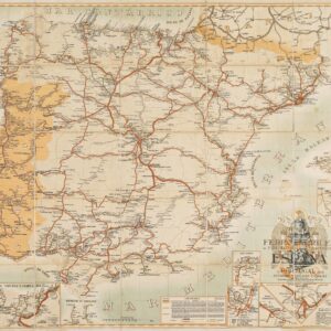
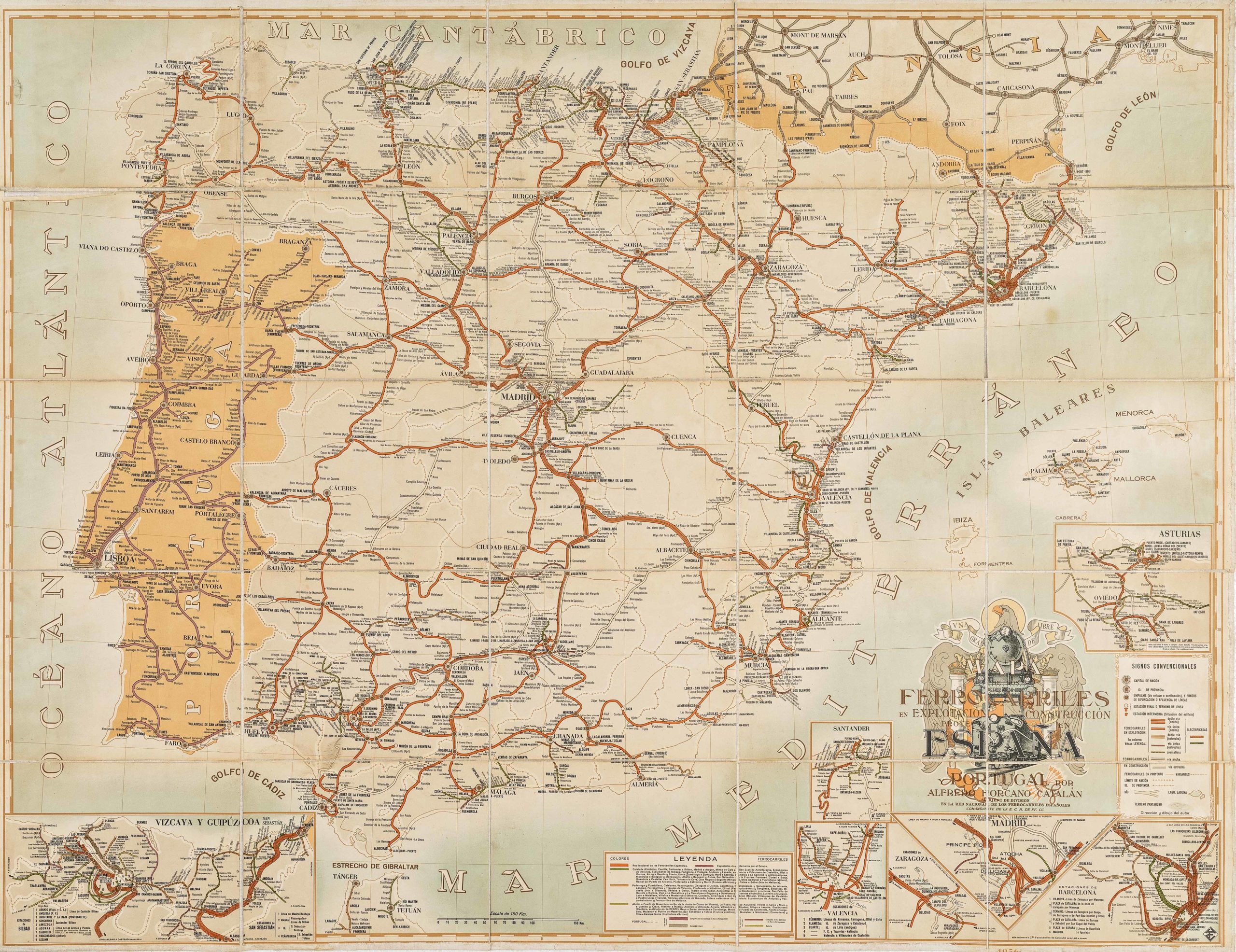
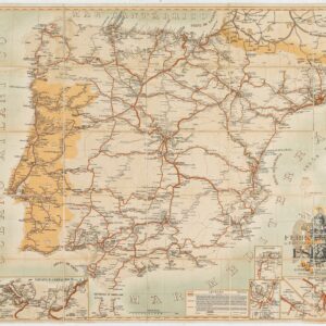
Mapa de los ferrocarriles en explotación, construcción y proyecto en España y Portugal
- $775
- Absolutely gorgeous 1956 railroad map of Spain and Portugal with Francoist coat-of-arms.
-
-
-
-
-
-
Add to cart

 Quick View
 - Europe, France & Switzerland, Bird's-eye-views
Klassischer Boden oder Malerisches Relief des Vierwaldstättersees / Plan Pittoresque du Lac des IV Cantons 1853. Lith Frères Eglin à Lucerne.
- $1,250
- Spectacular panoramic view of Lake Lucerne, with dynamic topographic relief and pictorial cities and towns.
-
-
-

-
-
-
Add to cart
 Quick View
 - Germany & the Netherlands
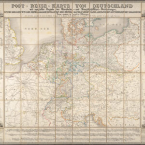
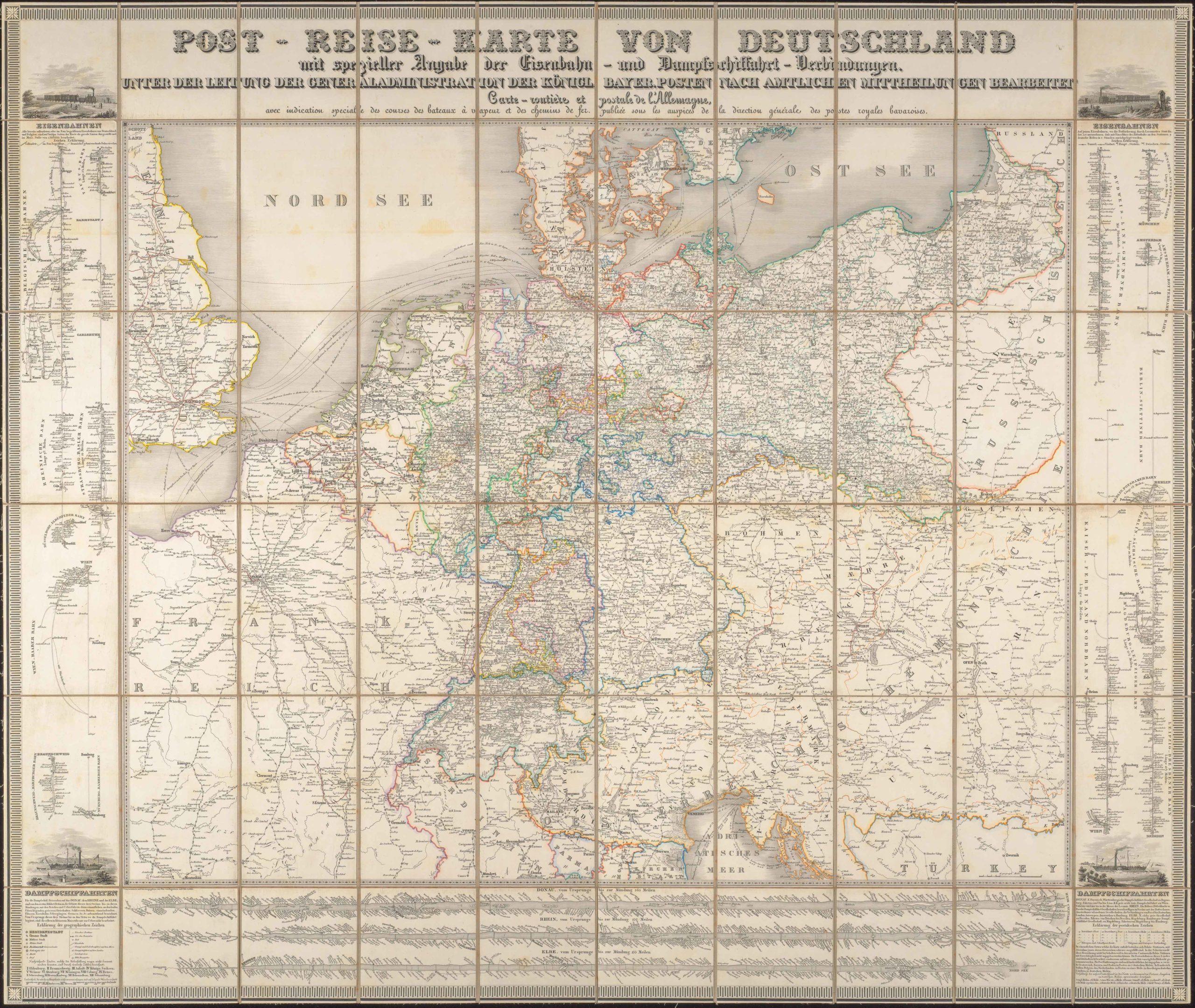
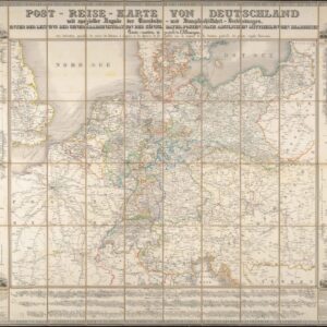
Post-Reise-Karte von Deutschland mit spezieller Angabe der Eisenbahn- und Dampfschiffahrt-Verbindungen, unter der Leitung der Generaladministration der Königl. Bayer. Posten nach amtlichen Mittheilungen bearbeitet. Carte routi’ere et postale de l’Allemagne.
- $425
- A large-format 1843 post-road and transportation map of the German Confederation.
-
-
-
-
-
Add to cart

 Quick View
 - Europe, Italy
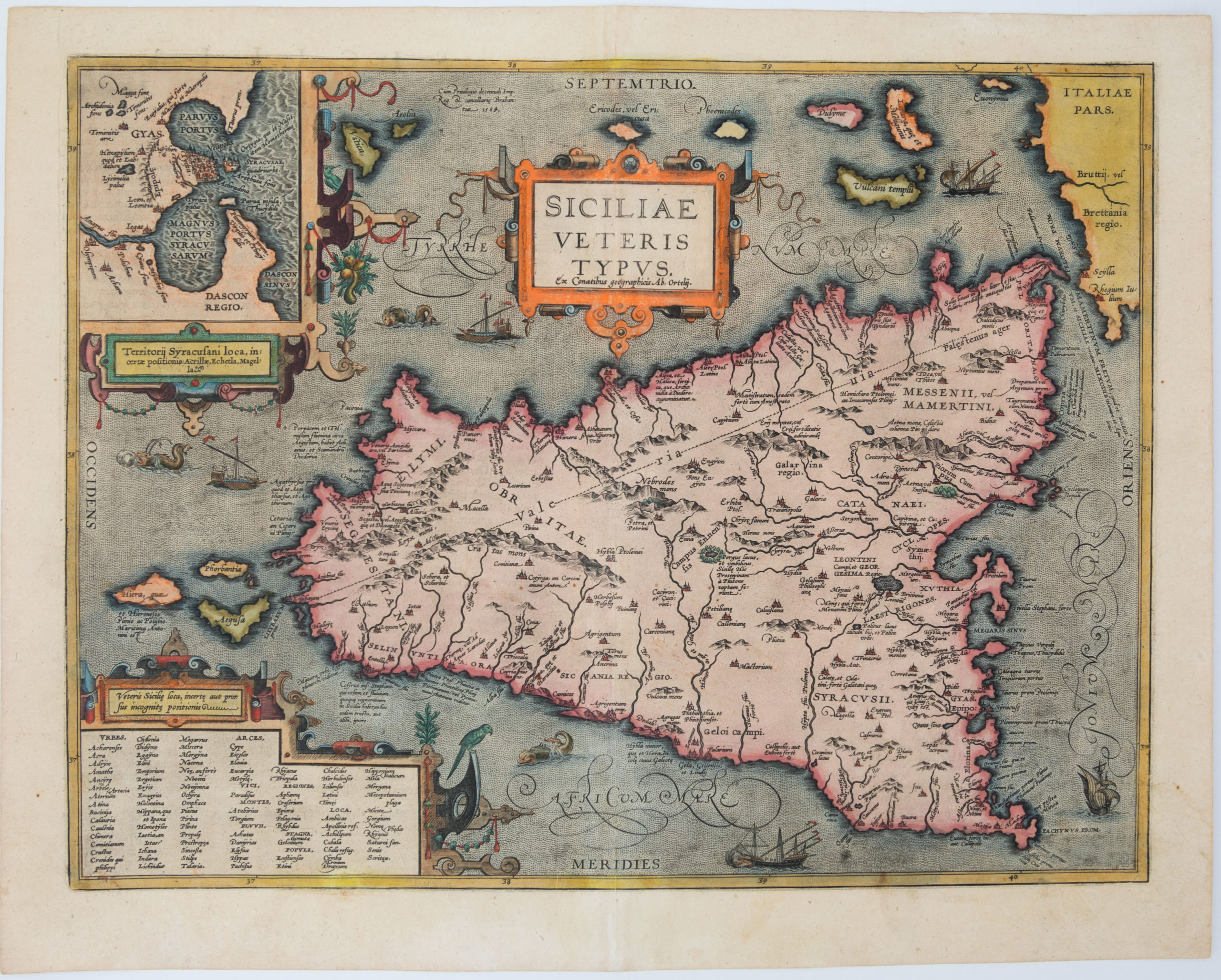
Siciliae Veteris Typus
- $1,200
- Beautiful old color Ortelius map of Sicily.
-
-
-
-
-
Add to cart
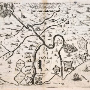
 Quick View
 -
-
-
-
-
Add to cart
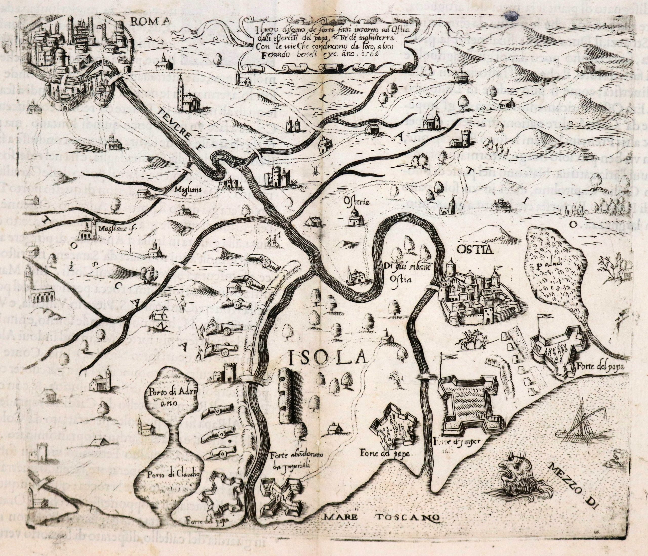 Quick View
 -
-
-
-
-
Add to cart
 Quick View
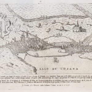
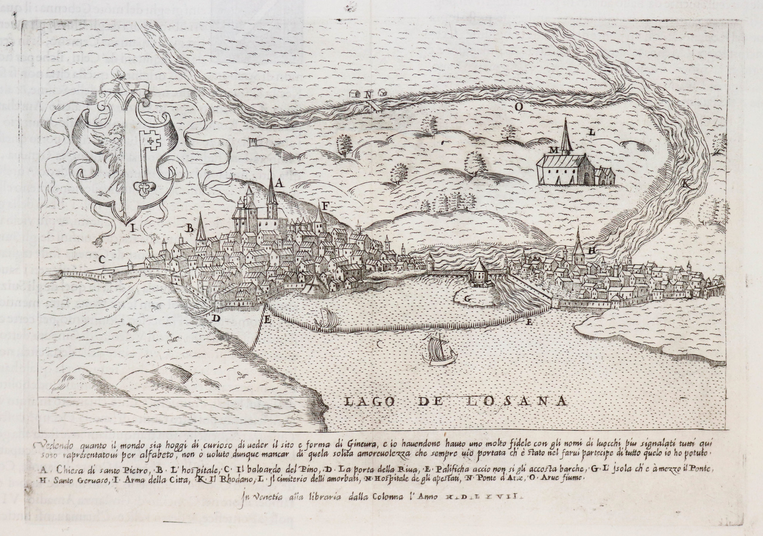
 - Europe, France & Switzerland, Bird's-eye-views
Ginevra
- $800
- Excellent 1567 Lafreri view of Geneva.
-
-
-
-
-
Add to cart
 Quick View
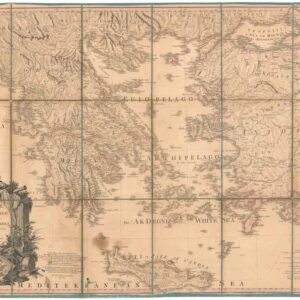
 - Europe, Greece & the Balkans
Greece Archipelago and part of Anadoli. By L.S. de la Rochette. MDCCXC. London, Published for Willm. Faden, Geographer to the King. January 1st. 1791
- Large, detailed 1791 map of Greece and Asia Minor with striking cartouche.
-
-
-
-
Add to cart
 Quick View
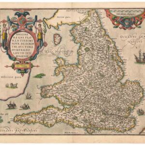
 - Europe, British Isles
Angliae Regni Florentissimi Nova Descriptio, Auctore Humfredo Lhuyd Denbygiense
- $975
- Lovely 1574 Ortelius map of England and Wales with elaborate cartouche.
-
-