-
-
Add to cart
 Quick View
 - East & Midwest United States, United States
Gettysburg. Repulse of Longstreet’s Assault.
- $900
- Bachelder’s magnificent rendering of Longstreet’s Assault (Pickett's Charge).
-
-
-
-
Add to cart
 Quick View
 - East & Midwest United States, Featured Maps & Views, United States
Gettysburg Battle-Field.
- $2,400
- Bachelder's iconic 1863 view of the Battle of Gettysburg.
-
-
-
-
Add to cart
 Quick View
 - Pacific Northwest - Hawaii - Alaska
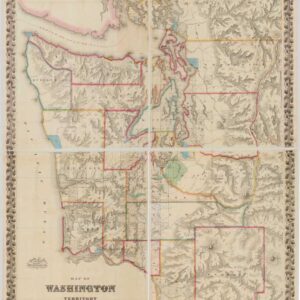
Map of Washington Territory West of the Cascade Mountains.
- $9,500
- The first large-format map of Washington Territory and a masterpiece of American cartography.
-
-
-
-
Add to cart
 Quick View
 - East & Midwest United States, United States
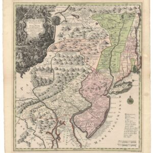
Pensylvania Nova Jersey et Nova York cum Regionibus Ad Fluvium Delaware…
- $2,900
- Seutter’s first state map of Pennsylvania, Jersey, and New York, with original color.
-
-
-
-
Add to cart
 Quick View
 - Atlases & Books, Canada and The Great Lakes, North America, United States
Reports upon the Survey of the Boundary between the Territory of the United States and the Possessions of Great Britain. Washington: Government Printing Office, 1878.
- $500
- 1878 U.S. report on the survey that fixed the U.S.–Canadian border along the 49th parallel.
-
-
-
-
Add to cart
 Quick View
 - Atlases & Books, Canada and The Great Lakes, North America, United States
Joint maps of the northern boundary of the United States: from the Lake of the Woods to the summit of the Rocky Mountains.
- $500
- Defining the U.S.–Canadian border along the 49th parallel from the Lake of the Woods to the Rockies.
-
-
-
-
Add to cart
 Quick View
 - Americas, North America, United States
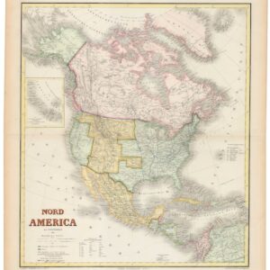
Nord America mit Westindien.
- $975
- Hand-colored ca. 1867 Kiepert map of North America, capturing the post-Civil War U.S., shifting Canadian and Mexican frontiers, and colonial Caribbean.
-
-
-
-
Add to cart
 Quick View
 - Atlases & Books, California, Texas and The West
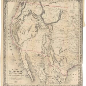
Map of California, Oregon, Texas, and the territories adjoining, with routes &c.
- $1,900
- Colton’s iconic map of the West, with California Gold region and extended Texas borders.
-
-
-
-
Add to cart
 Quick View
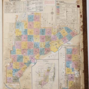
 - Atlases & Books, East & Midwest United States, United States
Insurance Maps of Miami, Florida Volume Three.
- $8,500
- Sanborn Fire Insurance Atlas of Miami, Florida – Volume 3: Coconut Grove & Silver Bluff.
-
-
-
-
Add to cart
 Quick View
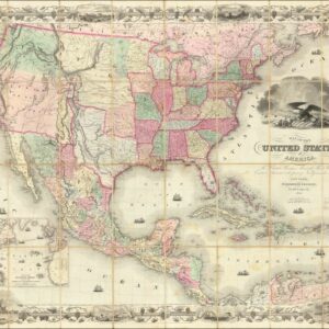
 - Featured Maps & Views, Texas and The West, United States
Map of the United States of America, The British Provinces, Mexico, The West Indies and Central America, with part of New Granada and Venezuela.
- $8,500
- A First State of Colton's Map of the United States with Texas extending into Colorado.
-
-
-
-
Add to cart
 Quick View
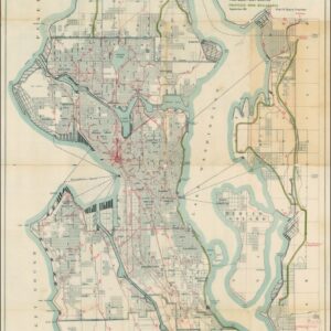
 - Pacific Northwest - Hawaii - Alaska
A Map for the City of Seattle and adjacent territory accompanying a report of MUNICIPAL PLANS COMMISSION.
- $1,200
- The famous ‘Bogue Plan’ of Seattle: an ambitious urban design for the city and environs from 1911.
-
-
-
-
Add to cart
 Quick View
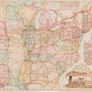
 - Featured Maps & Views, United States
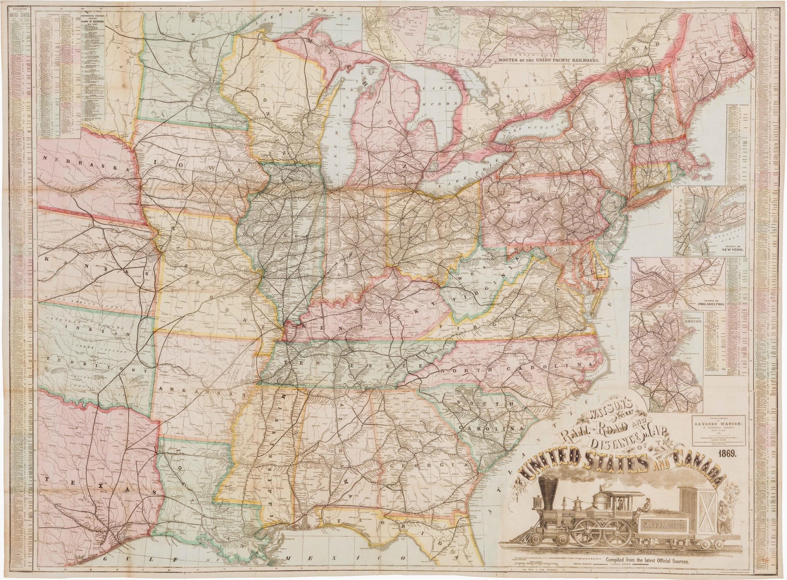
Watson’s New Rail Road and Distance Map of the United States and Canada.
- $3,800
- Among the finest railroad maps of America made in the 19th century.
-
-

-
