-
-
Add to cart
 Quick View
 - Pictorial maps, United States
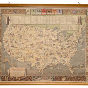
Folklore Music Map of the United States.
- $975
- A fantastic folklore map of America.
-
-
-
-
Add to cart
 Quick View
 - United States, East & Midwest United States
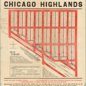
The Central Subdivision at Chicago Highlands.
- $775
- Promotional broadside for the industrial community of Chicago Highlands.
-
-
-
-
Add to cart
![[AMERICAN REVOLUTION] Boston, George Washington, Franklin, Philadelphia, Washington, D.C.](https://neatlinemaps.com/wp-content/uploads/2024/05/NL-02090a_thumbnail-300x300.jpg) Quick View
Quick View - East & Midwest United States, United States
[AMERICAN REVOLUTION] Boston, George Washington, Franklin, Philadelphia, Washington, D.C.
- $600
- A set of six hand-colored plates from Guilio Ferrario’s iconic encyclopedia showcasing the American Revolution.
-
-
-
-
Add to cart
 Quick View
 - East & Midwest United States
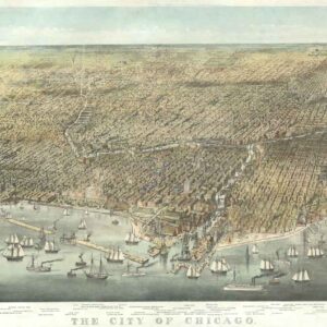
The City of Chicago.
- $6,500
- Probably the most iconic view of Chicago ever made…
-
-
-
-
Add to cart
 Quick View
 - Pacific Northwest - Hawaii - Alaska, Pictorial maps, United States
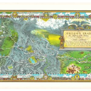
The Oregon Trail: The Highway of the Pioneers to the Pacific Northwest.
- $575
- William Forsyth McIlwraith’s vibrant and historically rich Oregon Trail map.
-
-
-
-
Add to cart
 Quick View
 - Texas and The West
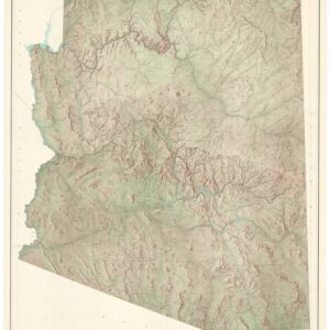
State of Arizona.
- $650
- A large, exquisite topographical map of Arizona, produced after World War II by the most reliable mapping agency on the planet.
-
-
-
-
Add to cart
![[Morenci, Arizona Photograph Album]](https://neatlinemaps.com/wp-content/uploads/2024/05/NL-01915_thumbnail-300x300.jpg) Quick View
Quick View - Texas and The West
[Morenci, Arizona Photograph Album]
- $1,800
- An unrecorded early 20th-century photo album of mining operations in Arizona.
-
-
-
-
Add to cart
 Quick View
 - United States, Curiosities - Miscellanea
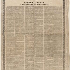
Farewell Address of Andrew Jackson to the People of the United States.
- Printed silk broadside of President Andrew Jackson’s 1837 farewell address.
-
-
-
-
Add to cart
![[Untitled] Portraits and facsimile signatures of 48 American patriots.](https://neatlinemaps.com/wp-content/uploads/2024/05/NL-01743_thumbnail-300x300.jpg) Quick View
Quick View - Curiosities - Miscellanea, East & Midwest United States
[Untitled] Portraits and facsimile signatures of 48 American patriots.
- $2,400
- A formative sheet in patriotic printing.
-
-
-
-
Add to cart
![[First State] Panorama of the Seat of the War Birds Eye View of Virginia, Maryland, Delaware and the District of Columbia](https://neatlinemaps.com/wp-content/uploads/2024/05/NL-00664-scaled-1-300x300.jpg)
![[First State] Panorama of the Seat of the War Birds Eye View of Virginia, Maryland, Delaware and the District of Columbia](https://neatlinemaps.com/wp-content/uploads/2024/05/NL-00664-scaled-1.jpg) Quick View
Quick View - Bird's-eye-views, East & Midwest United States, Featured Maps & Views
[First State] Panorama of the Seat of the War Birds Eye View of Virginia, Maryland, Delaware and the District of Columbia
- $2,200
- Bachmann's dramatic 1861 panoramic view of the central theater of the American Civil War.
-
-
-
-
-
Add to cart

 Quick View
 - Americas, North America, Pacific Northwest - Hawaii - Alaska, United States
A Chart of North and South America, Including the Atlantic and Pacific Oceans, with the nearest Coasts of Europe, Africa, and Asia
- $4,200
- Sayer-Bennet-Mead's 1775 chart of the Western Hemisphere with Pacific and Arctic routes of exploration.
-
-
-
-
-
Add to cart
 Quick View
 - Americas, Mexico - Central & South America, Texas and The West
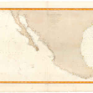
Carte de la côte occidentale d’Amérique…
- $875
- Nautical chart of Mexico, including San Diego and the Texas coast.
-
-