-
-
Add to cart
 Quick View
 - East & Midwest United States
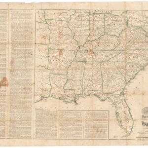
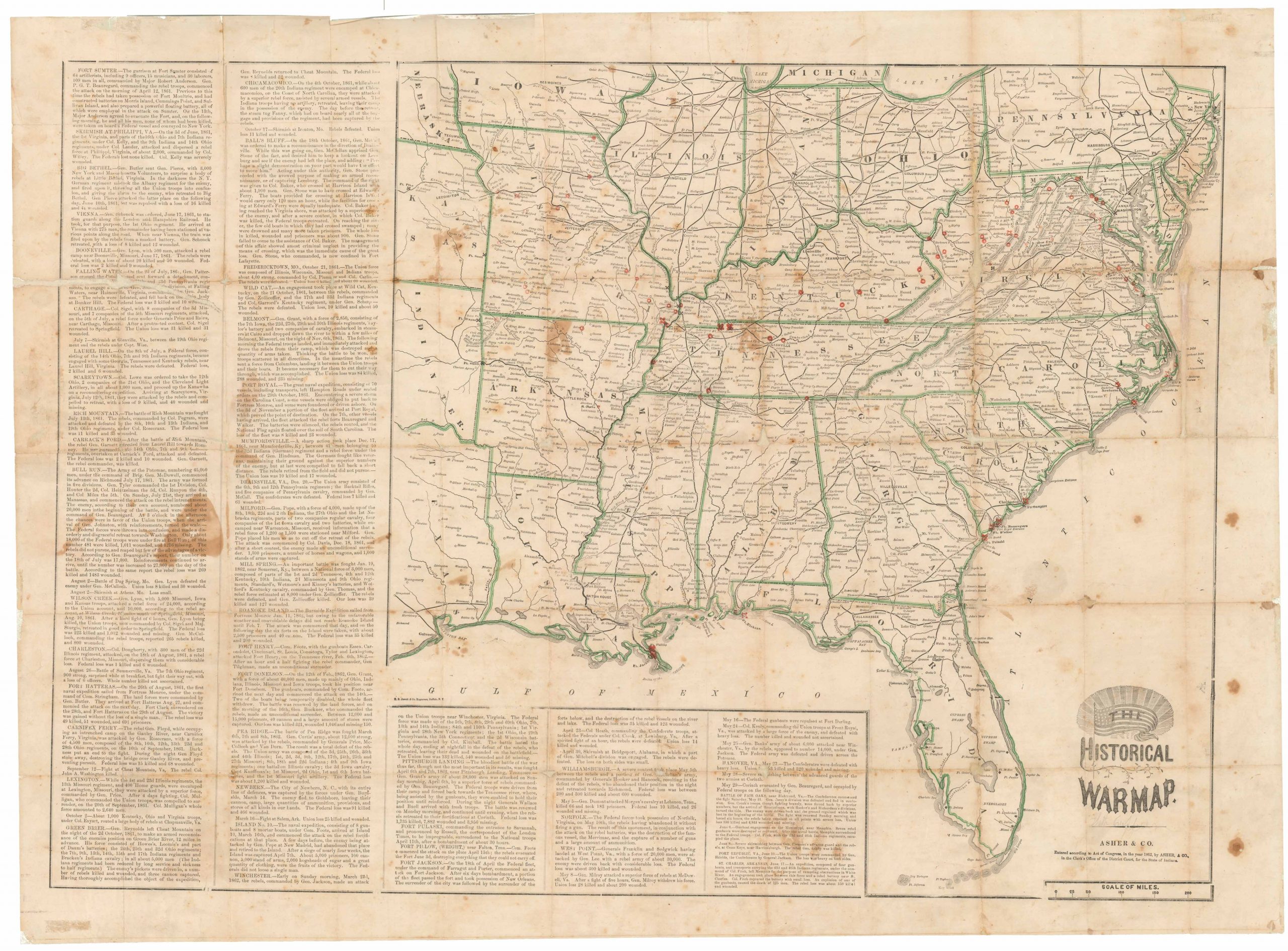
The Historical War Map.
- $975
- Printed broadside that provided the American public with a comprehensive overview of the Civil War, with an extensive narrative on the war’s progress.
-
-
-
-
-
Add to cart

 Quick View
 - East & Midwest United States
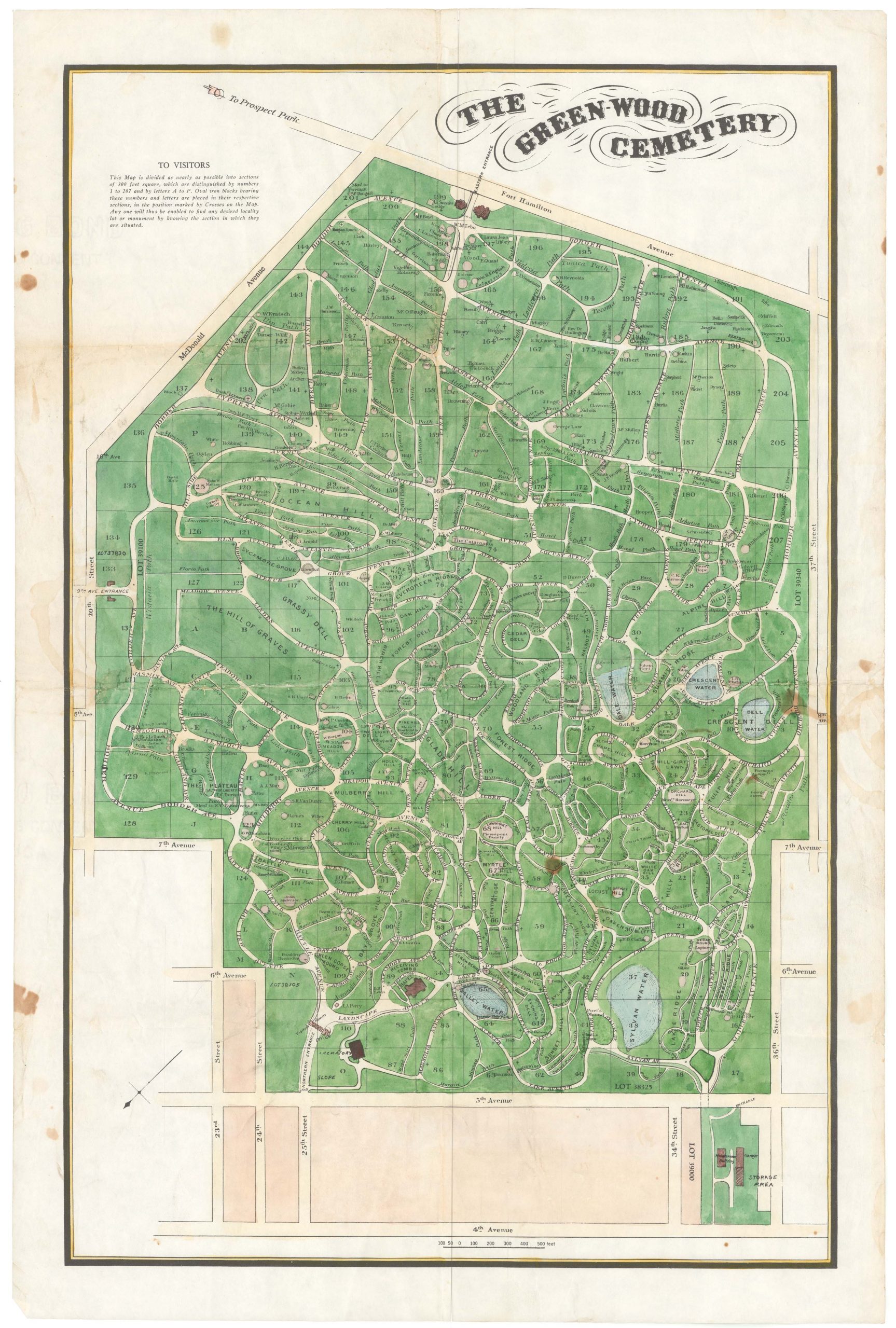
The Green-Wood Cemetery
- $550
- A hand-colored lithographed map of a well-known Brooklyn landmark.
-
-
-
-
-
Add to cart
 Quick View
 - East & Midwest United States
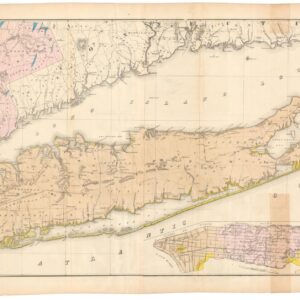
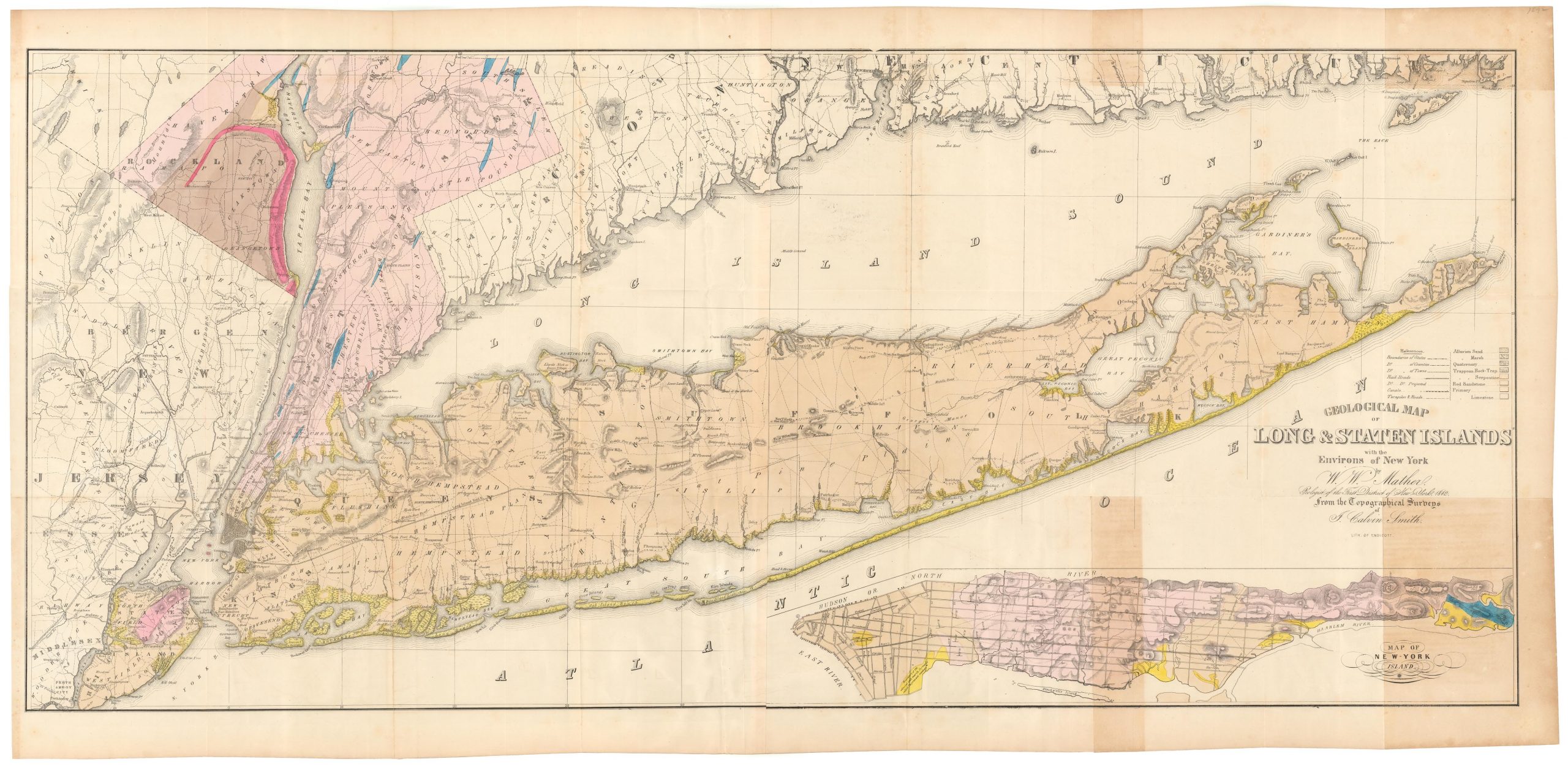
Geological map of Long & Staten islands with the environs of New York
- $1,700
- The first systematic mapping of the geology of Long Island.
-
-
-
-
-
Add to cart
 Quick View
 - United States
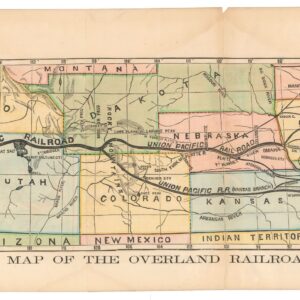
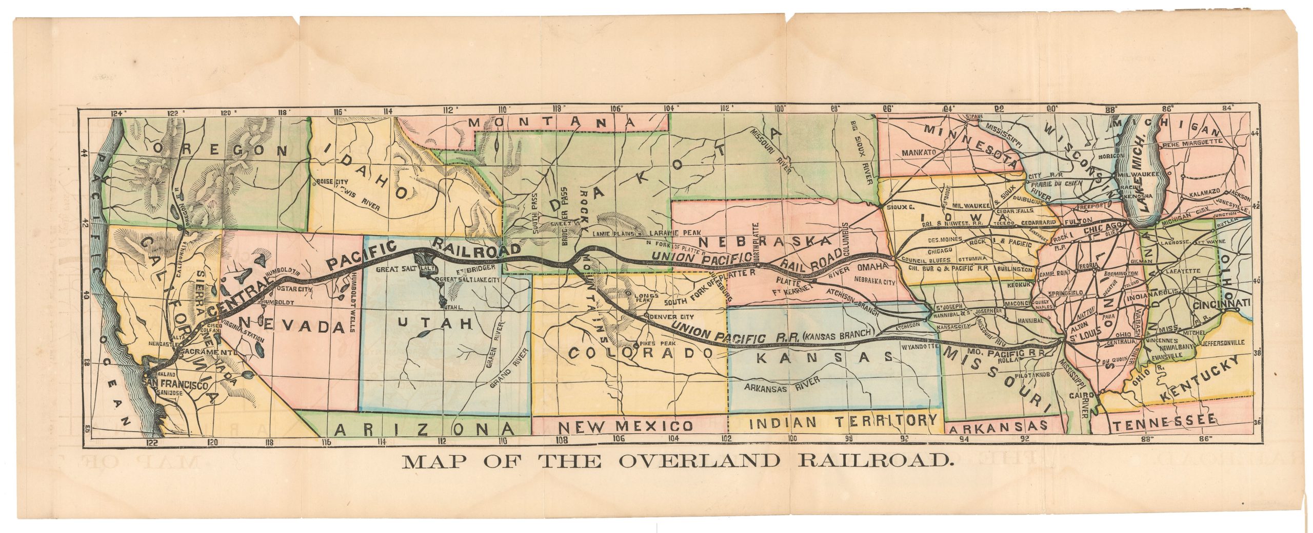
Map of the Overland Railroad
- $850
- Rare early map showing the proposed route of the Central Pacific Railroad during a relatively early period of its construction.
-
-
-
-
-
Add to cart

 Quick View
 - East & Midwest United States, Texas and The West
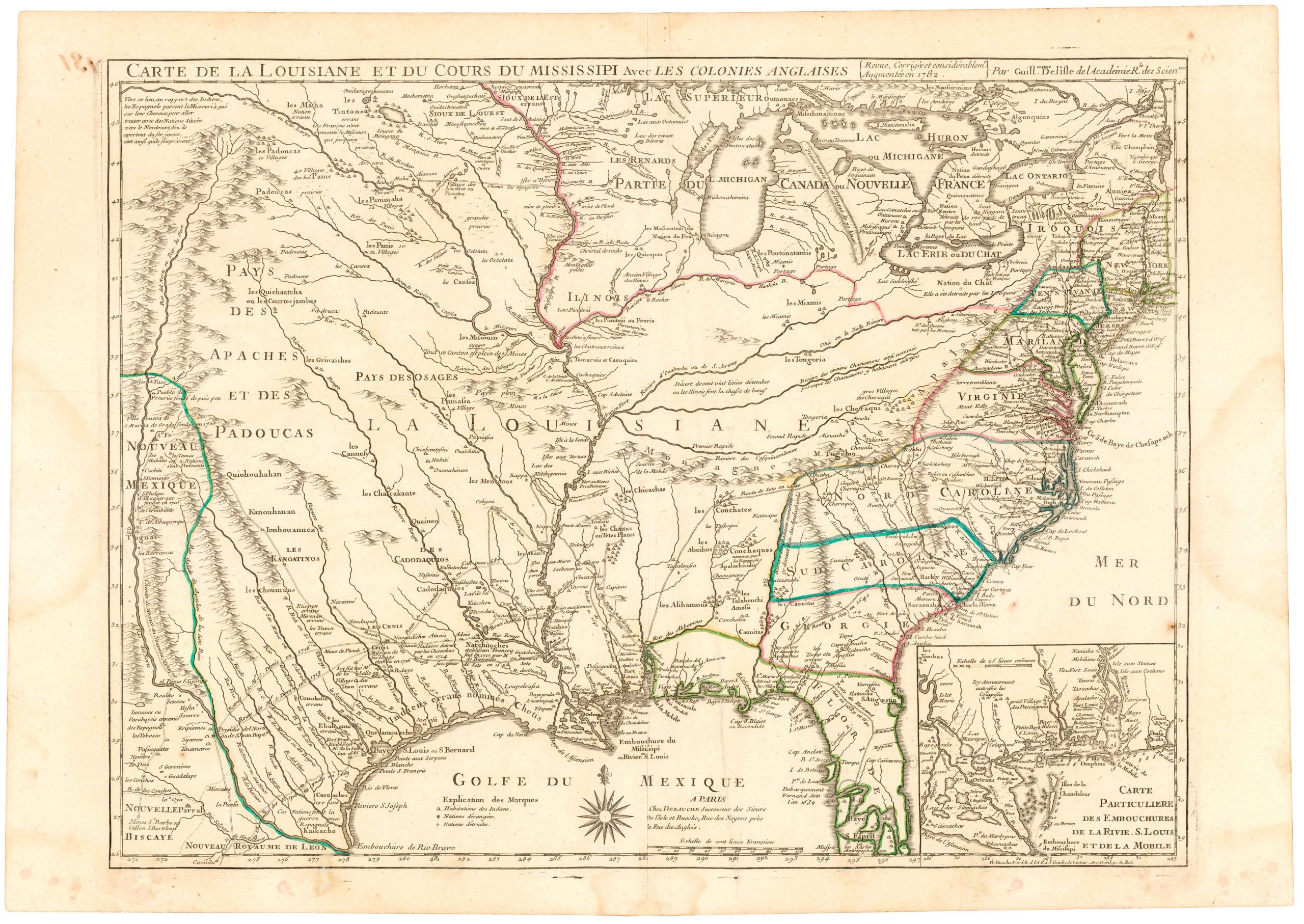
Carte De La Louisiane Et Du Cours Du Mississipi Avec Les Colonies Anglaises.
- $1,200
- Dezauche's 1782 map of colonial America: a map that blends Delisle's celebrated achievements with new features for the Revolutionary War.
-
-
-
-
-
Add to cart
 Quick View
 - Pacific Northwest - Hawaii - Alaska
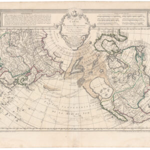
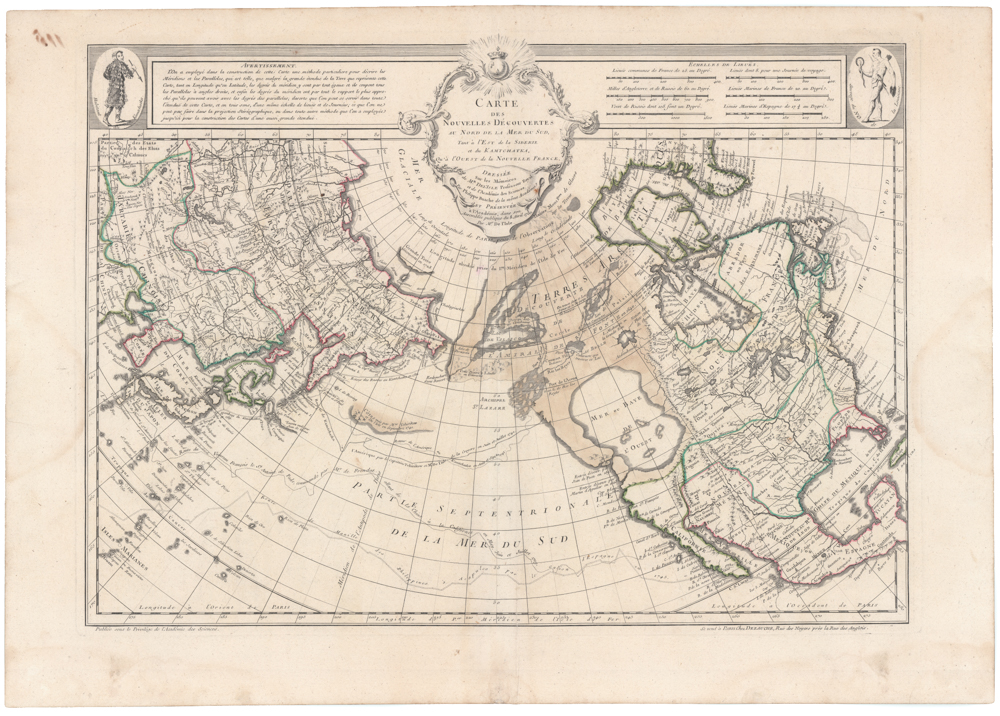
Carte Des Nouvelles Decouvertes Au Nord de la Mer de Sud, Tant a l’Est de la Siberie et du Kamtchatcka, Qu’a l’Ouest de la Nouvelle France, Dressee sur les Memoires…1750
- $1,800
- Famed North Pacific map, with a giant Sea of the West and the dubious discoveries of Admiral de Fonte.
-
-
-
-
-
Add to cart

 Quick View
 - Curiosities - Miscellanea, United States
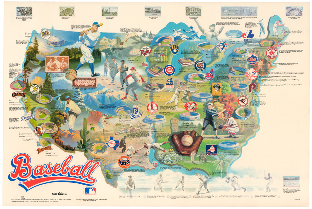
Baseball. 1987 Edition
- $450
- A 1987 baseball-themed pictorial map of the United States.
-
-
-
-
-
Add to cart
 Quick View
 - Texas and The West
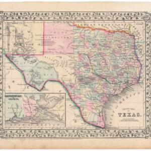
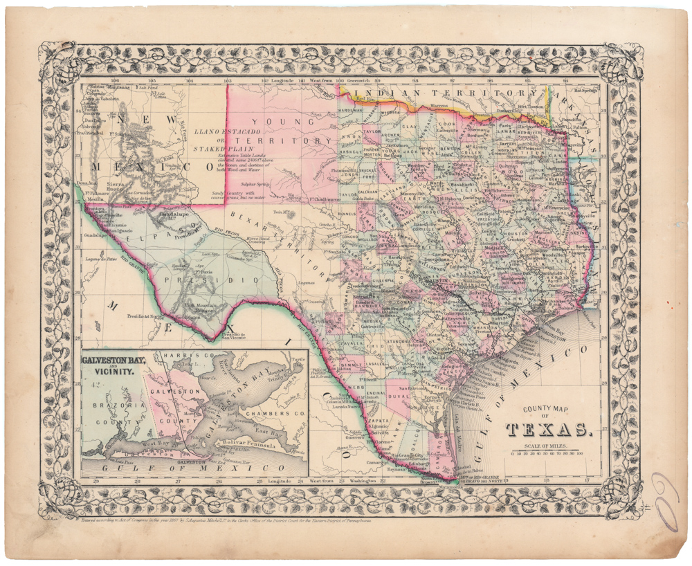
County Map of Texas.
- $450
- A fascinating post-Civil War map of Texas.
-
-
-
-
-
Add to cart
 Quick View
 - Featured Maps & Views, Pacific Northwest - Hawaii - Alaska
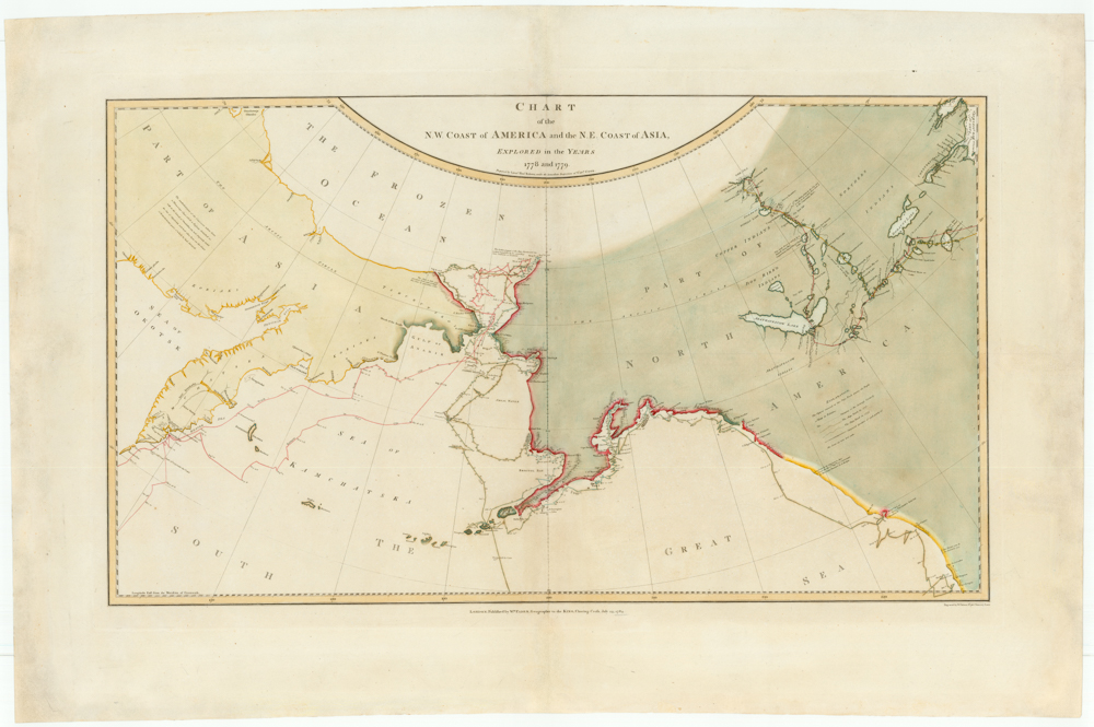
Chart of the N. W. Coast of America and the N. E. Coast of Asia, Explored in the Years 1778 and 1779. Prepared by Lieut’t Henry Roberts, under the immediate Inspection of Capt. Cook.
- $8,500
- The "Legendary lost chart of Captain Cook" - Rare first edition.
-
-
-
-
-
Add to cart
 Quick View
 - Texas and The West
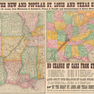
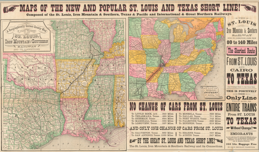
Maps of the New and Popular St. Louis and Texas Short Line!
- $1,800
- An eye-catching 1878 broadside inviting people to come and settle in Texas; a state in which a formal civilian government had only been restored eight years earlier.
-
-
-
-
-
Add to cart

 Quick View
 - Americas, Curiosities - Miscellanea, Mexico - Central & South America, United States
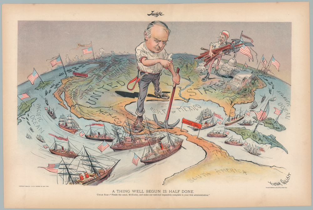
A THING WELL BEGUN IS HALF DONE. UNCLE SAM—“Finish the canal, McKinley, and make our national expansion complete in your first administration.”
- $1,200
- William McKinley & Uncle Sam: a wonderful 1899 persuasive map advocating for the construction of the Nicaragua Canal.
-
-
-
-
-
Add to cart
 Quick View
 - Americas, Cuba, West Indies, Caribbean, East & Midwest United States
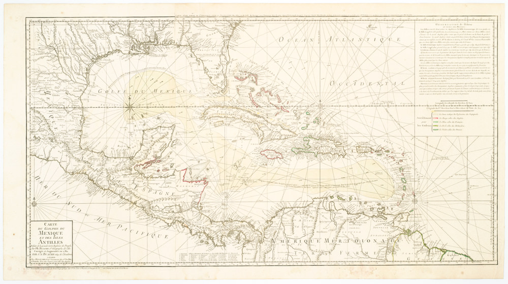
Carte Du Golphe Du Mexique Et Des Isles Antilles Reduite de la grande carte Angloise de Popple, Par PH. Buache…1780.
- $900
- Dezauche's exquisite chart of the Gulf Coast, Florida, and Caribbean Archipelago depicts a French Colonial Empire that is slowly falling apart.
-
-
-