-
-
Add to cart
 Quick View
 - California
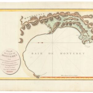
Plan De La Baie De Monterey Situee Dans La Californie Septentrionale…
- $675
- The earliest acquirable map of the Bay of Monterey.
-
-
-
-
Add to cart
![[Arctic Exploration] Nord Polar Karte von V. v. Haardt.](https://neatlinemaps.com/wp-content/uploads/2024/05/NL-02108_thumbnail-300x300.jpg) Quick View
Quick View - Polar - Arctic
[Arctic Exploration] Nord Polar Karte von V. v. Haardt.
- $12,500
- The last great map of the North Pole before it was reached.
-
-
-
-
Add to cart
 Quick View
 - San Francisco
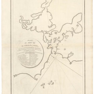
Plan du Port de St. François, Situé su la côte de la Californie Septentrionale.
- $975
- The world’s first detailed look at San Francisco.
-
-
-
-
Add to cart
 Quick View
 - Americas, Atlases & Books, Canada and The Great Lakes, North America
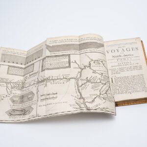
New Voyages to North-America. Containing an Account of the Several Nations of That Vast Continent…
- $8,500
- First English edition of Lahontan's description and mapping of New France, which propagated the myth of the Northwest Passage.
-
-
-
-
Add to cart

 Quick View
 - North America, Pacific Northwest - Hawaii - Alaska, United States, Americas
A Chart of North and South America, Including the Atlantic and Pacific Oceans, with the nearest Coasts of Europe, Africa, and Asia
- $4,200
- Sayer-Bennet-Mead's 1775 chart of the Western Hemisphere with Pacific and Arctic routes of exploration.
-
-
-
-
-
Add to cart
 Quick View
 - Pacific Northwest - Hawaii - Alaska, United States, Europe, Russia & Eastern Europe, Atlases & Books
Account of the Russian discoveries between Asia and America. To which is added the conquest of Siberia and the history of the transactions and commerce between Russia and China.
- $900
- The most comprehensive English assessment of Russian explorations in the Arctic and Pacific ever written.
-
-
-
-
Add to cart
 Quick View
 - Europe, Spain & Portugal
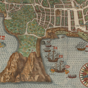
A Cidade De Angra. Na Ilha De Iesu Xpoda Tercera Que Esta Em 39 Graos.
- $2,000
- The first printed plan of the Atlantic frontier port of Angra in the Azores.
-
-
-
-
Add to cart
 Quick View
 - California, Pacific Northwest - Hawaii - Alaska
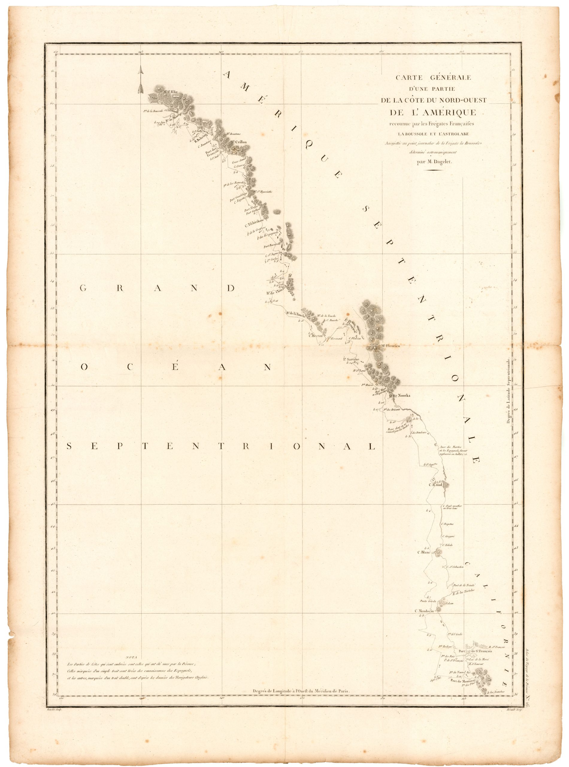
Carte de la Partie de la Cote Nord-Ouest de L’Amerique Reconnue pendant Etes de 1792, 1793, et 1794.
- $1,200
- Vancouver's chart of America’s Pacific coastline: the first printed map to identify the Columbia River estuary and Vancouver Island.
-
-
-
-
-
Add to cart
![[Cook’s Discovery of Eastern Australia] Carte de la Nle. Galles Merid. ou de la Cote Oriental de la Nle. Hollande.](https://neatlinemaps.com/wp-content/uploads/2021/12/NL-01183_Thumbnail-300x300.jpg)
![[Cook’s Discovery of Eastern Australia] Carte de la Nle. Galles Merid. ou de la Cote Oriental de la Nle. Hollande.](https://neatlinemaps.com/wp-content/uploads/2021/12/NL-01183_Thumbnail.jpg) Quick View
Quick View - Asia, Southeast Asia & Australia
[Cook’s Discovery of Eastern Australia] Carte de la Nle. Galles Merid. ou de la Cote Oriental de la Nle. Hollande.
- $1,500
- The first French edition of Cook's chart of New South Wales -- a landmark map for the cartography of Australia.
-
-
-
-
-
Add to cart

 Quick View
 - Americas, Atlases & Books, Mexico - Central & South America, World
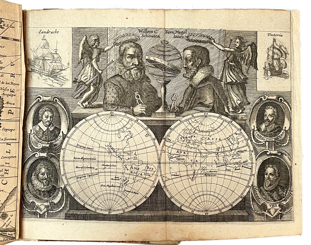
Diarium vel Descriptio laboriosissimi, & molestissimi Itineris, factia Guilielmo Cornelli Schoutenio, Hornano. Annis 1615, 1616 & 1617.
- $6,200
- Willem Schouten’s journal of the famous 1615-7 Le Maire-Schouten expedition, one of history’s greatest voyages of discovery.
-
-
-
-
-
Add to cart
 Quick View
 - Curiosities - Miscellanea, Pictorial maps, World
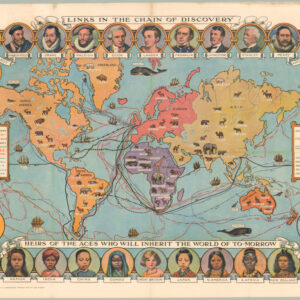
Cassell’s Children’s Book of Knowledge Wonder Map of the World.
- $750
- Thematic mapping for children: a fabulous circa 1930 world map depicting the history of exploration.
-
-
-
-
-
Add to cart
 Quick View
 - Featured Maps & Views, Pacific Northwest - Hawaii - Alaska
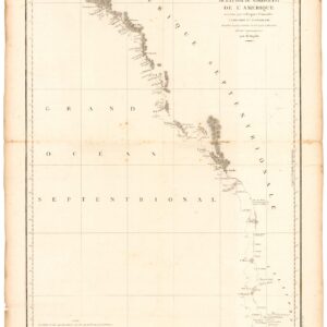
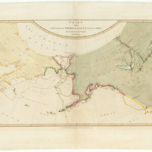
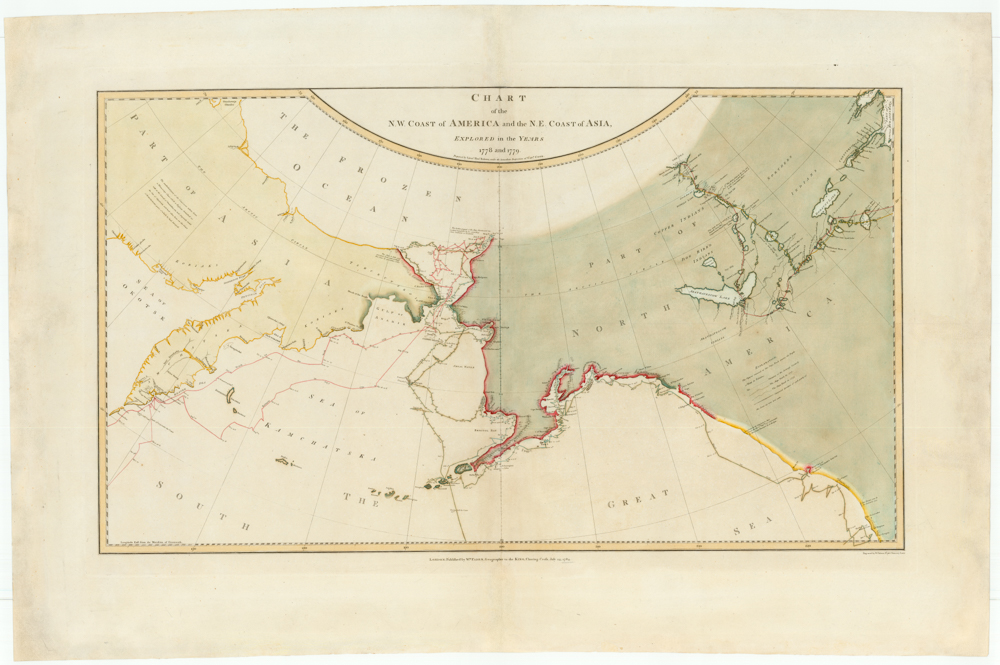
Chart of the N. W. Coast of America and the N. E. Coast of Asia, Explored in the Years 1778 and 1779. Prepared by Lieut’t Henry Roberts, under the immediate Inspection of Capt. Cook.
- $8,500
- The "Legendary lost chart of Captain Cook" - Rare first edition.
-
-
-