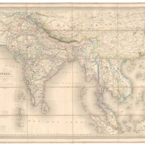
1850 Map of India Showing the Power of the East India Company.
Neueste Karte von Vorder Indien oder Hindostan.
$200
1 in stock
Description
This is sheet 16 from Meyer’s Grosser Zeitungs-Atlas, drawn by Captain Carl Radefeld in 1850 and published by the Bibliographisches Institut in Hildburghausen. It presents the Indian subcontinent from Afghanistan and the Himalayas in the north to Ceylon and the Maldives in the south, with a detailed political legend that is among the most analytically sophisticated in the entire atlas. In five graduated categories, it maps the extraordinary complexity of East India Company power over the subcontinent at its zenith, seven years before the Rebellion of 1857 would bring that power to crisis and transfer India from Company to Crown.
The Map in Detail
The map covers the full extent of the subcontinent, with Afghanistan and Baluchistan to the northwest, the Himalayas and Tibet along the northern edge, the Bay of Bengal to the east, and Ceylon, the Maldives, and the Lakshadweep Islands in the south. The political legend, headed Erklärung, is exceptional in its granularity. It distinguishes five categories of political status: direct British possessions of the East India Company, with Calcutta, Madras, and Bombay listed with population figures; states paying subsidies to the Company, including Oudh, Nagpur, Hyderabad, Berar, Travancore, Cochin, and Baroda; states under British protection, including Bhopal and the Rajputana kingdoms; states in which British influence was significant, including Nepal, Lahore, and Kashmir, the latter two specifically dated to 1846, the year of the First Anglo-Sikh War; and finally the remaining European possessions, noting Portuguese Goa, Daman, and Diu, French Pondicherry, and Danish holdings.
Pondicherry is labeled on the eastern coast. The Ganges delta and its approaches are shown in the upper right, with the comparative scale panel in the lower right providing equivalencies across multiple national measurement systems.
Historical Context
The India that Radefeld mapped in 1850 was not yet a unified British colony but a patchwork of direct rule, subsidiary alliances, tributary relationships, and nominally sovereign kingdoms that the East India Company had assembled over nearly a century of expansion. The Punjab, just annexed after the Second Anglo-Sikh War of 1848 to 1849, appears on this map already within the British sphere, its incorporation so recent that Radefeld’s annotation dates Lahore’s transition explicitly to 1846. Sindh had been taken in 1843. The great princely states, Hyderabad, Baroda, Travancore, and the Rajput kingdoms, remained under their own rulers but within the Company’s tributary system, their armies subordinated and their foreign relations controlled.
Seven years after this map was drawn, the Indian Rebellion of 1857 — triggered in part by the very system of subsidiary alliances and annexations the legend so carefully describes — would end Company rule entirely. The Government of India Act of 1858 transferred sovereignty to the British Crown, and Queen Victoria was proclaimed Empress of India in 1877. Radefeld’s map preserves the last stable image of Company India, a political order whose own logic was already making it unsustainable.
Publication History and Census
This map was published as sheet 16 of Meyer’s Grosser Zeitungs-Atlas by the Bibliographisches Institut in Hildburghausen in 1850, with distribution through Amsterdam, Paris, and Philadelphia. Individual sheets are occasionally encountered as extracts from bound volumes.
Cartographer(s):
Carl Christian Franz Radefeld (1788–1874) was among the most prolific German cartographers of the nineteenth century, working primarily for the Bibliographisches Institut founded by Joseph Meyer — first at Hildburghausen, later at Leipzig — for which he served as principal cartographer across several decades. His most substantial contributions were to Meyer’s geographical publishing programme: the Grosser Hand-Atlas and the Grosser Zeitungs-Atlas, the latter an innovative reference work designed to help newspaper readers locate and understand the geography of current events as they unfolded. The concept of the Zeitungs-Atlas — an atlas organized around the news rather than around conventional regional divisions — was itself a reflection of the mid-nineteenth century’s appetite for timely geographical information, driven by the acceleration of events during the revolutionary and nationalist upheavals of the 1840s and 1850s. Radefeld’s maps for Meyer’s publications were engraved to a high standard and widely distributed through the Bibliographisches Institut’s extensive retail network, making his work among the most commonly encountered German cartography of its era.
Joseph Meyer (May 9, 1796 – June 27, 1856) was a German businessman and publisher of maps and atlases. After an active early career in business, which included early investments in railways, Meyer founded the publishing house Bibliographisches Institut in Gotha in 1826, which moved to Hildburghausen two years later. Initially, the publisher focused on reliable sellers like Bibles and encyclopedias, but gradually moved into maps and atlases and became especially known for its ‘Meyer’s Groẞer Hand-Atlas.’ After Joseph’s death, his son continued the business and continued to find great success, moving to Leipzig in 1874, with periodic bumps in the road due to wars and economic crises. The company survived both world wars and was divided along with Germany, but after 1991 moved back to its original location in Leipzig. In 1984, the company merged with a competitor to form Bibliographisches Institut & F. A. Brockhaus AG, which survives today.
Condition Description
Minor blemishes, mostly in the margin.
References
![[Northern India and Pakistan] Tabula Asiae IX.](https://neatlinemaps.com/wp-content/uploads/2023/07/NL-00244-NEW_thumbnail-300x300.jpg)