Melchisédec Thévenot (1620-1692) was a French scientist, author, cartographer, traveller, inventor and diplomat. A true polymath, Thévenot has been attributed as diverse accomplishments as the invention of the bubble level and the promulgation of the breaststroke in swimming. He served the French King as Royal Librarian and later as the French ambassador to Italy. In addition to his mother tongue, he supposedly spoke six or seven languages fluently, including Oriental languages such as Hebrew, Arabic and Turkish. His family background was Huguenot (French protestants), but Thëvenot was a true renaissance man, corresponding fervently with the great minds of the age, including the Dutch physicist Christiaan Huygens and the Florentine mathematician Vincenzo Viviani.
Thévenot became interested in cartography as part of his work on the book Relation du Divers Voyages Curieux, which was published in Paris in 1663. In it, he used his extensive knowledge of oriental languages to translate and summarize ancient manuscripts pertaining to voyages of exploration and discovery. Among these was the first European translation of Cosmas Indicopleustes, the travelogue of a 6th century Christian missionary to India (although the India referred to in his book most likely is Ethiopia). To this day, Indicopleustes is one of the most important sources we have on Late Antique trade with the East.
Thévenot’s cartographic claim to fame came from his mapping of Hollandia Nova (greater Australia), in which he physically separated it from Terre Australe. This division, emphasized by a meridian staff on the map, was not only geographically innovative, but served as a demarcation for Spain’s claims to the Pacific, lending a clear political dimension to the map as well. While there was some discussion as to how and how much Thévenot’s map differed from the more famous map by Johan Blaue, it cemented his name in cartographic circles. Consequently, when Emmanuel Bowen published his famous Complete System of Geography in 1747, it included Thévenot’s map.
-
- Add to cart
- Africa, Arabia and the Red Sea, Asia, Featured Maps & Views
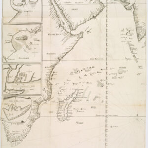
João Teixeira Cosmographo. De sua, Magestade. Aféz em Lixboa o Anno de 1649
- $6,000
- Rare 17th century portolan-style chart designed for use aboard Portuguese merchant vessels.
