Richard Edes Harrison (1901-1994) was an American scientific illustrator and mapmaker who primarily worked as the in-house cartographer for Fortune magazine and a cartographic consultant at Life. Many of his maps were produced within the context of the Cold War and the rise of an American military-industrial complex. He has been credited for and accused of playing a significant role in “challenging cartographic perspectives and attempting to change spatial thinking on the everyday level during America’s rise to superpower status.” He continues to divide waters even thirty years after his death.
In 2012, Timothy Barney, an assistant professor of Rhetoric at Richmond University, published an article in which he interprets Harrison’s motivations in his cartographic output. In the abstract of the article (published in Rhetoric & Public Affairs Vol. 15, No. 3: 397–434), Barney states:
“Air-age globalism was a discursive phenomenon throughout the development of World War II that accounted for the rapid “shrinking” of the world through air technologies and the internationalization of American interests. Cartography became air-age globalism’s primary popular expression, and journalistic cartographers such as Richard Edes Harrison at Fortune magazine introduced new mapping projections and perspectives in response to these global changes. This essay argues that Harrison’s mapping innovations mediate a geopolitical shift in America toward a modern, image-based internationalism. Through recastings of “vision” and “strategy,” Harrison’s work offers an opportunity to assess the rhetorical tensions between idealism and realism in midcentury cartographic forms and the larger spatial and perceptual challenges facing U.S. foreign policy during its rise to superpower status.”
Regardless of the motivations attributed to him, Harrison’s charts were conducive to broadening how Americans viewed the world and its mapping. His charts built a crucial bridge, not just from the science to the public, but from the raw data to a tangible final result. Harrison’s maps have become highly sought-after collectors’ items despite their relatively young age.
-
- Add to cart
- Mexico - Central & South America
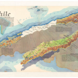
Chile
- $675
- A distinctive, mind-bending view of Chile.
-
- Add to cart
- Rare Maps of Curiosities - Miscellanea, World
The Floor of the World Ocean
- $975
- Richard Edes Harrison's chart of the ocean floors: one of the first serious commercial attempts at underwater mapping.
Archived
- Out of Stock
- Asia, Bird's-eye-views
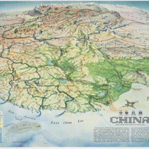
China. As seen from the direction of Guam.
- Richard Edes Harrison bird's-eye-view of China detailing its dramatic wartime inland shift.
- Read more
-


