The Sahab Geographic & Drafting Institute (SGDI) is a Tehran-based private cartographic house that has been active since the mid-twentieth century. It is closely associated with the work of Iranian cartographer ʿAbbās Sahāb (1921–2000), which Encyclopaedia Iranica identifies as central to modern Persian cartography. EI also records that he produced hundreds of maps and atlases, many hand-drafted, with originals preserved in the institute’s own library.
SGDI’s output spans general reference maps, road and regional sheets, thematic maps, and large illustrated atlases. The firm consistently appears as the publisher or issuing body in national library records from the 1950s to the 1970s, which helps chart its sustained activity and public role in Iranian mapmaking, particularly during Iran’s high-modernizing decades.
-
-
Add to cart
 Quick View
 - Iran - Persia - Central Asia, Middle East - Holy Land Maps
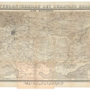
Tehran Shemiran Rey Demavand Karaj and Environs.
- $675
- Rare first state of Abbas Sahab’s iconic map of Tehran and Environs.
-
-
Archived
- Out of Stock
- Iran - Persia - Central Asia
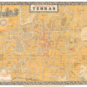
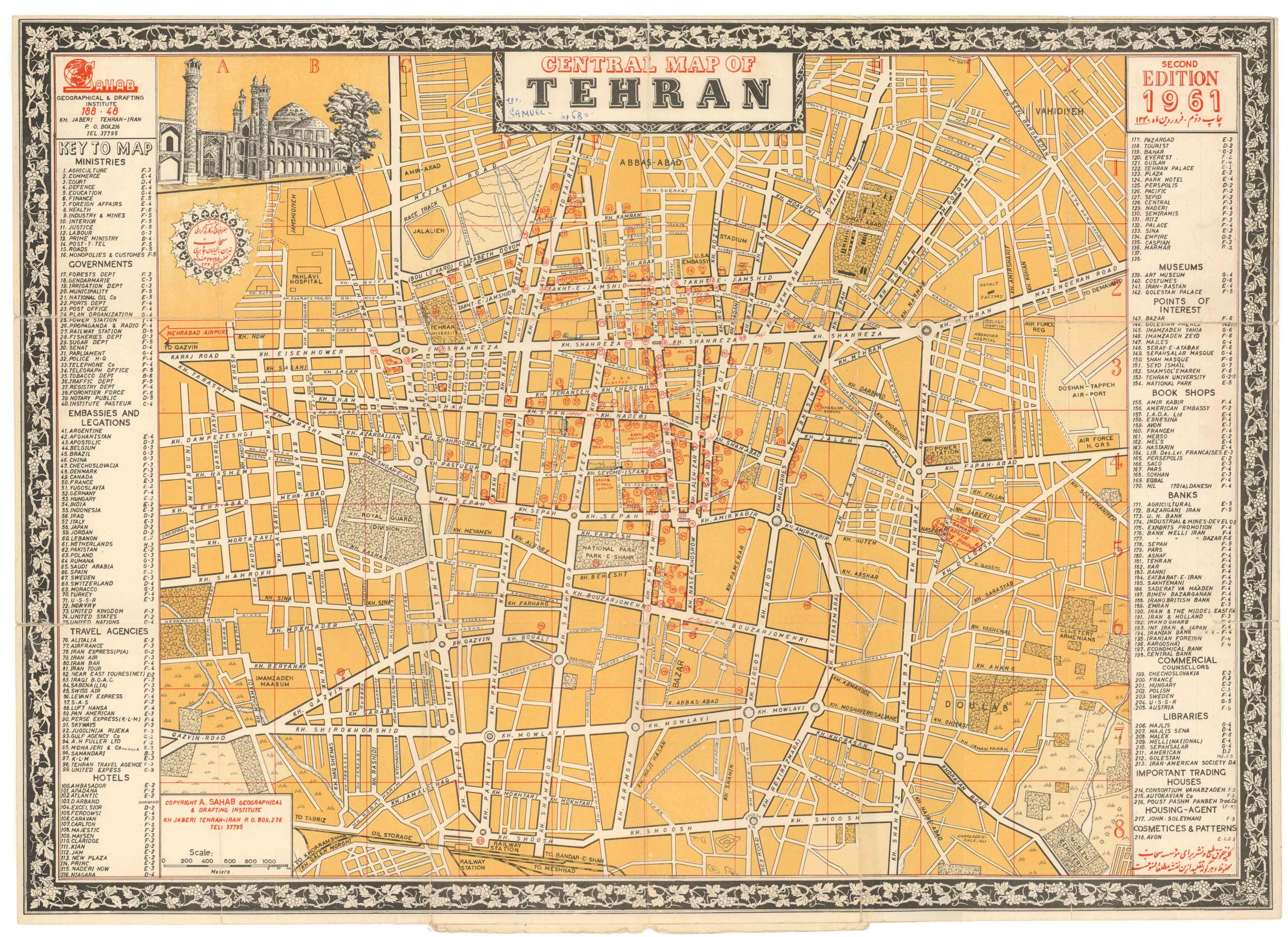
Central Map of Tehran
- An absolutely marvelous lithograph of Tehran, produced during the tumultuous late 1950s.
- Read moreQuick View
-