-
-
Add to cart
 Quick View
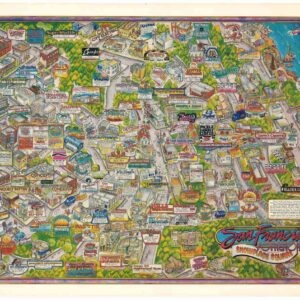
 - Bird's-eye-views, Pictorial maps, San Francisco
San Francisco Potrero Hill Showplace Square.
- $900
- Images of a different era: an exciting, block-by-block glimpse of late 1980s Potrero Hill, San Francisco.
-
-
-
-
Add to cart
![[3-Sheet Biodiversity Map of Madagascar] Carte Internationale du Tapis Végétal et des Conditions Écologiques.](https://neatlinemaps.com/wp-content/uploads/2024/05/NL-01035-middle_thumbnail-300x300.jpg) Quick View
Quick View - Africa
[3-Sheet Biodiversity Map of Madagascar] Carte Internationale du Tapis Végétal et des Conditions Écologiques.
- $875
- A three-sheet map of one of Earth's biodiversity 'hot spots.'
-
-
-
-
Add to cart
 Quick View
 - Bay Area & Silicon Valley, California
Album of photographs of commercial and residential properties in Berkeley, California.
- $1,250
- A fascinating documentation of Berkeley in the 1930s.
-
-
-
-
Add to cart
 Quick View
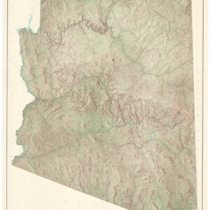
 - Texas and The West
State of Arizona.
- $650
- A large, exquisite topographical map of Arizona, produced after World War II by the most reliable mapping agency on the planet.
-
-
-
-
Add to cart
 Quick View
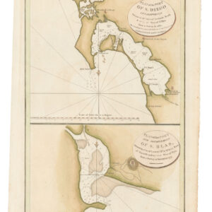
 - California
Plan of the Port of S. Diego in California. / Plan of the Port and Deparetement of S. Blas.
- $500
- The earliest acquirable map of the bay of San Diego.
-
-
-
-
Add to cart
 Quick View
 - Americas, Mexico - Central & South America
Archaeological Map of the Guatemala.
- $425
- An archaeological map depicting Guatemala’s extensive Mayan ruins.
-
-
-
-
Add to cart
 Quick View
 - Mexico - Central & South America
Archaeological Map of the Yucatan Peninsula.
- $475
- An archaeological map depicting the extensive Mayan ruins of the Yucatan Peninsula.
-
-
-
-
Add to cart
 Quick View
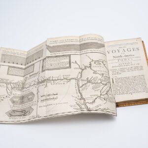
 - Americas, Atlases & Books, Canada and The Great Lakes, North America
New Voyages to North-America. Containing an Account of the Several Nations of That Vast Continent…
- $8,500
- First English edition of Lahontan's description and mapping of New France, which propagated the myth of the Northwest Passage.
-
-
-
-
Add to cart

 Quick View
 - North America, Pacific Northwest - Hawaii - Alaska, United States, Americas
A Chart of North and South America, Including the Atlantic and Pacific Oceans, with the nearest Coasts of Europe, Africa, and Asia
- $4,200
- Sayer-Bennet-Mead's 1775 chart of the Western Hemisphere with Pacific and Arctic routes of exploration.
-
-
-
-
-
Add to cart
 Quick View
 - Africa
Africa Ioanne Baptista Nicolosio S.T.D. Sic Describente.
- $4,400
- A landmark map for the historical cartography of Africa.
-
-
-
-
Add to cart
 Quick View
 - Bay Area & Silicon Valley, California
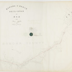
Sonoma & Marin Rail-Road Map, May 1875.
- $3,800
- Railroad manuscript map with early Petaluma town plan and survey work down to Marin County.
-
-
-
-
Add to cart
 Quick View
 - Africa, Middle East - Holy Land Maps
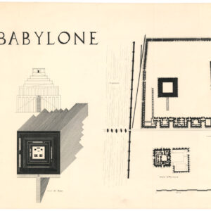
Babylone. / Temple de djeser. / Temple of Mentouhote.
- $550
- Three hand-inked plans of ancient monuments, drawn by one of France’s most revered historical illustrators.
-
-