-
-
Add to cart

 Quick View
 - California, San Francisco, Pictorial maps, Bird's-eye-views
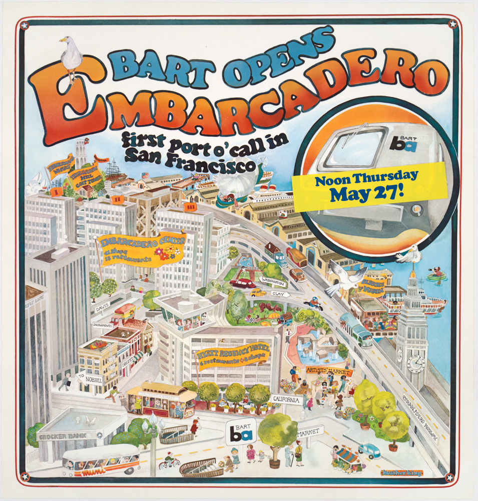
Bart Opens Embarcadero. First port o’call in San Francisco
- $475
- Celebrating public transit -- a pictorial view of downtown San Francisco announcing the 1976 opening of the Embarcadero BART station.
-
-
-
-
-
Add to cart
 Quick View
 - Asia, Atlases & Books
Southern Tibet. MAPS I.
- $800
- The cartographic record of Sven Hedin’s incredible Third Expedition across the Tibetan Plateau.
-
-
-
-
Add to cart
![[Seventeen original Taber albumen photographs of California and Oregon]](https://neatlinemaps.com/wp-content/uploads/2023/07/447973_0-300x300.jpg) Quick View
Quick View - California, San Francisco
[Seventeen original Taber albumen photographs of California and Oregon]
- $975
- An extraordinary collection of late 19th-century photographs from America's West Coast.
-
-
-
-
Add to cart
 Quick View
 - Europe, Iceland & Scandinavia
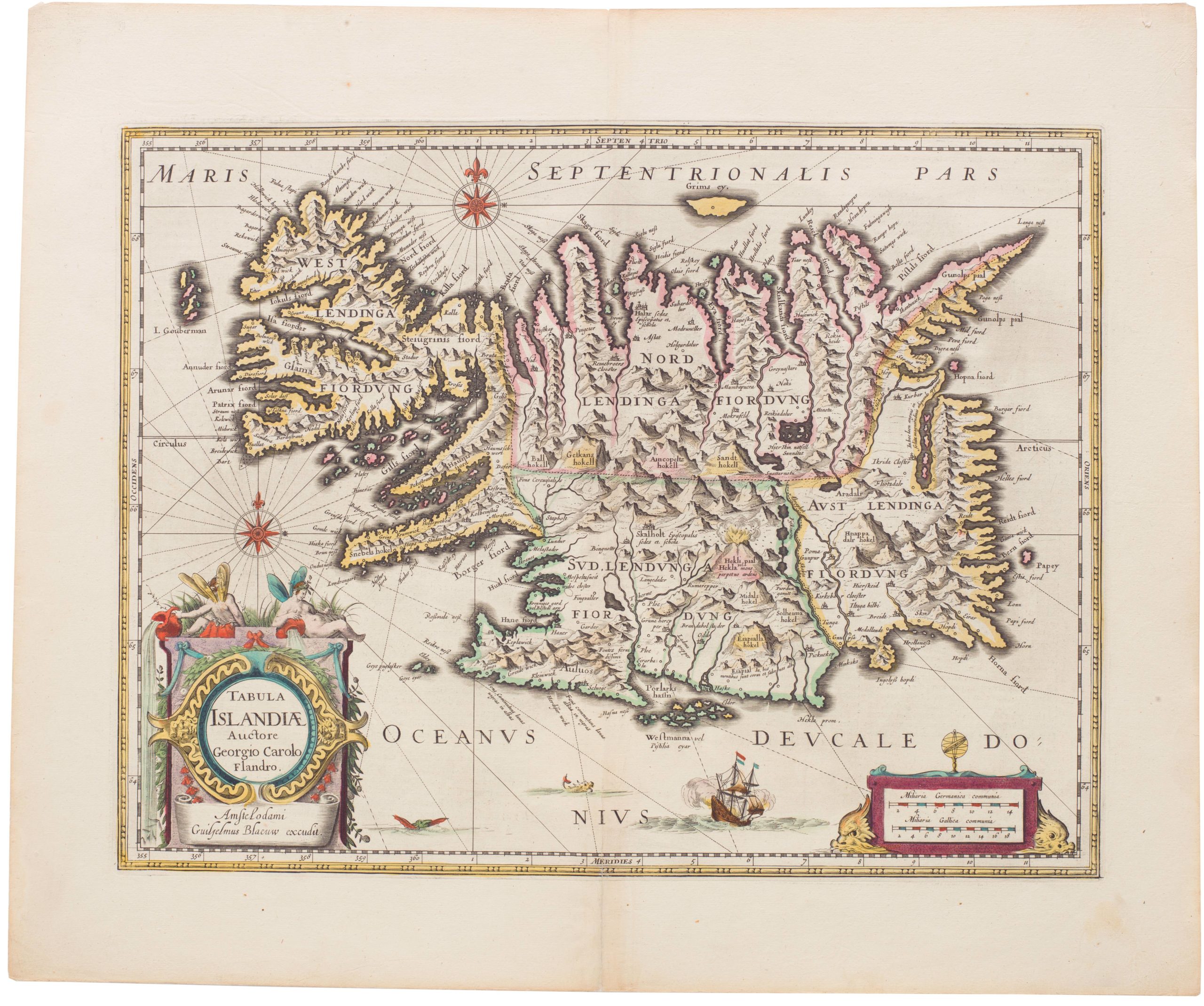
Tabula Islandiae
- $1,000
- Blaeu’s stunning Carolus Map of Iceland: A Landmark in North Atlantic Cartography.
-
-
-
-
-
Add to cart
 Quick View
 - Europe, Iceland & Scandinavia
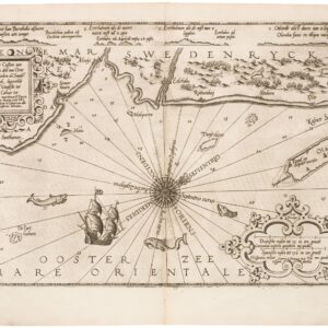
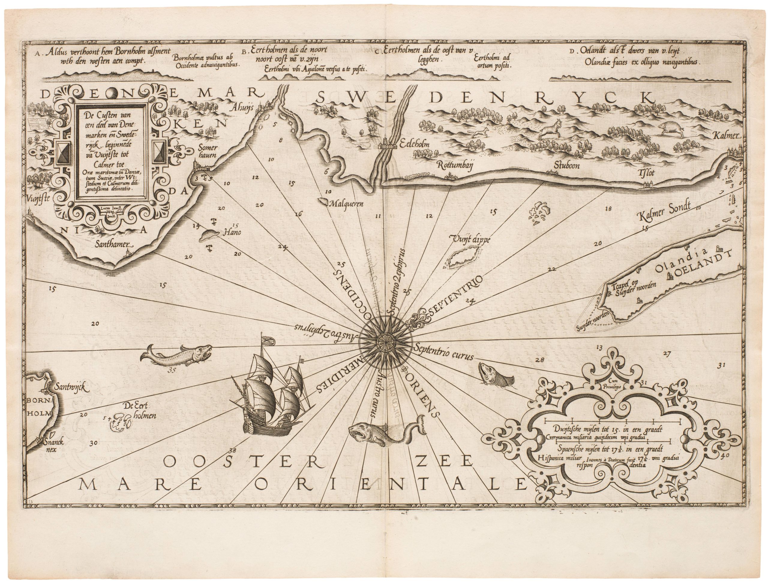
De Custen van een deel van Denemarken en Swederijck, beginnede va Vuijtste to Calmer Toe…
- $900
- Waghenear’s gorgeous 16th-century sea chart of Sweden’s Baltic coastline.
-
-
-
-
-
Add to cart
![[1838 Republic of Texas manuscript document detailing the votes for elected office, including President].](https://neatlinemaps.com/wp-content/uploads/2023/06/NL-01852-front_thumbnail-300x300.jpg) Quick View
Quick View - Michael's Collection, Texas and The West
[1838 Republic of Texas manuscript document detailing the votes for elected office, including President].
- $8,500
- Original Republic of Texas referendum document stipulating the results of the 1838 election of Mirabeau Lamar.
-
-
-
-
Add to cart
 Quick View
 - San Francisco
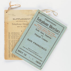
Temporary Telephone Directory with Supplement, San Francisco May 12, 1906
- $2,200
- The first 1906 San Francisco Temporary Telephone Directory - with rare extra supplement!
-
-
-
-
Add to cart
 Quick View
 - Asia, Southeast Asia & Australia
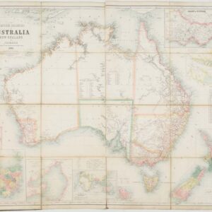
The British Colonies of Australia, New Zealand and Tasmania Shewing the Latest Discoveries and Travellers Routes.
- $2,800
- Britain’s Austral Colonies in the Victorian Era.
-
-
-
-
Add to cart
 Quick View
 - Eastern Mediterranean - Holy Land
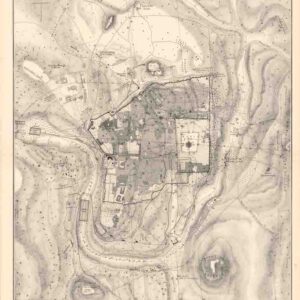
Plan of Ancient Jerusalem.
- $400
- Pierotti's scientific 19th-century plan depicting Ancient Jerusalem.
-
-
-
-
Add to cart
 Quick View
 - Atlases & Books, Europe, Pacific Northwest - Hawaii - Alaska, Russia & Eastern Europe, United States
Account of the Russian discoveries between Asia and America. To which is added the conquest of Siberia and the history of the transactions and commerce between Russia and China.
- $900
- The most comprehensive English assessment of Russian explorations in the Arctic and Pacific ever written.
-
-
-
-
Add to cart
 Quick View
 - East & Midwest United States
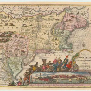
Recens Edita totius Novi Belgii, in America Septenrionali siti, delineatio cura et sumptibus
- $4,000
- The most widely emulated map of colonial North America, with one of the earliest views of New York City.
-
-
-
-
Add to cart
 Quick View
 - Bird's-eye-views, British Isles, Europe
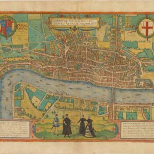
Londinum Feracissimi Angliae Regni Metropolis.
- $8,500
- Braun & Hogenberg’s extraordinary rendition of Elizabethan London as Shakespeare knew it.
-
-