-
-
Add to cart
 Quick View
 - Bird's-eye-views, East & Midwest United States, United States
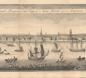
The South Prospect of the City of New York, in America.
- $5,500
- One of the Earliest Acquirable Views of New York City.
-
-
-
-
Add to cart
 Quick View
 - East & Midwest United States, Featured Maps & Views, United States
Gettysburg Battle-Field.
- $3,500
- Bachelder's iconic 1863 view of the Battle of Gettysburg.
-
-
-
-
Add to cart
 Quick View
 - East & Midwest United States, Featured Maps & Views
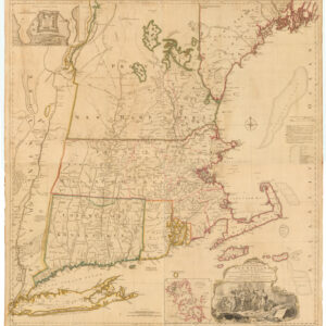
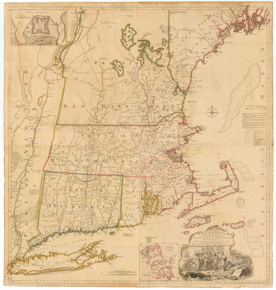
A MAP of the most INHABITED part of NEW ENGLAND, containing the PROVINCES of MASSACHUSETS BAY and NEW HAMPSHIRE, with the COLONIES of KONEKTIKUT AND RHODE ISLAND. Divided into Counties and Townships: The whole composed of Actual Surveys and its situation adjusted by ASTRONOMICAL OBSERVATIONS.
- $55,000
- Unobtainable first state of one of the most influential maps of New England ever made.
-
-
-
-
-
Add to cart
 Quick View
 - California, Texas and The West, United States
Map of the United States Mexico &c. Showing the various Land and Water Routes from the Atlantic Cities to California
- $750
- A scarce map from the early days of the Gold Rush.
-
-
-
-
Add to cart
 Quick View
 - California, Texas and The West
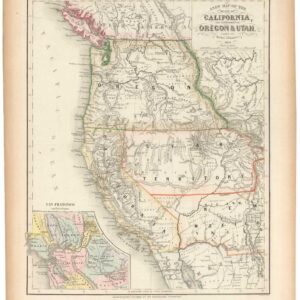
A New Map of the State of California, the Territories of Oregon & Utah…
- $675
- Promoting California and the Gold Rush to a Receptive Audience.
-
-
-
-
Add to cart

 Quick View
 - Texas and The West, United States
Williams New Trans-Continental Map of The Pacific R.R. and Routes of Overland Travel To Colorado, Nebraska, The Black Hills, Utah, Idaho, Nevada, Montana California and the Pacific Coast.
- $3,500
- 1876 Pacific Railroad map with references to notorious stagecoach robber Black Bart.
-
-

-

-
-
-
Add to cart
 Quick View
 - Pacific Northwest - Hawaii - Alaska
Mount St. Helen’s Quadrangle (7.5 Minute Series)
- $575
- Washington’s dramatic volcanic peak, taken a few years before the catastrophic 1980 eruption.
-
-
-
-
Add to cart
 Quick View
 - Bird's-eye-views, Pacific Northwest - Hawaii - Alaska
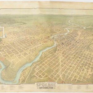
Spokane. Washington.
- $4,500
- A scarce and gorgeous bird’s-eye-view of Spokane during its heyday as the railroad hub of the Northern Plains.
-
-
-
-
Add to cart
 Quick View
 - East & Midwest United States, Texas and The West
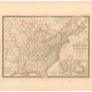
Carte Générale des Etats-Unis, des Haut et Bas-Canada, de la Nouvelle Ecosse, du Nouvelle Brunswick, de Terre Neuve.
- $875
- Brué’s important map of the United States prior to the Mexican-American War, with an overtly independent Texas.
-
-
-
-
Add to cart
 Quick View
 - United States
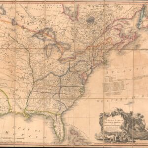
The United States of North America: with the British Territories and Those of Spain.
- $6,500
- With the proto-State of Franklin and the colony of New Iberia (Morgania)!
-
-
-
-
Add to cart
 Quick View
 - East & Midwest United States, United States
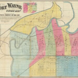
Fort Wayne Guide Map (location of First Professional Baseball Game shown).
- $6,500
- Earliest recorded printed map to locate the site of the world’s first professional baseball game.
-
-
-
-
Add to cart
 Quick View
 - Bird's-eye-views, East & Midwest United States, Featured Maps & Views, Michael's Collection, United States
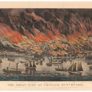
The Great Fire at Chicago. Octr. 8th 1871.
- $9,500
- Currier & Ives 1871 Great Chicago Fire.
-
-