Leander Ransom was born on September 5, 1800, in Colchester Connecticut. He spent time in New York State, before moving to Ohio in 1825. Early in his career Ransom was employed by the Ohio Canal Company and in 1826 he was appointed to locate a portion of the Ohio Canal. Later he was appointed as Commissioner to the Ohio Canal Commission. In 1836 he was appointed as President of Board of Public Works of Ohio, a position he held for 13 Years.
Ransom first came to California in 1851 to work with Samuel D. King, who was the U. S. Surveyor General for California. King and Ransom left New York by steamer for California in May of 1851. They left their ship and crossed the Isthmus of Panama overland, then boarded another steamer and continued their trip to San Francisco. They landed in San Francisco on June 14, 1851, and set up offices there.
On July 8, 1851, King issued special instructions to Ransom for the establishment of the Initial Point on Mount Diablo and the initial surveys of the Meridian and Base Line. King charged Ransom to “Go to Mount Diablo and provide that: an east and west Base and north and south Meridian line be run and established passing through the most prominent peak of Mount Diablo.”
From July 1851 to September 1851, Ransom conducted the first Public Land Survey in California as Deputy Surveyor. The Mount Diablo Principal Meridian and Base Line extending from the Mount Diablo Initial Point, established on July 17, 1851 by Ransom, controls Public Land Surveys within two-thirds of California and all of Nevada. In August of 1852, King ordered Ransom to examine the southern California region of San Bernardino Mountains to see if it would be feasible to establish an initial point on its summit. Ransom reported to King that it would be possible. In September of 1852, King issued instructions to Henry Washington, Deputy Surveyor to establish the San Bernardino Initial Point.
After completing these tasks, Ransom would go on to serve as Chief Clerk in the California Surveyor General’s Office in San Francisco until the 1860s.
In 1853 Ransom became a Charter Member of the California Academy of Sciences. In addition, he was an early and active member of the Academy, serving as President for eleven terms beginning in 1856.
Archived
- Out of Stock
- California
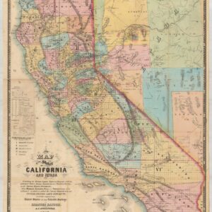
A New Map of the States of California and Nevada…Exhibiting the Rivers, Lakes, Bays and Islands, with the principal Towns, Roads, Railroads and Transit Routes to the Silver Mining Districts…1867
- Rare 1867 edition of Ransom & Doolittle's map of California and Nevada, published in San Francisco by Warren Holt.
- Read more
-
- Out of Stock
- San Francisco Bay Area & Silicon Valley
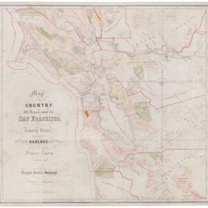
Map of the Country 40 Miles Around San Francisco, Exhibiting County Lines, and correct Plats of all the Ranchos finally surveyed and of the Public Land Sectionized. Compiled from United States Surveys by Leander Ransom
- A rare and important 1860 Bay Area rancho map.
- Read more
-

