-
-
Add to cart

- San Francisco, Pictorial maps, Bird's-eye-views
Bart Opens Embarcadero. First port o’call in San Francisco
- $275
- Celebrating public transit -- a pictorial view of downtown San Francisco announcing the 1976 opening of the Embarcadero BART station.
-
-
-
-
-
Add to cart
- Asia, Pictorial maps, Rare City Plans
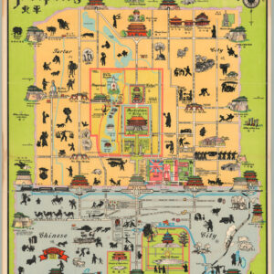
Peiping
- $1,250
- John Kirk Sewall's famous pictorial 1930 map of Beijing.
-
-
-
-
-
Add to cart
- United States
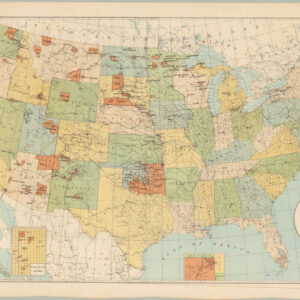
Map Showing Indian Reservations Within the Limits of the United States, Compiled Under the Direction of Hon. D.M. Browning. Commissioner of Indian Affairs, 1893
- $295
- Map of Native American tribes and reservation land at the end of the 19th century.
-
-
-
-
-
Add to cart

- Eastern United States, Featured Maps & Views, United States
Gettysburg Battle-Field
- $5,000
- Proof state of Bachelder's iconic 1863 view of the Battle of Gettysburg.
-
-

-
-
-
Add to cart

- San Francisco
Plat of the Pueblo Lands of San Francisco finally confirmed to the City Of San Francisco. Surveyed under instructions from the U.S. Surveyor General by F. von Leicht, U. S. Dep. Surv. in December 1883 Containing 17754 36/100 Acres
- $875
- Von Leicht’s historic 1883 survey confirming the boundaries of San Francisco, including land grants.
-
-
-
-
-
Add to cart
- San Francisco
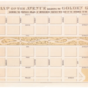
Map of the Avenue leading to Golden Gate Park Showing the Proposed Plan of Improvement, Together with that of the Entrance to the Park
- $250
- 1872 William Hammond Hall map of the Panhandle.
-
-
-
-
-
Add to cart
- San Francisco
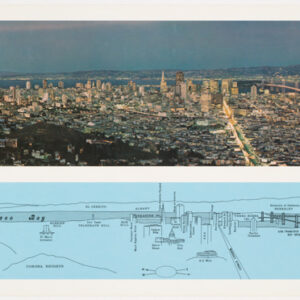
San Francisco
- $280
- A panoramic view of San Francisco with graphic key to identify landmarks.
-
-
-
-
-
Add to cart
![PORT OF SAN FRANCISCO. WHERE THE FAR EAST BEGINS [Japanese language version]](https://neatlinemaps.com/wp-content/uploads/2021/01/NL-00879_Thumbnail-300x300.jpg)
- San Francisco, Bird's-eye-views
PORT OF SAN FRANCISCO. WHERE THE FAR EAST BEGINS [Japanese language version]
- $875
- Rare Japanese language bird's-eye-view in the style of Saul Steinberg showing the port of San Francisco as the gateway to Pacific commerce.
-
-
-
-
-
Add to cart

- California, Mexico - Central & South America, Asia
Pascaart vertoonende de Zeecusten van Chile, Peru, Hispania Nova, Nova Granada, en California.
- $4,500
- Superb first state of Doncker's chart of the Pacific with California as an island.
-
-
-
-
-
Add to cart
- United States
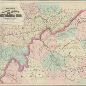
Colton’s Map of the Oil District of West Virginia and Ohio
- $3,600
- Mapping an early American oil boom: rare first state of Colton's Map of West Virginia and Ohio.
-
-
-
-
-
Add to cart
- Europe, Pictorial maps
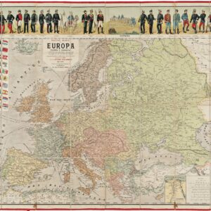
Nuevo Mapa de Europa Politico y Comercial Illustrado con los Tipos y Uniformes Militares de los Estados de Europa…
- $1,100
- Decorative World War I map of Europe with military uniforms and up-to-date borders.
-
-
-
-
-
Add to cart

- Asia, Featured Maps & Views
Paskaerte Zynde t’Oosterdeel van Oost Indien, met Alle de Eylanden daer Ontrendt Geleegen van C. Comorin tot aen Japan
- $9,000
- An accomplished work of design and engraving: 1666 chart of Southeast Asia by Abraham Goos with original color.
-
-

-