-
-
Add to cart

- Italy
Paphy / Papia (Thurin on verso).
- $225
- A lovely 16th century woodcut of Pavia, Italy.
-
-
-
-
Add to cart

- Bird's-eye-views, Italy
Venetia.
- $2,700
- Gorgeous 1577 Braun & Hogenberg bird's-eye-view of Venice.
-
-
-
-
-
Add to cart
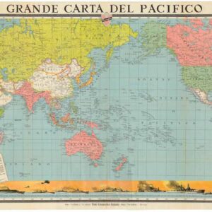
- World, Italy, World War I and World War II
Grande Carta del Pacifico.
- $475
- Mussolini’s Propaganda Map of the Pacific Ocean.
-
-
-
-
Add to cart
![Geografi della Toscana [Ferdinand de Medici Horse Map]](https://neatlinemaps.com/wp-content/uploads/2022/11/NL-01627-right_thumbnail-scaled-300x300.jpg)
- Italy, Michael's Collection
Geografi della Toscana [Ferdinand de Medici Horse Map]
- $15,000
- The rarest acquirable map of Tuscany.
-
-
-
-
Add to cart
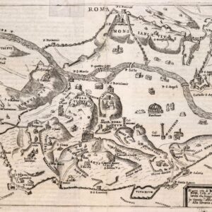
- Italy, Rare City Plans
Roma Vetus In usum scholarum editit Herm. Rheinhard Tymn Stuggt. Prof.
- $2,400
- A rare and spectacular vision of ancient Rome, compiled by a German scholar in the mid-19th century.
-
-
-
-
Add to cart
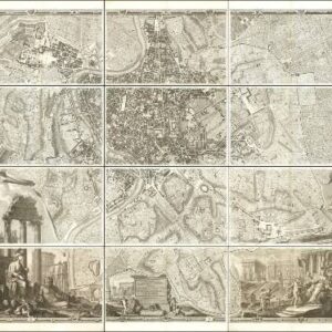
- Featured Maps & Views, Italy, Rare City Plans
Alla Santità di Nostro Signore Papa Benedetto XIV La Nuova Topografia di Roma Ossequiosamente Offerisce e Dedica l’Umilissimo Servo Giambattista Nolli Comasco
- $35,000
- The famous Nolli wall map of Rome: one of the finest urban plans ever made.
-
-

-
-
-
Add to cart
- Italy, Bird's-eye-views, Rare City Plans
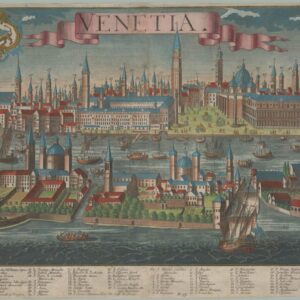
Venetia.
- $4,800
- A stunning and highly detailed view of the lagoon city of Venice, compiled in the early 18th century and issued by Probst, Augsburg’s most famous publishing dynasty.
-
-
-
-
-
Add to cart
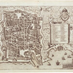
- Bird's-eye-views, Italy, Rare City Plans
Panormo
- $650
- A superb late 17th century Merian town-plan of Palermo.
-
-
-
-
-
Add to cart

- Bird's-eye-views, Italy
Lago di Como
- $4,000
- Francesco Citterio's fantastic mid-19th century panorama of Lake Como.
-
-
-
-
-
Add to cart

- Italy
A Topographical Map of the Republick of Genoua, Taken from the Celebrated Map by Chaffrion…1764 / To the Right Honourable James Steward Mackenzie, Lord Privy Seal of Scotland, One of His Majesty’s most Honourable Privy Council, and Late His Majesty’s Envoy Extraordinary and Plenipoteniary to the King Of Sardina. This Map is most Humbly Inscribed…
- $4,400
- A spectacular and historically important 18th century wall-map of the Republic of Genoa.
-
-
-
-
-
Add to cart

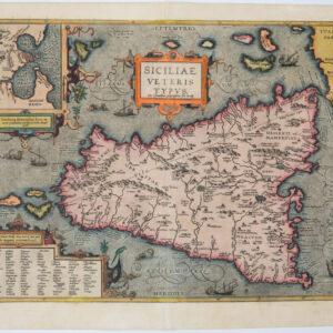
- Italy
Siciliae Veteris Typus
- $1,200
- Beautiful old color Ortelius map of Sicily.
-
-
-