-
-
Add to cart
- San Francisco
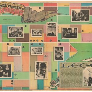
Stations of the God’s-Eye Pilgrimage Places in the Haight.
- $145
- Haight-Ashbury in 1976: a fascinating map celebrating a decade of counterculture landmarks and legends.
-
-
-
-
Add to cart
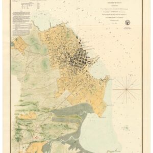
- San Francisco
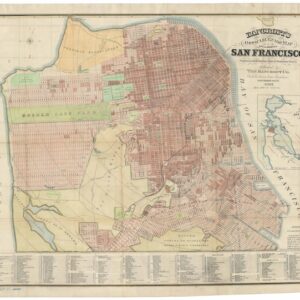
Bancroft’s Official Guide Map of the City and County of San Francisco, Compiled from Official Maps in Surveyor’s Office.
- $1,800
- One of the most iconic 19th-century maps of San Francisco.
-
-
-
-
Add to cart
- San Francisco
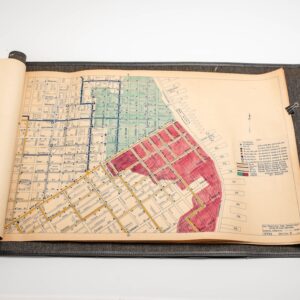
Fire Boat No. 2. S.F.F.D.
- $8,500
- A unique Depression-era map set from a San Francisco Fire Department Fireboat.
-
-
-
-
Add to cart
![San Francisco [June] 1849.](https://neatlinemaps.com/wp-content/uploads/2024/05/NL-01939_thumbnail-300x300.jpg)
- San Francisco
San Francisco [June] 1849.
- $4,800
- Henry Firks’ iconic birds-eye-view of San Francisco at the height of the Gold Rush.
-
-
-
-
Add to cart
- Bird's-eye-views, San Francisco, San Francisco Bay Area & Silicon Valley
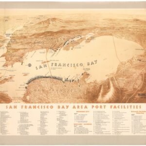
San Francisco Bay Area Port Facilities.
- $1,200
- A rare and splendid mid-century bird’s-eye-view highlighting maritime infrastructure in the Bay Area.
-
-
-
-
Add to cart
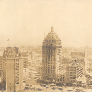
- San Francisco
Business District of San Francisco one year after the fire.
- $675
- A large panoramic photograph of San Francisco’s post-earthquake reconstruction, taken by one of the city’s most famous photographers.
-
-
-
-
Add to cart
- San Francisco
City of San Francisco and Its Vicinity.
- $1,200
- San Francisco transforms into a city.
-
-
-
-
Add to cart
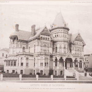
- Atlases & Books, California, San Francisco
Artistic Homes of California.
- $12,500
- The most extensive collection of pre-1906 Bay Area architectural masterpieces.
-
-
-
-
Add to cart
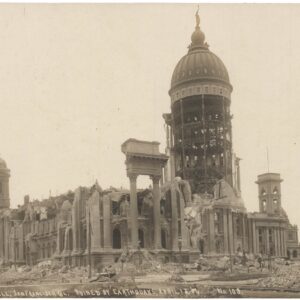
- San Francisco
City Hall, San Francisco, CA Ruined by Earthquake, April 18, ’06 No. 108.
- $145
- An evocative photograph of San Francisco City Hall destroyed by the 1906 Earthquake.
-
-
-
-
Add to cart
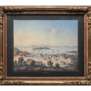
- San Francisco
Yerba Buena.
- $10,500
- A stunning retrospective of early San Francisco, painted by a highly skilled anonymous artist of America’s Continental School.
-
-
-
-
Add to cart

- San Francisco, Rare City Plans
Map of the City & County of San Francisco, from the Latest Certified Data.
- $575
- Settling the Southern Part of San Francisco.
-
-
-
-
Add to cart
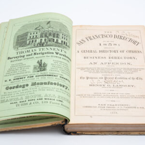
- San Francisco, Atlases & Books
San Francisco Directory Year and Business Guide for 1858: Henry G. Langley Compiler.
- $3,400
- The first Langley San Francisco city directory!
-
-