-
-
Add to cart
- Texas and The West
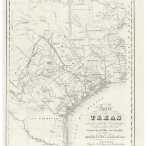
Karte von Texas entworfen nach den Vermessungen, welche in den Acten der General-Land-Office der Republic liegen bis zum Jahr 1839 von Richard S. Hunt & Jesse F. Randel…1841.
- $6,000
- A rare German capture of the young Republic of Texas.
-
-
-
-
Add to cart
- North America, Texas and The West, United States
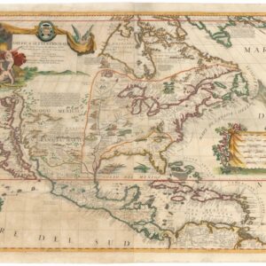
AMERICA SETTENTRIONALE Colle Nuove Scoperte fin all’Anno 1688…
- $14,500
- A beautiful hand-colored example of Coronelli’s ground-breaking 1688 map of North America.
-
-
-
-
Add to cart

- Canada and The Great Lakes, Pacific Northwest - Hawaii - Alaska, Texas and The West
Map of Oregon Territory.
- $550
- One of the earliest maps of Oregon Territory.
-
-
-
-
Add to cart

- Bird's-eye-views, Railroad Maps, Texas and The West
Panoramic Views Along the Line of the Denver & Rio Grande Railroad. The Scenic Line of the World.
- $400
- The Scenic Route through the Rockies.
-
-
-
-
Add to cart
- Eastern United States, Texas and The West
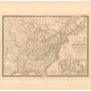
Carte Générale des Etats-Unis, des Haut et Bas-Canada, de la Nouvelle Ecosse, du Nouvelle Brunswick, de Terre Neuve.
- $875
- Brué’s important map of the United States prior to the Mexican-American War, with a blatantly independent Texas.
-
-
-
-
Add to cart
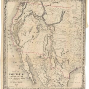
- Atlases & Books, California, Texas and The West
Map of California, Oregon, Texas, and the territories adjoining, with routes &c.
- $1,900
- Colton’s iconic map of the West, with California Gold region and extended Texas borders.
-
-
-
-
Add to cart

- California, Gold Rush maps, Texas and The West, United States
Map of the United States Mexico &c. Showing the various Land and Water Routes from the Atlantic Cities to California
- $750
- A scarce map from the early days of the Gold Rush.
-
-
-
-
Add to cart
![Route of the Mormon Pioneers from Nauvoo to Great Salt Lake [Issued by the New Wilson European Hotel, Salt Lake City]](https://neatlinemaps.com/wp-content/uploads/2024/05/NL-02012_thumbnail-300x300.jpg)
- Texas and The West
Route of the Mormon Pioneers from Nauvoo to Great Salt Lake [Issued by the New Wilson European Hotel, Salt Lake City]
- $775
- A wonderful 1899 panoramic bird’s-eye-view of the route of the Mormon pioneers.
-
-
-
-
Add to cart
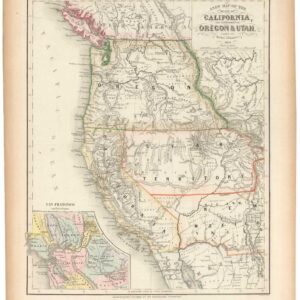
- California, Gold Rush maps, Texas and The West
A New Map of the State of California, the Territories of Oregon & Utah…
- $675
- Promoting California and the Gold Rush to a Receptive Audience.
-
-
-
-
Add to cart
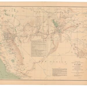
- Texas and The West
Territory and Military Department of Utah.
- $145
- The American West during the Civil War.
-
-
-
-
Add to cart
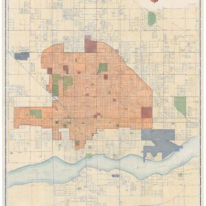
- Texas and The West
Phoenix Street Map.
- $200
- Hand water colored 1952 urban plan of Phoenix, Arizona.
-
-