-
-
Add to cart
- Texas and The West, East & Midwest United States
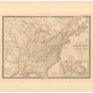
Carte Générale des Etats-Unis, des Haut et Bas-Canada, de la Nouvelle Ecosse, du Nouvelle Brunswick, de Terre Neuve.
- $875
- Brué’s important map of the United States prior to the Mexican-American War, with a overtly independent Texas.
-
-
-
-
Add to cart
- East & Midwest United States, United States
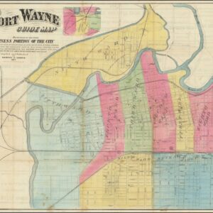
Fort Wayne Guide Map (location of First Professional Baseball Game shown).
- $12,500
- Earliest recorded printed map to locate the site of the world’s first professional baseball game.
-
-
-
-
Add to cart
- Bird's-eye-views, East & Midwest United States, United States
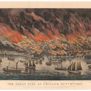
The Great Fire at Chicago. Octr. 8th 1871.
- $9,500
- Currier & Ives 1871 Great Chicago Fire.
-
-
-
-
Add to cart
- United States, East & Midwest United States
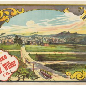
Buy Homes of J.W. Wilbur Co.
- $650
- An invitation to settle in New England.
-
-
-
-
Add to cart
- East & Midwest United States, United States
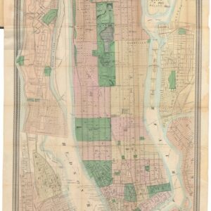
Map of New York and Vicinity.
- $1,200
- From city to metropolis: Matthew Dripps’ rare folding map of New York.
-
-
-
-
Add to cart
- United States, East & Midwest United States
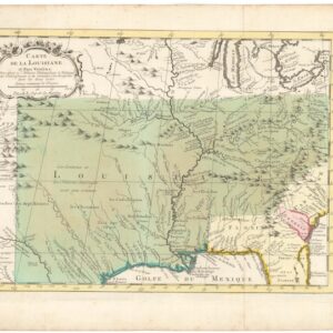
Carte de la Louisiane et Pays Voisins.
- $350
- Showcasing French territorial claims and Native American settlements during the French and Indian War.
-
-
-
-
Add to cart
- East & Midwest United States
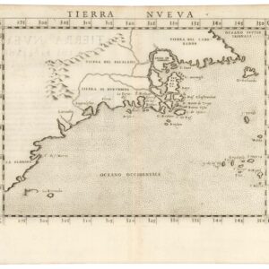
Tierra Nueva.
- $1,800
- A true first state of one the earliest maps of the Eastern Seaboard.
-
-
-
-
Add to cart
- East & Midwest United States, United States
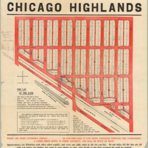
The Central Subdivision at Chicago Highlands.
- $775
- Promotional broadside for the industrial community of Chicago Highlands.
-
-
-
-
Add to cart
![[AMERICAN REVOLUTION] Boston, George Washington, Franklin, Philadelphia, Washington, D.C.](https://neatlinemaps.com/wp-content/uploads/2024/05/NL-02090a_thumbnail-300x300.jpg)
- East & Midwest United States, United States
[AMERICAN REVOLUTION] Boston, George Washington, Franklin, Philadelphia, Washington, D.C.
- $600
- A set of six hand-colored plates from Guilio Ferrario’s iconic encyclopedia showcasing the American Revolution.
-
-
-
-
Add to cart
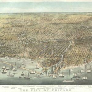
- East & Midwest United States
The City of Chicago.
- $6,500
- Probably the most iconic view of Chicago ever made…
-
-
-
-
Add to cart
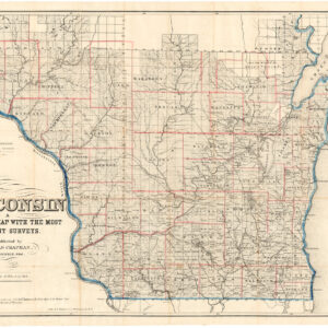
- East & Midwest United States, United States
Sectional Map of Wisconsin.
- $575
- A pioneering map of the most inhabited parts of Wisconsin, based on the most recent surveys.
-
-
-
-
Add to cart
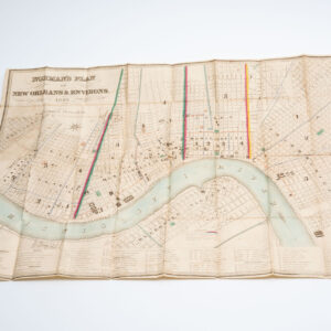
- East & Midwest United States
Norman’s Plan of New Orleans & Environs. 1849.
- $5,500
- Locally published plan of New Orleans, issued three years before the 1852 city charter.
-
-