-
-
Add to cart
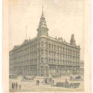
- San Francisco
Holbrook Merrill & Stetson, Stoves, Metals Etc. Cor. of Market & Beale Sts. San Francisco.
- $1,200
- A large circa 1881 Bosqui lithograph of an important San Francisco architectural landmark.
-
-
-
-
-
Add to cart
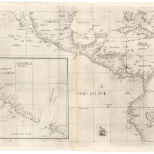
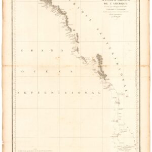
- California, Mexico - Central & South America, Cuba, West Indies, Caribbean
Carta prima generale d’America dell’India Occidentale e Mare del Zur
- $4,800
- The earliest published sea chart to focus on the California coast!
-
-
-
-
-
Add to cart
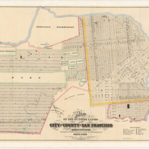
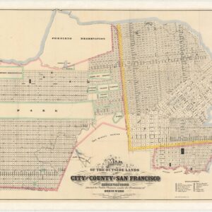
- San Francisco
Map of the Outside Lands of the City and County of San Francisco Showing Reservations Selected for Public Purposes, under the Provisions of Order No. 800
- $3,800
- Mapping the Outside Lands - a foundational map for the history of San Francisco.
-
-
-
-
-
Add to cart
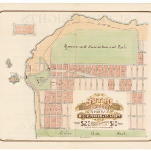
- San Francisco
Map of Sutro Heights Lots for Sale by Will E. Fisher and Co. Agents.
- $650
- An 1893 commercial broadsheet for the real estate development at Sutro Heights - the site of San Francisco landmarks like the Sutro Baths and Cliff House.
-
-
-
-
-
Add to cart
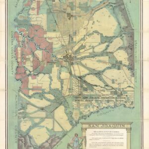
- California
San Joaquin, the Gateway County of California
- $1,250
- How the Central Valley became America's agricultural powerhouse.
-
-
-
-
-
Add to cart
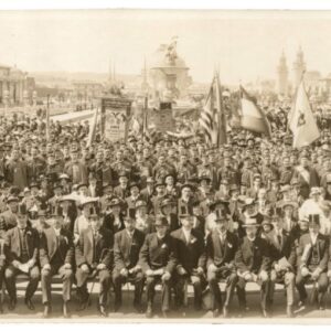
- San Francisco
Slavonic Bay
- $2,200
- Celebrating San Francisco's Slavic Communities during the 1915 Expo.
-
-
-
-
-
Add to cart
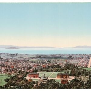
- San Francisco Bay Area & Silicon Valley
The Golden Gate from Berkeley Heights
- $2,200
- William Henry Jackson’s panoramic photochrom of Berkeley and the Bay Area at the dawn of the 20th century.
-
-
-
-
-
Add to cart
![5-sheet set showing San Francisco’s post-1906 earthquake water supply [SF’s first fireboat!]](https://neatlinemaps.com/wp-content/uploads/2022/03/NL-01375-sheet-4_thumbnail-scaled-300x300.jpg)
- San Francisco
5-sheet set showing San Francisco’s post-1906 earthquake water supply [SF’s first fireboat!]
- $8,500
- Four technical maps focussing on urban infrastructure and water supply and one engineering blueprint for a new fireboat, together reflecting San Francisco's coordinated response to the devastation of the 1906 earthquake. With an interesting provenance.
-
-
-
-
-
Add to cart
- California, Pacific Northwest - Hawaii - Alaska
Carte de la Partie de la Cote Nord-Ouest de L’Amerique Reconnue pendant Etes de 1792, 1793, et 1794.
- $1,200
- Vancouver's chart of America’s Pacific coastline: the first printed map to identify the Columbia River estuary and Vancouver Island.
-
-
-
-
-
Add to cart
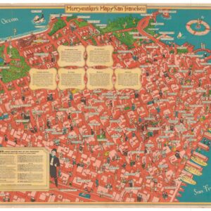
- San Francisco, Pictorial maps
Merry-Maker’s Map of San Francisco
- $1,600
- A 1940 pictorial map of San Francisco that captures the zeitgeist of Herb Caen's “Baghdad-by-the-Bay.”
-
-
-
-
-
Add to cart
![Thomas Brothers Map of Mill Valley [and] Sausalito](https://neatlinemaps.com/wp-content/uploads/2022/02/NL-01366_thumbnail-scaled-300x300.jpg)
- San Francisco Bay Area & Silicon Valley
Thomas Brothers Map of Mill Valley [and] Sausalito
- $675
- Beautiful 1920 map of Mill Valley, with Sausalito on the verso.
-
-
-
-
-
Add to cart
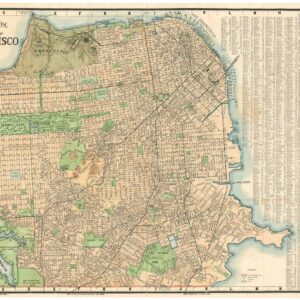
- San Francisco, Rare City Plans
Thomas Bros Map of the City and County of San Francisco.
- $475
- Large and attractive 1938 Thomas Brothers map of San Francisco.
-
-
-