-
-
Add to cart
 Quick View
 - Pacific Northwest - Hawaii - Alaska
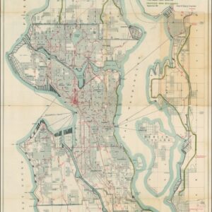
A Map for the City of Seattle and adjacent territory accompanying a report of MUNICIPAL PLANS COMMISSION.
- $1,200
- The famous ‘Bogue Plan’ of Seattle: an ambitious urban design for the city and environs from 1911.
-
-
-
-
Add to cart
 Quick View
 - Featured Maps & Views, United States
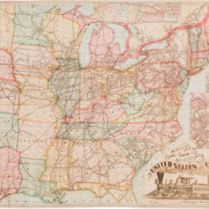
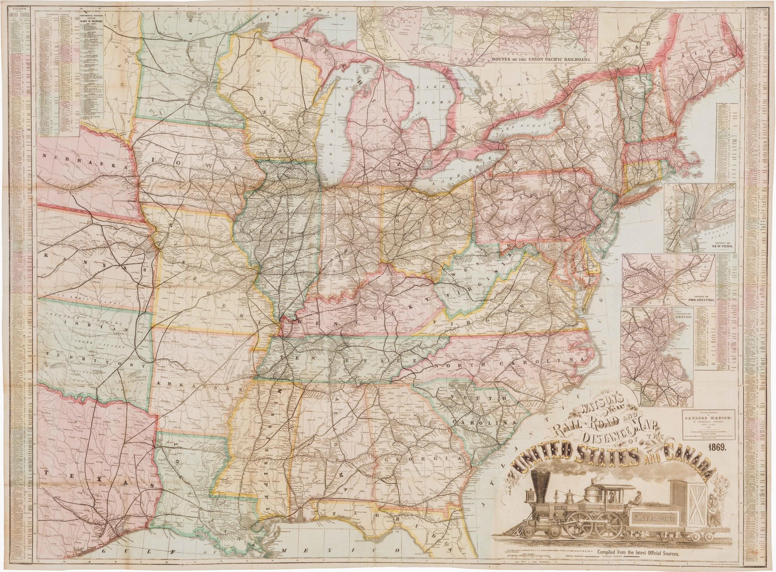
Watson’s New Rail Road and Distance Map of the United States and Canada.
- $3,800
- Among the finest railroad maps of America made in the 19th century.
-
-

-
-
-
Add to cart
![Carte De La Floride Occidentale et Louisiane…[with] La Peninnsule Et Golfe De La Floride ou Canal De Bahama Avec Les Isles De Bahama Traduit de Gefferys…1777.](https://neatlinemaps.com/wp-content/uploads/2025/01/NL-02329_thumbnail-300x300.jpg) Quick View
Quick View - East & Midwest United States
Carte De La Floride Occidentale et Louisiane…[with] La Peninnsule Et Golfe De La Floride ou Canal De Bahama Avec Les Isles De Bahama Traduit de Gefferys…1777.
- $2,800
- A scarce 1777 French map of Florida and the Gulf Coast.
-
-
-
-
Add to cart
 Quick View
 - Americas, Cuba, West Indies, Caribbean, East & Midwest United States, North America
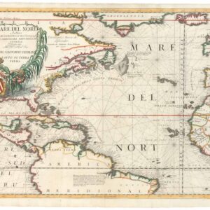
Mare del Nord.
- $2,200
- A gorgeous full-color example of Coronelli's chart of the Eastern Seaboard and North Atlantic.
-
-
-
-
Add to cart
 Quick View
 - Pictorial maps, Texas and The West, United States
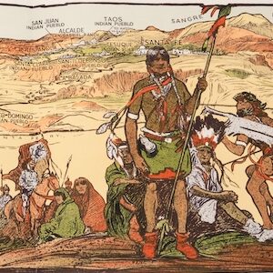
The Indian-detour; Santa Fe; Harveycars.
- $1,400
- The Roots of Romanticism of the American Southwest.
-
-
-
-
Add to cart
 Quick View
 - East & Midwest United States, United States
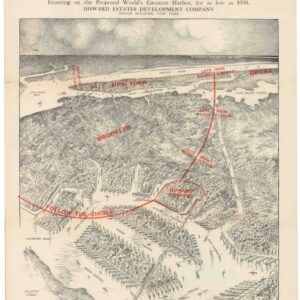
How Jamaica Bay is Being Made into a Great Harbor / Jamaica Bay Harbor / Plan of Dock Comm’r Tomkins.
- $675
- A failed scheme to make Jamaica Bay a seaport.
-
-
-
-
Add to cart
 Quick View
 - Bird's-eye-views, East & Midwest United States, United States
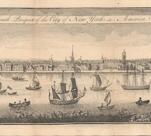
The South Prospect of the City of New York, in America.
- $5,500
- One of the Earliest Acquirable Views of New York City.
-
-
-
-
Add to cart

 Quick View
 - East & Midwest United States, Featured Maps & Views, United States
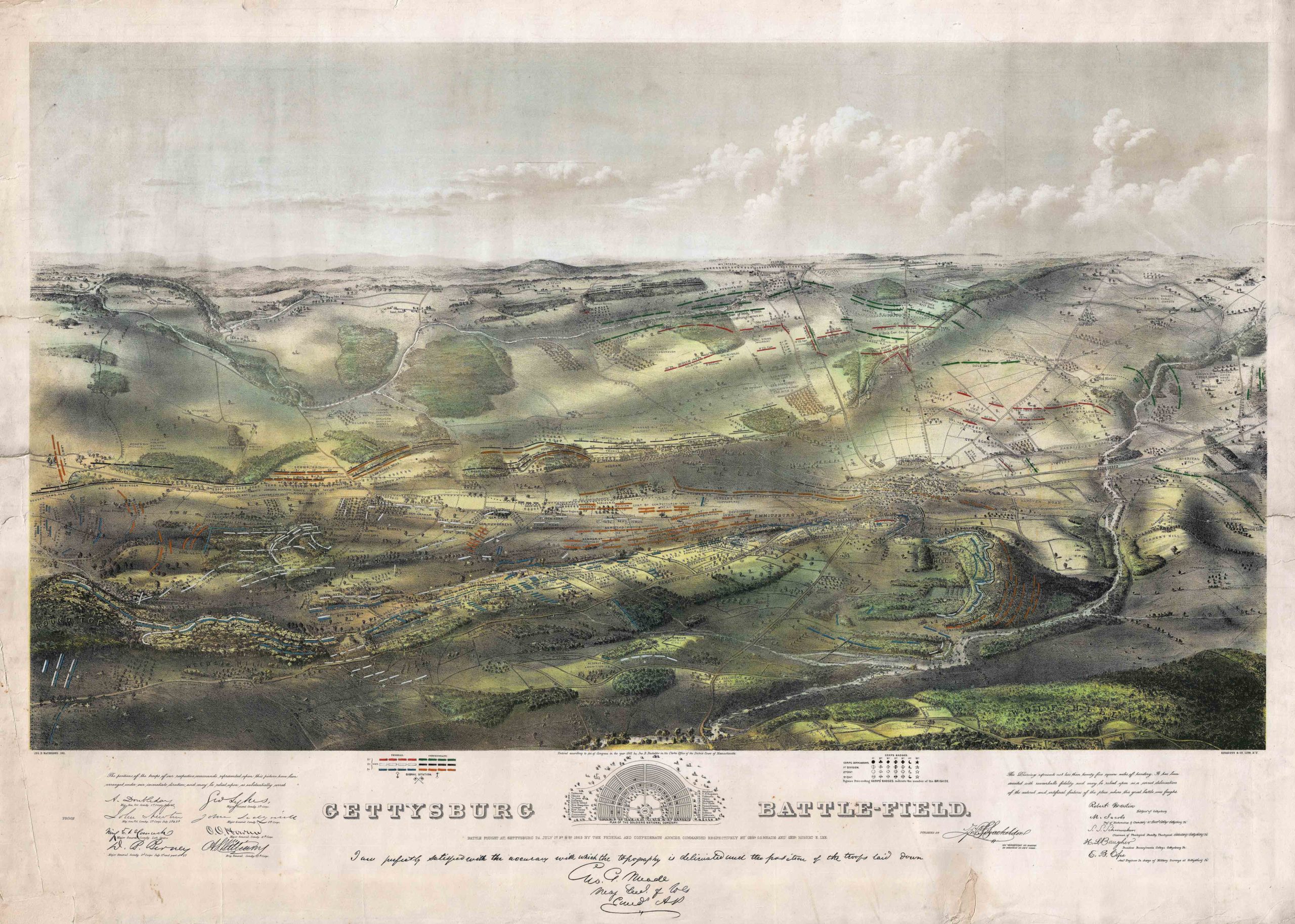
Gettysburg Battle-Field
- $5,500
- Bachelder's iconic 1863 view of the Battle of Gettysburg.
-
-

-
-
-
Add to cart
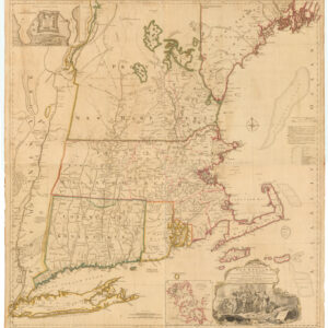
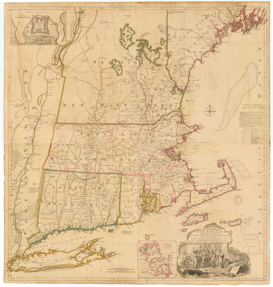 Quick View
 - East & Midwest United States, Featured Maps & Views
A MAP of the most INHABITED part of NEW ENGLAND, containing the PROVINCES of MASSACHUSETS BAY and NEW HAMPSHIRE, with the COLONIES of KONEKTIKUT AND RHODE ISLAND. Divided into Counties and Townships: The whole composed of Actual Surveys and its situation adjusted by ASTRONOMICAL OBSERVATIONS.
- $55,000
- Unobtainable first state of one of the most influential maps of New England ever made.
-
-
-
-
-
Add to cart
 Quick View
 - California, Texas and The West, United States
Map of the United States Mexico &c. Showing the various Land and Water Routes from the Atlantic Cities to California
- $750
- A scarce map from the early days of the Gold Rush.
-
-
-
-
Add to cart
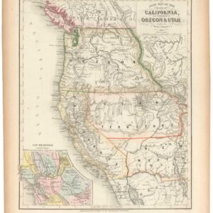 Quick View
 - California, Texas and The West
A New Map of the State of California, the Territories of Oregon & Utah…
- $675
- Promoting California and the Gold Rush to a Receptive Audience.
-
-
-
-
Add to cart

 Quick View
 - Texas and The West, United States
Williams New Trans-Continental Map of The Pacific R.R. and Routes of Overland Travel To Colorado, Nebraska, The Black Hills, Utah, Idaho, Nevada, Montana California and the Pacific Coast.
- $3,500
- 1876 Pacific Railroad map with references to notorious stagecoach robber Black Bart.
-
-

-

-
